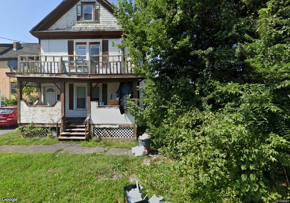
304 Walnut Ave Syracuse, NY 13210
Estimated Value: $342,628
Studio
--
Bath
--
Sq Ft
1,481
Sq Ft Lot
About This Home
This home is located at 304 Walnut Ave, Syracuse, NY 13210 and is currently estimated at $342,628. 304 Walnut Ave is a home located in Onondaga County with nearby schools including Edward Smith School PTO, Nottingham High School, and Cathedral Academy at Pompei.
Ownership History
Date
Name
Owned For
Owner Type
Purchase Details
Closed on
Dec 17, 2019
Sold by
Szalach Heidi P
Bought by
Singer Michael P and Sisson Lauren E
Current Estimated Value
Home Financials for this Owner
Home Financials are based on the most recent Mortgage that was taken out on this home.
Original Mortgage
$195,300
Outstanding Balance
$172,185
Interest Rate
3.6%
Mortgage Type
Stand Alone Refi Refinance Of Original Loan
Estimated Equity
$170,443
Purchase Details
Closed on
Sep 10, 1999
Sold by
Tyo John D
Bought by
Tyo Development Llc
Purchase Details
Closed on
Aug 24, 1998
Purchase Details
Closed on
Dec 29, 1997
Create a Home Valuation Report for This Property
The Home Valuation Report is an in-depth analysis detailing your home's value as well as a comparison with similar homes in the area
Purchase History
| Date | Buyer | Sale Price | Title Company |
|---|---|---|---|
| Singer Michael P | $217,000 | None Available | |
| Tyo Development Llc | -- | Kenneth P. Holden | |
| -- | $8,900 | -- | |
| -- | -- | -- |
Source: Public Records
Mortgage History
| Date | Status | Borrower | Loan Amount |
|---|---|---|---|
| Open | Singer Michael P | $195,300 |
Source: Public Records
Tax History
| Year | Tax Paid | Tax Assessment Tax Assessment Total Assessment is a certain percentage of the fair market value that is determined by local assessors to be the total taxable value of land and additions on the property. | Land | Improvement |
|---|---|---|---|---|
| 2024 | $107 | $10,000 | $10,000 | $0 |
| 2023 | $71 | $6,400 | $6,400 | $0 |
| 2022 | $71 | $6,400 | $6,400 | $0 |
| 2021 | $71 | $6,400 | $6,400 | $0 |
| 2020 | $70 | $5,700 | $5,700 | $0 |
| 2019 | $71 | $5,700 | $5,700 | $0 |
| 2018 | $71 | $5,700 | $5,700 | $0 |
| 2017 | $69 | $5,700 | $5,700 | $0 |
| 2016 | $71 | $5,700 | $5,700 | $0 |
| 2015 | -- | $5,700 | $5,700 | $0 |
| 2014 | -- | $5,700 | $5,700 | $0 |
Source: Public Records
Map
Nearby Homes
- 1115 E Genesee St
- 917 Madison St Unit 5
- 917 Madison St Unit 107
- 917 Madison St Unit 112
- 1337 Madison St
- 349 Elm St
- 104 Fountain St
- 926 Burnet Ave Unit 30
- 208 Delhi St
- 217 Green St
- 107 Oak Place
- 228 Delhi St
- 308 Lexington Ave
- 201 Lincoln Park Dr
- 306 Allen St
- 534 Elm St
- 231 Allen St
- 415 Greenwood Place
- 101 Avondale Place
- 722 Ackerman Ave
- 306 Walnut Ave
- 127 Ashworth Place
- 129 Ashworth Place
- 311 Walnut Ave
- 123 Ashworth Place
- 315 Walnut Ave Unit 1
- 315 Walnut Ave Unit 3
- 315 Walnut Ave Unit 2
- 201 Ashworth Place Unit 3
- 121 Ashworth Place
- 1129 E Fayette St
- 119 Ashworth Place
- 205 Ashworth Place
- 117 Ashworth Place
- 1208 E Fayette St Unit 10
- 209 Ashworth Place
- 211 Ashworth Place
- 111 Ashworth Place
- 213 Ashworth Place
- 208 Ashworth Place
Your Personal Tour Guide
Ask me questions while you tour the home.