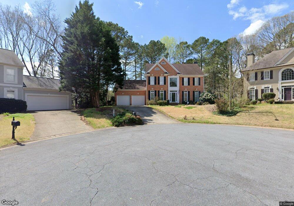
304 Westbriar Way Unit 1 Woodstock, GA 30189
Oak Grove NeighborhoodEstimated Value: $527,518 - $599,000
4
Beds
3
Baths
2,709
Sq Ft
$208/Sq Ft
Est. Value
About This Home
This home is located at 304 Westbriar Way Unit 1, Woodstock, GA 30189 and is currently estimated at $563,259, approximately $207 per square foot. 304 Westbriar Way Unit 1 is a home located in Cherokee County with nearby schools including Bascomb Elementary School, E. T. Booth Middle School, and Etowah High School.
Ownership History
Date
Name
Owned For
Owner Type
Purchase Details
Closed on
Jul 15, 1999
Sold by
Reeves Robert D and Reeves Lisa F
Bought by
Denham Michael S and Denham Karen L
Current Estimated Value
Home Financials for this Owner
Home Financials are based on the most recent Mortgage that was taken out on this home.
Original Mortgage
$168,000
Outstanding Balance
$45,697
Interest Rate
7.43%
Mortgage Type
New Conventional
Estimated Equity
$517,562
Purchase Details
Closed on
Mar 1, 1994
Sold by
John Wieland Homes
Bought by
Reeves Robt D Lisa Ford
Home Financials for this Owner
Home Financials are based on the most recent Mortgage that was taken out on this home.
Original Mortgage
$159,750
Interest Rate
6.96%
Create a Home Valuation Report for This Property
The Home Valuation Report is an in-depth analysis detailing your home's value as well as a comparison with similar homes in the area
Home Values in the Area
Average Home Value in this Area
Purchase History
| Date | Buyer | Sale Price | Title Company |
|---|---|---|---|
| Denham Michael S | $210,000 | -- | |
| Reeves Robt D Lisa Ford | $177,500 | -- |
Source: Public Records
Mortgage History
| Date | Status | Borrower | Loan Amount |
|---|---|---|---|
| Open | Denham Michael S | $168,000 | |
| Previous Owner | Reeves Robt D Lisa Ford | $159,750 |
Source: Public Records
Tax History Compared to Growth
Tax History
| Year | Tax Paid | Tax Assessment Tax Assessment Total Assessment is a certain percentage of the fair market value that is determined by local assessors to be the total taxable value of land and additions on the property. | Land | Improvement |
|---|---|---|---|---|
| 2025 | $1,095 | $200,056 | $48,000 | $152,056 |
| 2024 | $1,061 | $196,100 | $46,000 | $150,100 |
| 2023 | $873 | $180,144 | $46,000 | $134,144 |
| 2022 | $950 | $146,744 | $30,560 | $116,184 |
| 2021 | $972 | $132,108 | $30,560 | $101,548 |
| 2020 | $936 | $121,352 | $27,800 | $93,552 |
| 2019 | $906 | $113,520 | $25,600 | $87,920 |
| 2018 | $902 | $108,160 | $23,200 | $84,960 |
| 2017 | $2,945 | $263,100 | $23,200 | $82,040 |
| 2016 | $2,750 | $241,900 | $23,200 | $73,560 |
| 2015 | $2,763 | $240,700 | $23,800 | $72,480 |
| 2014 | $2,793 | $242,800 | $23,800 | $73,320 |
Source: Public Records
Map
Nearby Homes
- 3009 High Vista Walk
- 3007 Clove Tree Ln
- 509 Courtyard Way
- 1086 Atherton Ln
- 2012 Spicers Ln
- 125 Tambourine Trail
- 243 Cordova St
- 613 Sweet Basil Ln
- 100 Eagle Glen Dr
- 227 Strawberry Ln
- 2000 Spicers Ln
- 223 Strawberry Ln
- Sanctuary Plan at Maple Grove at Towne Lake
- Stillhouse Plan at Maple Grove at Towne Lake
- Ridgeford Plan at Maple Grove at Towne Lake
- Copperdale Plan at Maple Grove at Towne Lake
- Octavia Plan at Maple Grove at Towne Lake
- Cartwright II Plan at Maple Grove at Towne Lake
- Montage Plan at Maple Grove at Towne Lake
- 6387 Bells Ferry Rd
- 302 Westbriar Way
- 305 Westbriar Way
- 2044 Cresthaven Walk
- 1013 Wellesley Crest Dr
- 2042 Cresthaven Walk
- 303 Westbriar Way
- 2045 Cresthaven Walk Unit 3
- 1015 Wellesley Crest Dr Unit 1
- 301 Westbriar Way
- 0 Eagle Dr Unit 7517502
- 0 Eagle Dr Unit 7333326
- 0 Eagle Dr Unit 7399396
- 0 Eagle Dr Unit 7512578
- 0 Eagle Dr Unit 5341898
- 0 Eagle Dr Unit 5393601
- 0 Eagle Dr Unit 5587529
- 0 Eagle Dr Unit 5591375
- 0 Eagle Dr Unit 10482629
- 0 Eagle Dr Unit 7511629
- 0 Eagle Dr Unit 8887073