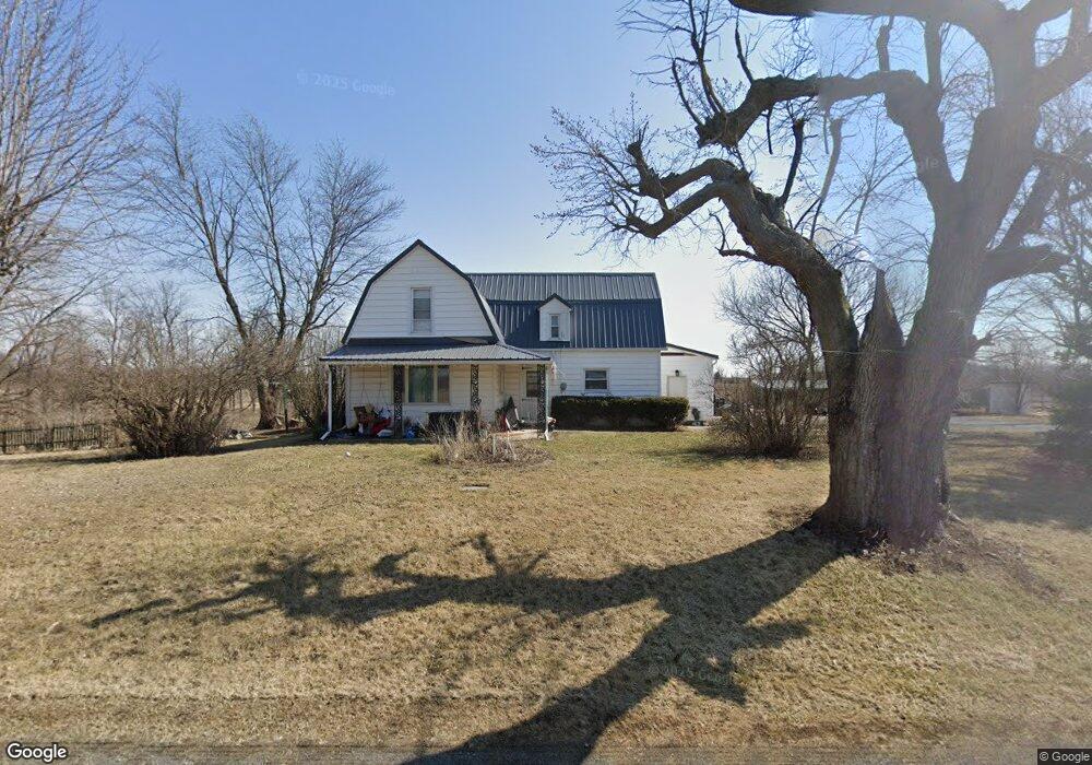
3040 N Pevee Rd Harrod, OH 45850
Estimated Value: $255,000 - $344,000
4
Beds
3
Baths
2,399
Sq Ft
$119/Sq Ft
Est. Value
About This Home
This home is located at 3040 N Pevee Rd, Harrod, OH 45850 and is currently estimated at $286,203, approximately $119 per square foot. 3040 N Pevee Rd is a home located in Allen County with nearby schools including Allen East Elementary School, Allen East Middle School, and Allen East High School.
Ownership History
Date
Name
Owned For
Owner Type
Purchase Details
Closed on
May 29, 2014
Sold by
Patton Harold D and Patton Karen S
Bought by
Conrad Michael W and Conrad Rochelle
Current Estimated Value
Home Financials for this Owner
Home Financials are based on the most recent Mortgage that was taken out on this home.
Original Mortgage
$132,795
Outstanding Balance
$101,310
Interest Rate
4.28%
Mortgage Type
VA
Estimated Equity
$184,893
Purchase Details
Closed on
Mar 2, 2009
Sold by
Patton Harold D
Bought by
Patton Harold D and Patton Karen S
Purchase Details
Closed on
Jun 1, 1969
Bought by
Patton Harold D
Create a Home Valuation Report for This Property
The Home Valuation Report is an in-depth analysis detailing your home's value as well as a comparison with similar homes in the area
Home Values in the Area
Average Home Value in this Area
Purchase History
| Date | Buyer | Sale Price | Title Company |
|---|---|---|---|
| Conrad Michael W | $130,000 | None Available | |
| Patton Harold D | -- | None Available | |
| Patton Harold D | $8,000 | -- |
Source: Public Records
Mortgage History
| Date | Status | Borrower | Loan Amount |
|---|---|---|---|
| Open | Conrad Michael W | $132,795 |
Source: Public Records
Tax History Compared to Growth
Tax History
| Year | Tax Paid | Tax Assessment Tax Assessment Total Assessment is a certain percentage of the fair market value that is determined by local assessors to be the total taxable value of land and additions on the property. | Land | Improvement |
|---|---|---|---|---|
| 2024 | $2,282 | $66,570 | $22,890 | $43,680 |
| 2023 | $1,918 | $50,830 | $17,470 | $33,360 |
| 2022 | $1,933 | $50,830 | $17,470 | $33,360 |
| 2021 | $1,933 | $50,830 | $17,470 | $33,360 |
| 2020 | $1,835 | $46,900 | $17,430 | $29,470 |
| 2019 | $1,835 | $46,900 | $17,430 | $29,470 |
| 2018 | $1,833 | $46,900 | $17,430 | $29,470 |
| 2017 | $1,734 | $43,050 | $17,430 | $25,620 |
| 2016 | $1,733 | $43,050 | $17,430 | $25,620 |
| 2015 | $1,255 | $42,530 | $17,430 | $25,100 |
| 2014 | $1,255 | $38,860 | $16,560 | $22,300 |
| 2013 | $1,222 | $38,860 | $16,560 | $22,300 |
Source: Public Records
Map
Nearby Homes
- 8955 Lafayette Rd
- 118 E Main St
- 4700 Herr Rd
- 3475 N Napoleon Rd
- 752 County Road 60
- 000 Phillips Rd
- 4071 Township Road 35
- 000 Napoleon Rd
- 2088 County Road 20
- 4995 N Napoleon Rd
- 351 W Buckeye Ave
- 405 Heistand St
- 6487 Mickelson Ln
- 6476 Mickelson Ln
- 629 N Main St
- 2072 State Route 235
- 538 N Main St
- 803 Union St
- 21 Unit Real Estate Package
- 301 S Main St