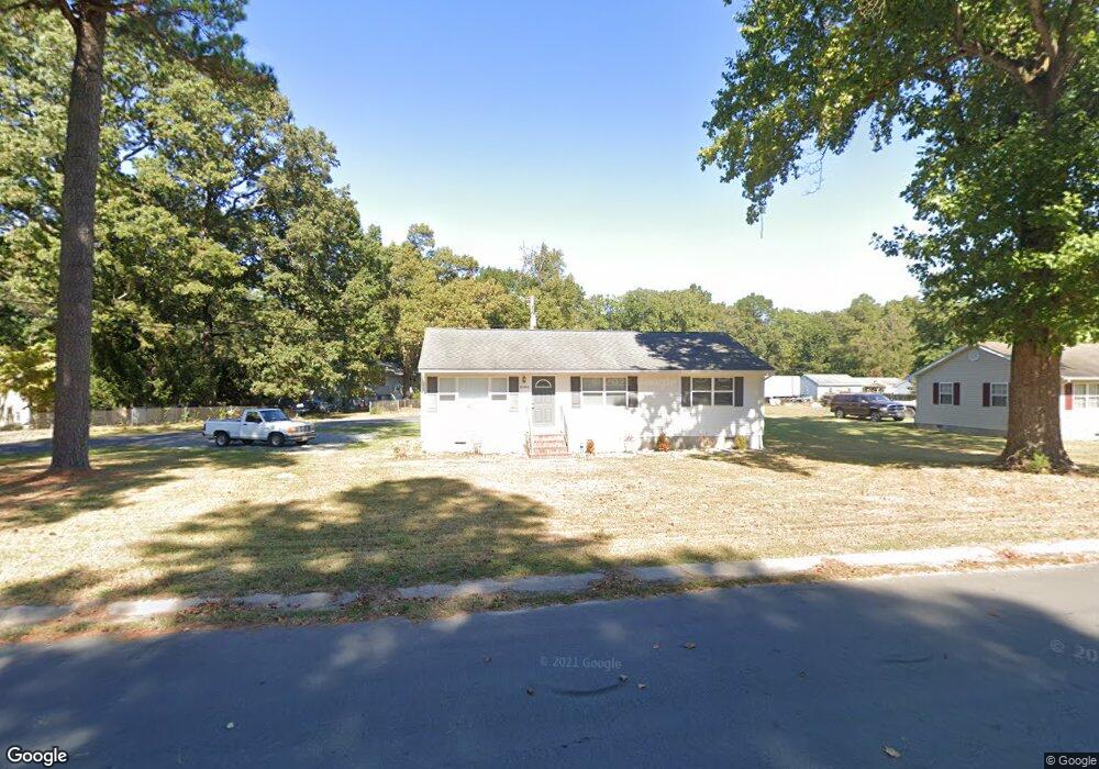
30400 Bennett Rd Salisbury, MD 21804
North Salisbury NeighborhoodEstimated Value: $211,799 - $260,000
Studio
1
Bath
1,056
Sq Ft
$225/Sq Ft
Est. Value
About This Home
This home is located at 30400 Bennett Rd, Salisbury, MD 21804 and is currently estimated at $237,450, approximately $224 per square foot. 30400 Bennett Rd is a home located in Wicomico County with nearby schools including West Salisbury Elementary School, North Salisbury Elementary School, and Wicomico Middle School.
Ownership History
Date
Name
Owned For
Owner Type
Purchase Details
Closed on
Aug 23, 2019
Sold by
Williams Gary P and Williams Cathy Jo
Bought by
Ennis Willard Stanford
Current Estimated Value
Home Financials for this Owner
Home Financials are based on the most recent Mortgage that was taken out on this home.
Original Mortgage
$144,000
Outstanding Balance
$126,376
Interest Rate
3.8%
Mortgage Type
VA
Estimated Equity
$111,074
Purchase Details
Closed on
Mar 9, 2005
Sold by
Porter Marianna G
Bought by
Williams Gary P and Williams Cath
Home Financials for this Owner
Home Financials are based on the most recent Mortgage that was taken out on this home.
Original Mortgage
$65,000
Interest Rate
5.56%
Mortgage Type
Future Advance Clause Open End Mortgage
Create a Home Valuation Report for This Property
The Home Valuation Report is an in-depth analysis detailing your home's value as well as a comparison with similar homes in the area
Home Values in the Area
Average Home Value in this Area
Purchase History
| Date | Buyer | Sale Price | Title Company |
|---|---|---|---|
| Ennis Willard Stanford | $144,000 | Sage Title Group Llc | |
| Williams Gary P | $65,000 | -- |
Source: Public Records
Mortgage History
| Date | Status | Borrower | Loan Amount |
|---|---|---|---|
| Open | Ennis Willard Stanford | $144,000 | |
| Previous Owner | Williams Gary P | $65,000 |
Source: Public Records
Tax History
| Year | Tax Paid | Tax Assessment Tax Assessment Total Assessment is a certain percentage of the fair market value that is determined by local assessors to be the total taxable value of land and additions on the property. | Land | Improvement |
|---|---|---|---|---|
| 2025 | $1,298 | $147,400 | $28,400 | $119,000 |
| 2024 | $1,295 | $139,167 | $0 | $0 |
| 2023 | $1,270 | $130,933 | $0 | $0 |
| 2022 | $1,246 | $122,700 | $28,400 | $94,300 |
| 2021 | $1,165 | $113,767 | $0 | $0 |
| 2020 | $1,141 | $104,833 | $0 | $0 |
| 2019 | $1,004 | $95,900 | $28,400 | $67,500 |
| 2018 | $1,060 | $95,067 | $0 | $0 |
| 2017 | $1,053 | $94,233 | $0 | $0 |
| 2016 | $1,047 | $93,400 | $0 | $0 |
| 2015 | $1,047 | $93,400 | $0 | $0 |
| 2014 | $1,047 | $93,400 | $0 | $0 |
Source: Public Records
Map
Nearby Homes
- 30420 Cannon Dr
- 911 Outten Rd
- 808 Friar Tuck Ln
- 416 Birchwood Dr
- 310 Zion Rd
- 703 Parker Rd
- 2519 N Salisbury Blvd
- 418 Twin Creeks Dr
- 1953 Pine Way
- 0 N U S 13 Unit 1004257479
- 2120 Ruxton Dr
- 371 Wheatfield Dr
- 234 Clement Loop
- 237 Clement Loop
- 227 Clement Loop
- 242 Clement Loop
- 229 Clement Loop
- 233 Clement Loop
- 235 Clement Loop
- 238 Clement Loop
- 30408 Bennett Rd
- 30407 Bennett Rd
- 30397 Bennett Rd
- 30390 Cannon Dr
- 30411 Bennett Rd
- 30386 Cannon Dr
- 30418 Bennett Rd
- 30380 Cannon Dr
- 30376 Cannon Dr
- 30396 Cannon Dr
- 30423 Bennett Rd
- 30375 Cannon Dr
- 30417 Cannon Dr
- 30400 Cannon Dr
- 30372 Cannon Dr
- 30432 Bennett Rd
- 30431 Bennett Rd
- 30406 Cannon Dr
- 30425 Cannon Dr
- 30371 Cannon Dr
Your Personal Tour Guide
Ask me questions while you tour the home.