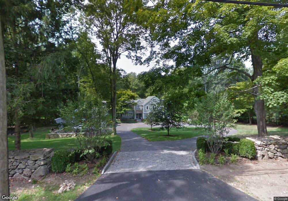
3041 Redding Rd Fairfield, CT 06824
Greenfield Hill NeighborhoodEstimated Value: $1,550,389 - $2,135,000
3
Beds
3
Baths
3,727
Sq Ft
$492/Sq Ft
Est. Value
About This Home
This home is located at 3041 Redding Rd, Fairfield, CT 06824 and is currently estimated at $1,834,347, approximately $492 per square foot. 3041 Redding Rd is a home located in Fairfield County with nearby schools including Burr Elementary School, Tomlinson Middle School, and Fairfield Warde High School.
Ownership History
Date
Name
Owned For
Owner Type
Purchase Details
Closed on
Sep 16, 2008
Sold by
Mitchell David and Mitchell Linda
Bought by
Creta Thomas P and Creta Joanne
Current Estimated Value
Purchase Details
Closed on
Dec 2, 2004
Sold by
Fincl Cendant Mobility
Bought by
Mitchell David and Mitchell Linda
Purchase Details
Closed on
Sep 26, 2003
Sold by
Walsh Richard P
Bought by
Stevenson Todd S and Stevenson Cynthin F
Purchase Details
Closed on
Dec 26, 2001
Sold by
Kinney Robert L and Kinney Denise A
Bought by
Walsh Richard P
Create a Home Valuation Report for This Property
The Home Valuation Report is an in-depth analysis detailing your home's value as well as a comparison with similar homes in the area
Home Values in the Area
Average Home Value in this Area
Purchase History
| Date | Buyer | Sale Price | Title Company |
|---|---|---|---|
| Creta Thomas P | $1,090,000 | -- | |
| Creta Thomas P | $1,090,000 | -- | |
| Mitchell David | $970,000 | -- | |
| Cendant M Financial Co | $970,000 | -- | |
| Cendant M Financial Co | $970,000 | -- | |
| Stevenson Todd S | $880,000 | -- | |
| Stevenson Todd S | $880,000 | -- | |
| Walsh Richard P | $700,000 | -- | |
| Walsh Richard P | $700,000 | -- |
Source: Public Records
Mortgage History
| Date | Status | Borrower | Loan Amount |
|---|---|---|---|
| Closed | Walsh Richard P | $565,000 | |
| Closed | Walsh Richard P | $605,000 |
Source: Public Records
Tax History
| Year | Tax Paid | Tax Assessment Tax Assessment Total Assessment is a certain percentage of the fair market value that is determined by local assessors to be the total taxable value of land and additions on the property. | Land | Improvement |
|---|---|---|---|---|
| 2025 | $17,812 | $627,410 | $324,730 | $302,680 |
| 2024 | $17,505 | $627,410 | $324,730 | $302,680 |
| 2023 | $17,260 | $627,410 | $324,730 | $302,680 |
| 2022 | $17,091 | $627,410 | $324,730 | $302,680 |
| 2021 | $6,811 | $627,410 | $324,730 | $302,680 |
| 2020 | $6,932 | $614,530 | $315,280 | $299,250 |
| 2019 | $6,932 | $614,530 | $315,280 | $299,250 |
| 2018 | $16,199 | $614,530 | $315,280 | $299,250 |
| 2017 | $6,880 | $614,530 | $315,280 | $299,250 |
| 2016 | $15,640 | $614,530 | $315,280 | $299,250 |
| 2015 | $16,277 | $656,600 | $349,300 | $307,300 |
| 2014 | $16,021 | $656,600 | $349,300 | $307,300 |
Source: Public Records
Map
Nearby Homes
- 180 Catamount Rd
- 200 Long Meadow Rd
- 158 Coventry Ln
- 22 Brett Rd
- 4800 Congress St
- 11 Judges Hollow Rd
- 1375 Westport Turnpike
- 88 Merry Meet Cir
- 212 Fence Row Dr
- 85-95 Old Easton Turnpike
- 140 Mile Common Rd
- 3674 Congress St
- 312 Towne House Rd
- 14 Codfish Ln
- 1 Greenlea Ln
- 1380 Old Academy Rd
- 2177 Cross Hwy
- 319 Bayberry Ln
- 9 Greenbrier Rd
- 6 Nutcracker Ln
- 3085 Redding Rd
- 3007 Redding Rd
- 120 Catamount Rd
- 3060 Redding Rd
- 100 Catamount Rd
- 54 Catamount Rd
- 2940 Redding Rd
- 3115 Redding Rd
- 3100 Redding Rd
- 67 Catamount Rd
- 130 Catamount Rd
- 130+ Catamount Rd
- 140 Catamount Rd
- 3175 Redding Rd
- 267 Westlea Rd
- 206/130 Catamount Rd
- 180 Catamount Rd
- 121 Catamount Rd
- 271 Longmeadow Rd
- 269 Westlea Rd
Your Personal Tour Guide
Ask me questions while you tour the home.