Estimated Value: $39,000 - $74,000
--
Bed
--
Bath
--
Sq Ft
427
Acres
About This Home
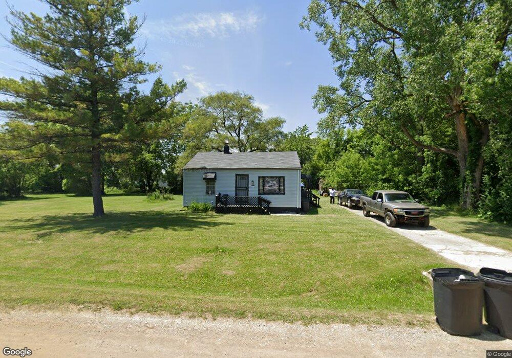
This home is located at 3041 Thornton Ave, Flint, MI 48504 and is currently estimated at $54,974. 3041 Thornton Ave is a home located in Genesee County with nearby schools including Col. Donald McMonagle Elementary School, Hamady Community Middle/High School, and Greater Heights Academy.
Ownership History
Date
Name
Owned For
Owner Type
Purchase Details
Closed on
Sep 23, 2019
Sold by
Howard Darryl L
Bought by
Benman Tyshieka T
Current Estimated Value
Purchase Details
Closed on
May 21, 2007
Sold by
Page Alphonso E
Bought by
Howard Stephanie L and Howard Darryl M
Purchase Details
Closed on
Jun 9, 2004
Sold by
Hud
Bought by
Page Alphonso E
Purchase Details
Closed on
Dec 2, 2003
Sold by
Lasalle Home Mortgage Corp
Bought by
Hud
Purchase Details
Closed on
Jun 18, 2003
Sold by
Rodriguez Antonio R and Nippa Englantina Ricio
Bought by
Lasalle Home Mortgage Corp and Abn Amro Mortgage Group Inc
Purchase Details
Closed on
Jan 30, 2003
Sold by
Ashton Land Trust #57
Bought by
Arc Investments Llc
Purchase Details
Closed on
May 22, 2000
Sold by
Rodriguez Antonio R and Rodriguez Englantina R
Bought by
Ashton Land Trust #57
Create a Home Valuation Report for This Property
The Home Valuation Report is an in-depth analysis detailing your home's value as well as a comparison with similar homes in the area
Home Values in the Area
Average Home Value in this Area
Purchase History
| Date | Buyer | Sale Price | Title Company |
|---|---|---|---|
| Benman Tyshieka T | -- | None Available | |
| Howard Stephanie L | -- | First American Title Ins Co | |
| Page Alphonso E | $4,000 | Wolverton Title Research Co | |
| Hud | -- | Attorneys Title Agency Llc | |
| Lasalle Home Mortgage Corp | $29,936 | -- | |
| Arc Investments Llc | -- | -- | |
| Ashton Land Trust #57 | -- | First American Title Ins Co |
Source: Public Records
Tax History Compared to Growth
Tax History
| Year | Tax Paid | Tax Assessment Tax Assessment Total Assessment is a certain percentage of the fair market value that is determined by local assessors to be the total taxable value of land and additions on the property. | Land | Improvement |
|---|---|---|---|---|
| 2025 | $798 | $18,800 | $0 | $0 |
| 2024 | $168 | $16,800 | $0 | $0 |
| 2023 | $160 | $13,900 | $0 | $0 |
| 2022 | $822 | $13,800 | $0 | $0 |
| 2021 | $837 | $15,100 | $0 | $0 |
| 2020 | $176 | $15,200 | $0 | $0 |
| 2019 | $135 | $14,700 | $0 | $0 |
| 2018 | $1,051 | $12,100 | $0 | $0 |
| 2017 | $1,021 | $12,200 | $0 | $0 |
| 2016 | $1,025 | $12,100 | $0 | $0 |
| 2015 | $651 | $11,000 | $0 | $0 |
| 2014 | $147 | $12,800 | $0 | $0 |
| 2012 | -- | $13,700 | $13,700 | $0 |
Source: Public Records
Map
Nearby Homes
- 3084 Roanoke St
- 3617 Kellar Ave
- 3145 Raywood St
- 3819 Brownell Blvd
- 3412 Comstock Ave
- 4201 Winona St
- 2495 Lavelle Rd
- 1705 W Pasadena Ave
- 2907 Trumbull Ave
- 3330 Maywood Dr
- 2214 Mack Ave
- 3420 Fleming Rd
- 2631 Brownell Blvd
- 1713 W Dartmouth St
- 2118 Santa Barbara Dr
- 1521 W Dartmouth St
- 2615 Trumbull Ave
- 1402 W Dartmouth St
- 2331 Welch Blvd
- 3722 Sterling St
- 3039 Thornton Ave
- 3029 Thornton Ave
- 3036 Maywood Dr
- 3038 Maywood Dr
- 3023 Thornton Ave
- 3032 Maywood Dr
- 3026 Maywood Dr
- 3069 Thornton Ave
- 3063 Thornton Ave
- 3064 Maywood Dr
- 3059 Maywood Dr
- 3059 Maywood Dr
- 3043 Maywood Dr
- 3037 Maywood Dr
- 3047 Maywood Dr
- 3031 Maywood Dr
- 3051 Sonny St
- 3023 Maywood Dr
- 3613 Clio Rd
- 3061 Maywood Dr