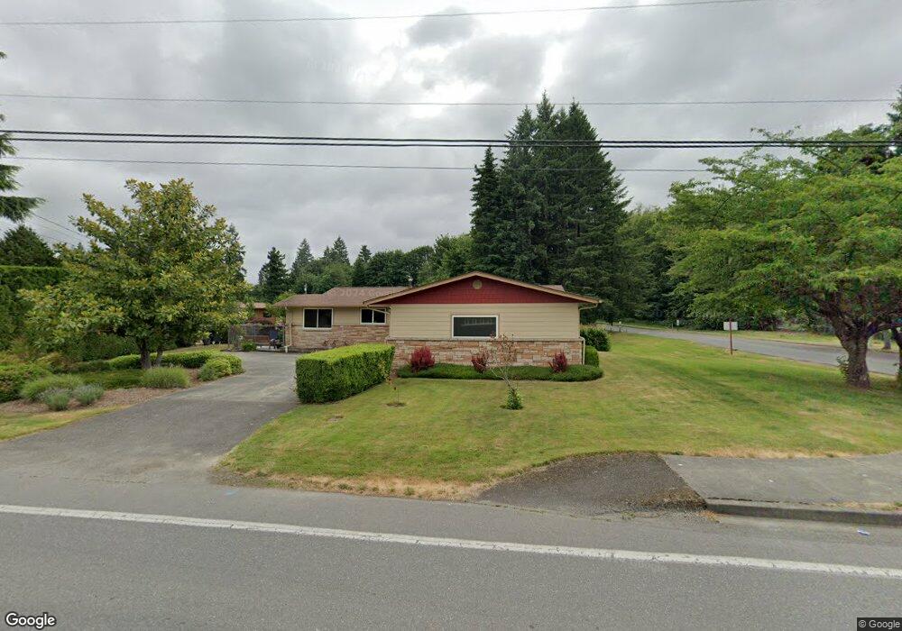
3042 Cain Rd SE Olympia, WA 98501
Cain Road NeighborhoodEstimated Value: $591,131 - $771,000
4
Beds
3
Baths
1,372
Sq Ft
$495/Sq Ft
Est. Value
About This Home
This home is located at 3042 Cain Rd SE, Olympia, WA 98501 and is currently estimated at $679,283, approximately $495 per square foot. 3042 Cain Rd SE is a home located in Thurston County with nearby schools including Pioneer Elementary School, Washington Middle School, and Olympia High School.
Ownership History
Date
Name
Owned For
Owner Type
Purchase Details
Closed on
Mar 3, 2008
Sold by
Smelcer David A
Bought by
Pop Johanna M
Current Estimated Value
Purchase Details
Closed on
Dec 29, 1995
Sold by
Fleehart Rita A
Bought by
Pop Johanna M and Smelcer David A
Home Financials for this Owner
Home Financials are based on the most recent Mortgage that was taken out on this home.
Original Mortgage
$118,400
Interest Rate
7.37%
Create a Home Valuation Report for This Property
The Home Valuation Report is an in-depth analysis detailing your home's value as well as a comparison with similar homes in the area
Home Values in the Area
Average Home Value in this Area
Purchase History
| Date | Buyer | Sale Price | Title Company |
|---|---|---|---|
| Pop Johanna M | $15,000 | Thurston County Title Co | |
| Pop Johanna M | $148,000 | Thurston County Title Co |
Source: Public Records
Mortgage History
| Date | Status | Borrower | Loan Amount |
|---|---|---|---|
| Previous Owner | Pop Johanna M | $118,400 |
Source: Public Records
Tax History
| Year | Tax Paid | Tax Assessment Tax Assessment Total Assessment is a certain percentage of the fair market value that is determined by local assessors to be the total taxable value of land and additions on the property. | Land | Improvement |
|---|---|---|---|---|
| 2025 | $625 | $569,600 | $179,900 | $389,700 |
| 2024 | $625 | $527,000 | $166,600 | $360,400 |
| 2023 | $625 | $541,200 | $143,000 | $398,200 |
| 2022 | $727 | $531,200 | $114,300 | $416,900 |
| 2021 | $797 | $428,600 | $96,700 | $331,900 |
| 2020 | $811 | $363,000 | $108,500 | $254,500 |
| 2019 | $827 | $342,600 | $92,400 | $250,200 |
| 2018 | $3,913 | $290,500 | $79,800 | $210,700 |
| 2017 | $3,364 | $269,100 | $74,000 | $195,100 |
| 2016 | $3,244 | $251,300 | $70,300 | $181,000 |
| 2014 | -- | $259,300 | $69,300 | $190,000 |
Source: Public Records
Map
Nearby Homes
- 1825 Forest Hill Dr SE
- 2517 Vista Place SE
- 2510 Morse Ct SE
- 3515 Gainsborough Ct SE
- 2222 Buckingham Dr SE
- 2122 Josie Lynn Ct SE
- 2218 Mccormick Ct SE
- 2915 Stirling Ct SE
- 2806 Briar Lea Loop SE
- 3104 Amhurst St SE
- 1515 Middle St SE
- 1824 Boundary St SE
- 3232 Maringo Rd SE
- 3004 Sugarloaf St SE
- 3607 Bittersweet St SE
- 1428 Frederick St SE
- 1833 Eastside St SE
- 3025 Maringo Rd SE
- 916 Cathy Ct SE
- 1812 Amhurst St SE
- 3041 Cain Rd SE
- 3041 Cain Rd SE Unit 3041
- 3041 Cain Rd SE Unit 1&2
- 3043 Cain Rd SE
- 3021 Edgewood Dr SE
- 2038 Centerwood Dr SE
- 3134 Cain Rd SE
- 2031 Governor Stevens Ave SE
- 3130 Cain Rd SE
- 2034 Governor Stevens Ave SE
- 2029 Governor Stevens Ave SE
- 3035 Edgewood Dr SE
- 3013 Edgewood Dr SE
- 3012 Edgewood Dr SE
- 2028 Governor Stevens Ave SE
- 2020 Centerwood Dr SE
- 3204 Cain Rd SE
- 3043 Edgewood Dr SE
- 2035 Centerwood Dr SE
- 2017 Governor Stevens Ave SE
Your Personal Tour Guide
Ask me questions while you tour the home.