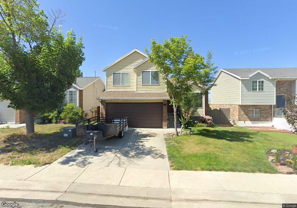
3042 Linton Dr West Jordan, UT 84088
Estimated Value: $429,000 - $471,000
4
Beds
2
Baths
1,328
Sq Ft
$336/Sq Ft
Est. Value
About This Home
This home is located at 3042 Linton Dr, West Jordan, UT 84088 and is currently estimated at $446,798, approximately $336 per square foot. 3042 Linton Dr is a home located in Salt Lake County with nearby schools including Columbia Elementary School, Joel P. Jensen Middle School, and West Jordan High School.
Ownership History
Date
Name
Owned For
Owner Type
Purchase Details
Closed on
Apr 1, 2012
Sold by
Marty Ronald K and Marty Ronald Kirk
Bought by
Marty Ronald K
Current Estimated Value
Home Financials for this Owner
Home Financials are based on the most recent Mortgage that was taken out on this home.
Original Mortgage
$86,000
Interest Rate
4.05%
Mortgage Type
New Conventional
Purchase Details
Closed on
Apr 28, 1998
Sold by
Beebe Marty Chandella
Bought by
Marty Ronald Kirk
Purchase Details
Closed on
Apr 3, 1997
Sold by
Hansen William D and Hansen Sherrill A
Bought by
Marty Ronald K and Marty Chandella Beebe
Home Financials for this Owner
Home Financials are based on the most recent Mortgage that was taken out on this home.
Original Mortgage
$114,162
Interest Rate
7.56%
Mortgage Type
FHA
Create a Home Valuation Report for This Property
The Home Valuation Report is an in-depth analysis detailing your home's value as well as a comparison with similar homes in the area
Home Values in the Area
Average Home Value in this Area
Purchase History
| Date | Buyer | Sale Price | Title Company |
|---|---|---|---|
| Marty Ronald K | -- | Magellan Title | |
| Marty Ronald Kirk | -- | -- | |
| Marty Ronald K | -- | -- |
Source: Public Records
Mortgage History
| Date | Status | Borrower | Loan Amount |
|---|---|---|---|
| Closed | Marty Ronald K | $86,000 | |
| Previous Owner | Marty Ronald K | $114,162 |
Source: Public Records
Tax History Compared to Growth
Tax History
| Year | Tax Paid | Tax Assessment Tax Assessment Total Assessment is a certain percentage of the fair market value that is determined by local assessors to be the total taxable value of land and additions on the property. | Land | Improvement |
|---|---|---|---|---|
| 2025 | $2,134 | $420,100 | $86,800 | $333,300 |
| 2024 | $2,134 | $410,600 | $85,200 | $325,400 |
| 2023 | $2,231 | $404,500 | $81,900 | $322,600 |
| 2022 | $2,310 | $412,000 | $80,300 | $331,700 |
| 2021 | $1,918 | $311,500 | $57,200 | $254,300 |
| 2020 | $1,818 | $277,100 | $57,200 | $219,900 |
| 2019 | $1,807 | $270,100 | $57,200 | $212,900 |
| 2018 | $0 | $237,000 | $55,000 | $182,000 |
| 2017 | $1,430 | $211,100 | $55,000 | $156,100 |
| 2016 | $1,372 | $190,300 | $55,000 | $135,300 |
| 2015 | $1,313 | $177,500 | $56,000 | $121,500 |
| 2014 | -- | $178,200 | $57,100 | $121,100 |
Source: Public Records
Map
Nearby Homes
- 3066 W Linton Dr
- 7987 S 2980 W
- 7942 S 2800 W
- 3165 W 7720 S
- 7721 Sunset Cir
- 7993 S 2760 W
- 7968 S 2700 W
- 3354 W 7800 S
- 3332 Lower Newark Way
- 7604 S Autumn Dr
- 2886 W 7550 S
- 8058 S Lismore Ln Unit 304
- 7611 S Springbrook Dr
- 7642 S 2700 W
- 3476 W Spaulding Rd
- 3422 Briar Dr
- 8407 Meadow Green Way
- 3112 Green Acre Dr
- 8180 S Old Bingham Hwy
- 3546 W 7980 S
- 3034 W Linton Dr
- 3034 Linton Dr
- 3050 Linton Dr
- 3058 Linton Dr
- 3026 Linton Dr
- 3058 W Linton Dr
- 7891 S Cold Stone Ln
- 3066 Linton Dr
- 3018 Linton Dr
- 3018 W Linton Dr
- 3041 W Linton Dr
- 3041 Linton Dr
- 3049 W Linton Dr
- 3049 Linton Dr
- 3031 Linton Dr
- 3031 W Linton Dr
- 3074 Linton Dr
- 3074 W Linton Dr
- 3057 Linton Dr
- 3057 W Linton Dr