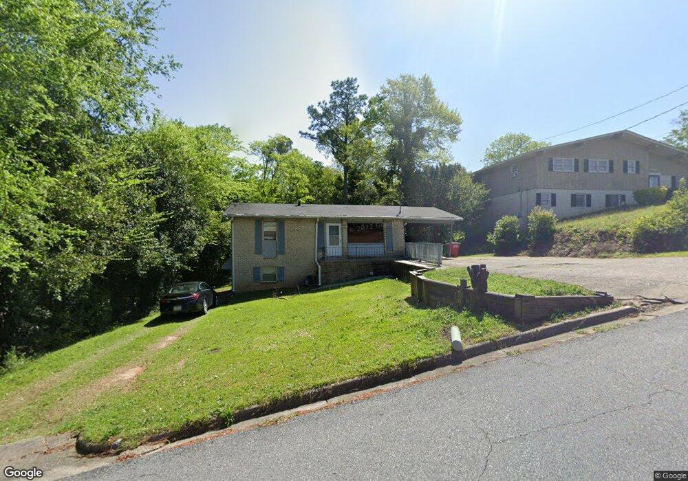
3042 Manchester Dr Macon, GA 31206
Estimated Value: $102,000 - $136,000
3
Beds
2
Baths
900
Sq Ft
$129/Sq Ft
Est. Value
About This Home
This home is located at 3042 Manchester Dr, Macon, GA 31206 and is currently estimated at $116,307, approximately $129 per square foot. 3042 Manchester Dr is a home located in Bibb County with nearby schools including Hartley Elementary School, Southwest High School, and Cirrus Charter Academy.
Ownership History
Date
Name
Owned For
Owner Type
Purchase Details
Closed on
Nov 16, 2020
Sold by
Duffey R Terry
Bought by
Furgerson Anthony Craig
Current Estimated Value
Home Financials for this Owner
Home Financials are based on the most recent Mortgage that was taken out on this home.
Original Mortgage
$72,659
Outstanding Balance
$64,509
Interest Rate
2.8%
Mortgage Type
FHA
Estimated Equity
$51,799
Purchase Details
Closed on
Nov 17, 1971
Sold by
Hall W O
Bought by
Duffey R Terry
Create a Home Valuation Report for This Property
The Home Valuation Report is an in-depth analysis detailing your home's value as well as a comparison with similar homes in the area
Home Values in the Area
Average Home Value in this Area
Purchase History
| Date | Buyer | Sale Price | Title Company |
|---|---|---|---|
| Furgerson Anthony Craig | $74,000 | None Available | |
| Duffey R Terry | $25,800 | -- |
Source: Public Records
Mortgage History
| Date | Status | Borrower | Loan Amount |
|---|---|---|---|
| Open | Furgerson Anthony Craig | $72,659 |
Source: Public Records
Tax History Compared to Growth
Tax History
| Year | Tax Paid | Tax Assessment Tax Assessment Total Assessment is a certain percentage of the fair market value that is determined by local assessors to be the total taxable value of land and additions on the property. | Land | Improvement |
|---|---|---|---|---|
| 2025 | $790 | $32,142 | $5,280 | $26,862 |
| 2024 | $816 | $32,142 | $5,280 | $26,862 |
| 2023 | $743 | $29,264 | $5,280 | $23,984 |
| 2022 | $858 | $24,773 | $4,097 | $20,676 |
| 2021 | $727 | $19,141 | $3,121 | $16,020 |
| 2020 | $594 | $15,292 | $2,341 | $12,951 |
| 2019 | $599 | $15,292 | $2,341 | $12,951 |
| 2018 | $1,097 | $15,292 | $2,341 | $12,951 |
| 2017 | $573 | $15,292 | $2,341 | $12,951 |
| 2016 | $529 | $15,292 | $2,341 | $12,951 |
| 2015 | $855 | $17,450 | $2,341 | $15,109 |
| 2014 | $983 | $17,450 | $2,341 | $15,109 |
Source: Public Records
Map
Nearby Homes
- 1504 Berkshire Dr
- 3158 Brownell Ave
- 1740 Downing Cir
- 3446 Tamplin Terrace
- 3254 Markwood Dr
- 3445 Travis Blvd
- 3480 Travis Blvd
- 3005 Margaret Dr
- 1527 Hurley Cir
- 3064 Margaret Dr
- 1138 Newberg Ave
- 1664 Randall Rd
- 3339 Markwood Dr
- 1066 Jessamine St
- 1254 W Grenada Terrace
- 1062 Rose St
- 999 Ponce de Leon Cir N
- 997 Ponce de Leon Cir N
- 3778 Spencer Cir
- 3050 Manchester Dr
- 3058 Manchester Dr
- 0 Manchester Dr
- 3075 Rice Mill Rd
- 1434 Canterbury Rd
- 3039 Manchester Dr
- 3043 Manchester Dr
- 1418 Canterbury Rd
- 3033 Manchester Dr
- 3060 Manchester Dr
- 1410 Canterbury Rd
- 3057 Manchester Dr
- 3055 Rice Mill Rd
- 3072 Manchester Dr
- 3063 Rice Mill Rd
- 1384 Canterbury Rd
- 3085 Rice Mill Rd
- 3065 Manchester Dr
- 3053 Rice Mill Rd
- 3053 Rice Mill Rd