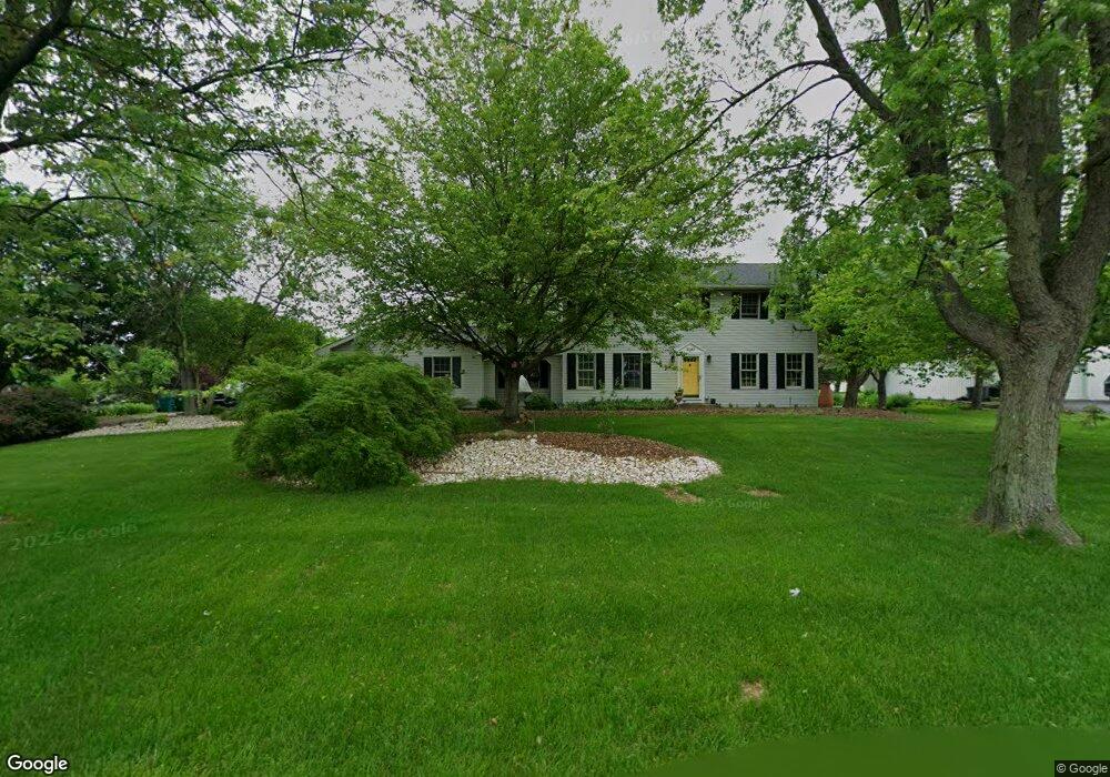
3043 Smith Ln Alburtis, PA 18011
Lower Macungie Township West NeighborhoodEstimated Value: $513,561 - $547,000
4
Beds
3
Baths
2,164
Sq Ft
$246/Sq Ft
Est. Value
About This Home
This home is located at 3043 Smith Ln, Alburtis, PA 18011 and is currently estimated at $532,390, approximately $246 per square foot. 3043 Smith Ln is a home located in Lehigh County with nearby schools including Alburtis Elementary School, Lower Macungie Middle School, and Emmaus High School.
Ownership History
Date
Name
Owned For
Owner Type
Purchase Details
Closed on
Dec 21, 2021
Sold by
Beers Iii Robert L
Bought by
Beers Robert L and Fox Robert
Current Estimated Value
Home Financials for this Owner
Home Financials are based on the most recent Mortgage that was taken out on this home.
Original Mortgage
$284,900
Interest Rate
3.12%
Mortgage Type
FHA
Purchase Details
Closed on
Dec 31, 1997
Sold by
Alvin Barrall and Alvin Lewis H
Bought by
Beers Robert L and Brown John W
Purchase Details
Closed on
May 27, 1994
Sold by
Korr Richard A and Korr Rilda
Bought by
Barrall Alvin
Purchase Details
Closed on
Sep 30, 1991
Sold by
Garvin Robert D and Garvin Barbara A
Bought by
Korr Richard A and Korr Rilda
Purchase Details
Closed on
Jun 21, 1985
Bought by
Garvin Robert D and Garvin Barbara A
Create a Home Valuation Report for This Property
The Home Valuation Report is an in-depth analysis detailing your home's value as well as a comparison with similar homes in the area
Home Values in the Area
Average Home Value in this Area
Purchase History
| Date | Buyer | Sale Price | Title Company |
|---|---|---|---|
| Beers Robert L | -- | Bc Law Firm Pa | |
| Beers Robert L | $155,000 | -- | |
| Barrall Alvin | $167,300 | -- | |
| Korr Richard A | $150,000 | -- | |
| Garvin Robert D | $85,000 | -- |
Source: Public Records
Mortgage History
| Date | Status | Borrower | Loan Amount |
|---|---|---|---|
| Previous Owner | Beers Robert L | $284,900 |
Source: Public Records
Tax History Compared to Growth
Tax History
| Year | Tax Paid | Tax Assessment Tax Assessment Total Assessment is a certain percentage of the fair market value that is determined by local assessors to be the total taxable value of land and additions on the property. | Land | Improvement |
|---|---|---|---|---|
| 2025 | $6,947 | $272,100 | $69,500 | $202,600 |
| 2024 | $6,721 | $272,100 | $69,500 | $202,600 |
| 2023 | $6,587 | $272,100 | $69,500 | $202,600 |
| 2022 | $6,431 | $272,100 | $202,600 | $69,500 |
| 2021 | $6,294 | $272,100 | $69,500 | $202,600 |
| 2020 | $6,234 | $272,100 | $69,500 | $202,600 |
| 2019 | $6,128 | $272,100 | $69,500 | $202,600 |
| 2018 | $6,047 | $272,100 | $69,500 | $202,600 |
| 2017 | $5,942 | $272,100 | $69,500 | $202,600 |
| 2016 | -- | $272,100 | $69,500 | $202,600 |
| 2015 | -- | $272,100 | $69,500 | $202,600 |
| 2014 | -- | $272,100 | $69,500 | $202,600 |
Source: Public Records
Map
Nearby Homes
- 354 W 2nd St
- 3371 Mathews Ln
- 241 Flint Hill Rd
- 121 S Main St Unit 123
- 108 E 2nd St
- 428 Thomas St
- 317 Lockridge Ln
- 8975 Mertztown Rd
- 31 Barbara Dr
- 8312 Mertztown Rd
- 1108 S Barbara Dr
- 1702 Windmill Ln
- 1649 Thorndale Rd
- 1649 Thorndale Rd Unit LOT 70
- 1716 Brookstone Dr
- 8051 Heritage Dr
- 8524 Mayfair Ct
- 8524 Mayfair Ct Unit LOT I-65
- 7318 Sauerkraut Ln Unit E
- 7699 Catalpa Dr
- 3073 Smith Ln
- 3003 Smith Ln
- 3095 Smith Ln
- 8845 Longswamp Rd
- 3123 Smith Ln
- 8800 Longswamp Rd
- 8860 Longswamp Rd
- 8893 Longswamp Rd
- 413 Front St
- 8870 Longswamp Rd
- 8711 Longswamp Rd
- 112 Ridgeview Dr
- 114 Ridgeview Dr
- 116 Ridgeview Dr
- 118 Ridgeview Dr
- 120 Ridgeview Dr
- 3341 Mathews Ln
- 8866 Longswamp Rd
- 122 Ridgeview Dr
- 210 Ridgeview Dr