Estimated Value: $206,000 - $269,862
4
Beds
4
Baths
1,812
Sq Ft
$130/Sq Ft
Est. Value
About This Home
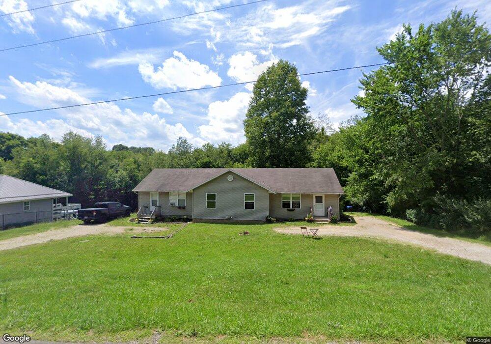
This home is located at 3048 Moffett Rd Unit 3050, Lucas, OH 44843 and is currently estimated at $236,466, approximately $130 per square foot. 3048 Moffett Rd Unit 3050 is a home located in Richland County with nearby schools including Lucas Elementary School, Lucas Heritage Middle School, and Lucas High School.
Ownership History
Date
Name
Owned For
Owner Type
Purchase Details
Closed on
Feb 4, 2019
Sold by
Grimmett Melissa A and Smith Melissa
Bought by
Grimmett Howard E
Current Estimated Value
Purchase Details
Closed on
Jul 14, 2012
Sold by
Smith Michael E and Smith Elizabeth
Bought by
Smith Melissa
Home Financials for this Owner
Home Financials are based on the most recent Mortgage that was taken out on this home.
Original Mortgage
$70,000
Outstanding Balance
$10,794
Interest Rate
3.73%
Mortgage Type
New Conventional
Estimated Equity
$225,672
Purchase Details
Closed on
Oct 5, 2001
Sold by
Ganson Charles S
Bought by
Smith Michael E
Home Financials for this Owner
Home Financials are based on the most recent Mortgage that was taken out on this home.
Original Mortgage
$84,000
Interest Rate
6.99%
Mortgage Type
New Conventional
Create a Home Valuation Report for This Property
The Home Valuation Report is an in-depth analysis detailing your home's value as well as a comparison with similar homes in the area
Home Values in the Area
Average Home Value in this Area
Purchase History
| Date | Buyer | Sale Price | Title Company |
|---|---|---|---|
| Grimmett Howard E | -- | None Available | |
| Smith Melissa | $100,000 | Williamson Title Agency Inc | |
| Smith Michael E | $105,000 | -- |
Source: Public Records
Mortgage History
| Date | Status | Borrower | Loan Amount |
|---|---|---|---|
| Open | Smith Melissa | $70,000 | |
| Previous Owner | Smith Michael E | $84,000 |
Source: Public Records
Tax History Compared to Growth
Tax History
| Year | Tax Paid | Tax Assessment Tax Assessment Total Assessment is a certain percentage of the fair market value that is determined by local assessors to be the total taxable value of land and additions on the property. | Land | Improvement |
|---|---|---|---|---|
| 2024 | $2,788 | $64,810 | $8,200 | $56,610 |
| 2023 | $2,788 | $64,810 | $8,200 | $56,610 |
| 2022 | $2,515 | $52,230 | $7,330 | $44,900 |
| 2021 | $2,521 | $52,230 | $7,330 | $44,900 |
| 2020 | $2,338 | $47,670 | $7,330 | $40,340 |
| 2019 | $2,108 | $40,400 | $6,210 | $34,190 |
| 2018 | $2,170 | $40,400 | $6,210 | $34,190 |
| 2017 | $2,218 | $40,400 | $6,210 | $34,190 |
| 2016 | $2,250 | $42,060 | $5,590 | $36,470 |
| 2015 | $2,248 | $42,060 | $5,590 | $36,470 |
| 2014 | $2,261 | $42,060 | $5,590 | $36,470 |
| 2012 | $1,115 | $42,060 | $5,590 | $36,470 |
Source: Public Records
Map
Nearby Homes
- 2905 Tucker Rd
- 3261 Moffett Rd
- 2221 Pleasant Valley Rd
- 0 Tucker Rd
- 0 Moffett Rd
- 174 W Main St
- 0 Garver Rd Washington Rd S Unit 20253648
- 2428 Applegate Rd
- 1135 E Hanley Rd
- 4978 Bott Rd
- 1679 Pulver Rd
- 0 Applegate Rd
- 2061 Washington North Rd
- 0 Garver Washington Rd S
- 3386 Trumpower Rd
- 68.40 Acres Trumpower Rd
- 0 Trumpower Rd
- 0 Mount Zion Rd Unit 9069748
- 3362 Possum Run Rd
- 0 Kenton Rd
- 3060 Moffett Rd
- 3072 Moffett Rd
- 3084 Moffett Rd Unit 3086
- 3096 Moffett Rd
- 3108 Moffett Rd
- 3124 Moffett Rd
- 3113 Moffett Rd
- 3125 Moffett Rd
- 3141 Moffett Rd
- 2859 Tucker Rd
- 3171 Moffett Rd
- 3223 Moffett Rd
- 2971 Tucker Rd
- 2969 Tucker Rd
- 3272 Moffett Rd
- 3249 Moffett Rd
- 2970 Tucker Rd
- 3017 Tucker Rd
- 2769 Tucker Rd
- 2796 Moffett Rd