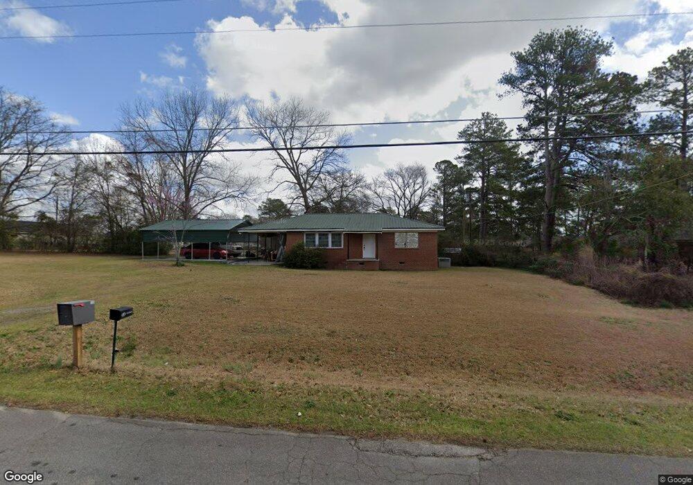
305 Brady Dr Warner Robins, GA 31088
Estimated Value: $120,502 - $159,000
Studio
1
Bath
1,080
Sq Ft
$129/Sq Ft
Est. Value
About This Home
This home is located at 305 Brady Dr, Warner Robins, GA 31088 and is currently estimated at $139,626, approximately $129 per square foot. 305 Brady Dr is a home located in Houston County with nearby schools including Miller Elementary School, Warner Robins Middle School, and Warner Robins High School.
Ownership History
Date
Name
Owned For
Owner Type
Purchase Details
Closed on
Oct 3, 2018
Sold by
Wages John J
Bought by
Wages John J
Current Estimated Value
Purchase Details
Closed on
Jan 1, 1971
Sold by
Debarry Kathryn W
Bought by
Cravey Kathryn W
Purchase Details
Closed on
Mar 26, 1970
Sold by
Debarry Herbert
Bought by
Debarry Kathryn W
Purchase Details
Closed on
May 18, 1965
Bought by
Debarry Herbert
Create a Home Valuation Report for This Property
The Home Valuation Report is an in-depth analysis detailing your home's value as well as a comparison with similar homes in the area
Home Values in the Area
Average Home Value in this Area
Purchase History
| Date | Buyer | Sale Price | Title Company |
|---|---|---|---|
| Wages John J | -- | None Available | |
| Cravey Kathryn W | -- | -- | |
| Debarry Kathryn W | -- | -- | |
| Debarry Herbert | -- | -- |
Source: Public Records
Tax History
| Year | Tax Paid | Tax Assessment Tax Assessment Total Assessment is a certain percentage of the fair market value that is determined by local assessors to be the total taxable value of land and additions on the property. | Land | Improvement |
|---|---|---|---|---|
| 2024 | $735 | $32,720 | $8,760 | $23,960 |
| 2023 | $839 | $34,720 | $14,840 | $19,880 |
| 2022 | $797 | $32,960 | $14,840 | $18,120 |
| 2021 | $742 | $30,560 | $14,840 | $15,720 |
| 2020 | $744 | $30,400 | $14,840 | $15,560 |
| 2019 | $740 | $30,320 | $14,840 | $15,480 |
| 2018 | $691 | $30,320 | $14,840 | $15,480 |
| 2017 | $692 | $30,320 | $14,840 | $15,480 |
| 2016 | $693 | $30,320 | $14,840 | $15,480 |
| 2015 | $694 | $30,320 | $14,840 | $15,480 |
| 2014 | -- | $30,320 | $14,840 | $15,480 |
| 2013 | -- | $30,320 | $14,840 | $15,480 |
Source: Public Records
Map
Nearby Homes
- 112 Holt Ave
- 225 Woodland Trail
- 209 Knodishall Dr
- 108 Madison Ave
- 707 Wilmington Dr
- 301 Millside Dr
- 112 Peacock Dr
- 101 Hampstead Ct
- 705 Corder Rd
- 105 Maga Ct
- 125 N Sky Dr
- 141 Peacock Dr
- 114 Skyway Dr
- 103 Lake Dr
- 111 Hawthorne Rd
- 103 Westcliff Cir Unit A
- 103 Westcliff Cir Unit A
- 201 Clairmont Dr
- 304 Laurie Ln
- 102 Westcliff Center St Unit D
- 197 Woodland Trail
- 227 Brady Dr
- 308 Brady Dr
- 203 Woodland Trail
- 203 Woodland Trail
- 225 Brady Dr Unit A
- 225 Brady Dr
- 200 Brady Dr
- 128 Jaybee Dr
- 217 Brady Dr
- 204 Woodland Trail
- 225a Brady Dr
- 126 Jaybee Dr
- 205 Woodland Trail
- 124 Jaybee Dr
- 129 Jaybee Dr
- 310 Brady Dr
- 206 Woodland Trail
- 122 Jaybee Dr
- 127 Jaybee Dr
Your Personal Tour Guide
Ask me questions while you tour the home.