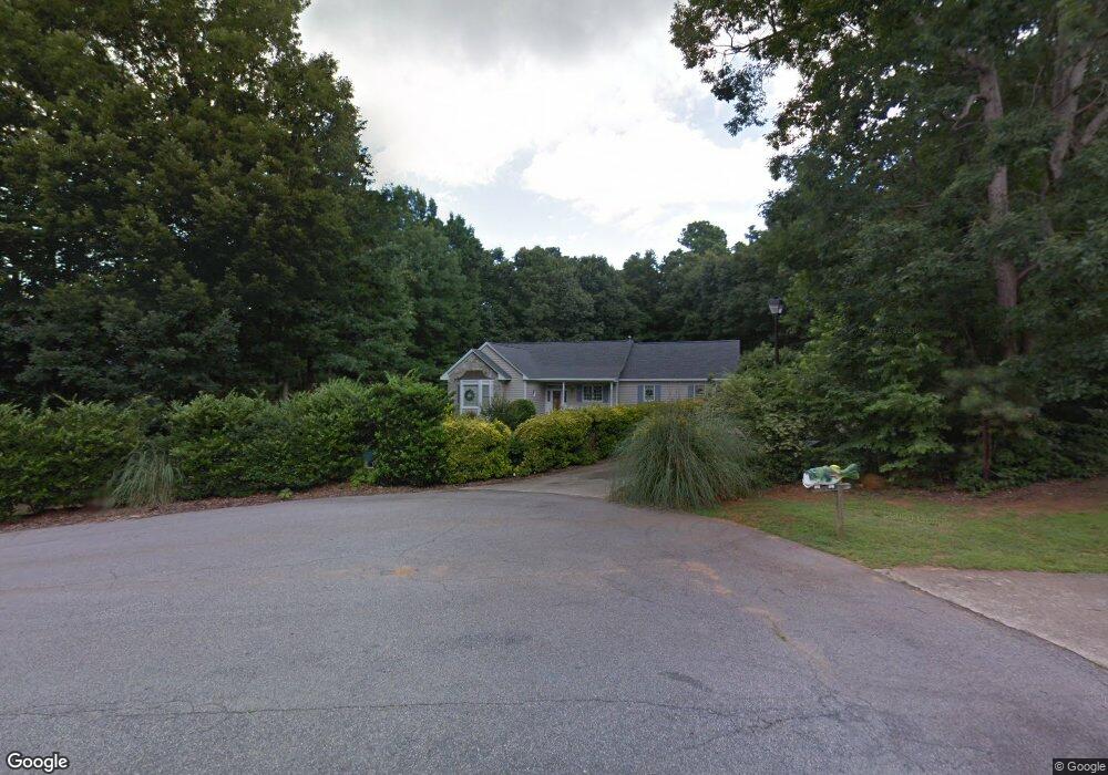
305 Brierroot Ct Wake Forest, NC 27587
Estimated Value: $390,000 - $448,000
3
Beds
2
Baths
1,500
Sq Ft
$278/Sq Ft
Est. Value
About This Home
This home is located at 305 Brierroot Ct, Wake Forest, NC 27587 and is currently estimated at $417,048, approximately $278 per square foot. 305 Brierroot Ct is a home located in Wake County with nearby schools including Richland Creek Elementary School, Wake Forest-Rolesville Middle School, and Wake Forest High School.
Ownership History
Date
Name
Owned For
Owner Type
Purchase Details
Closed on
Aug 27, 1998
Sold by
Dawson Daniel John
Bought by
Rosche Mark and Rosche Sherry
Current Estimated Value
Home Financials for this Owner
Home Financials are based on the most recent Mortgage that was taken out on this home.
Original Mortgage
$142,500
Outstanding Balance
$30,493
Interest Rate
6.92%
Estimated Equity
$386,555
Create a Home Valuation Report for This Property
The Home Valuation Report is an in-depth analysis detailing your home's value as well as a comparison with similar homes in the area
Home Values in the Area
Average Home Value in this Area
Purchase History
| Date | Buyer | Sale Price | Title Company |
|---|---|---|---|
| Rosche Mark | $150,000 | -- |
Source: Public Records
Mortgage History
| Date | Status | Borrower | Loan Amount |
|---|---|---|---|
| Open | Rosche Mark | $142,500 |
Source: Public Records
Tax History
| Year | Tax Paid | Tax Assessment Tax Assessment Total Assessment is a certain percentage of the fair market value that is determined by local assessors to be the total taxable value of land and additions on the property. | Land | Improvement |
|---|---|---|---|---|
| 2025 | $2,853 | $442,901 | $140,000 | $302,901 |
| 2024 | $2,770 | $442,901 | $140,000 | $302,901 |
| 2023 | $1,973 | $250,518 | $65,000 | $185,518 |
| 2022 | $1,829 | $250,518 | $65,000 | $185,518 |
| 2021 | $1,780 | $250,518 | $65,000 | $185,518 |
| 2020 | $1,751 | $250,518 | $65,000 | $185,518 |
| 2019 | $1,819 | $220,273 | $65,000 | $155,273 |
| 2018 | $1,673 | $220,273 | $65,000 | $155,273 |
| 2017 | $1,586 | $220,273 | $65,000 | $155,273 |
| 2016 | $1,554 | $220,273 | $65,000 | $155,273 |
| 2015 | $1,627 | $231,430 | $76,000 | $155,430 |
| 2014 | $1,543 | $228,348 | $76,000 | $152,348 |
Source: Public Records
Map
Nearby Homes
- 708 Dragonfly Pond Way
- 737 Dragonfly Pond Way
- 720 Dragonfly Pond Way
- 733 Dragonfly Pond Way
- 729 Dragonfly Pond Way
- 725 Dragonfly Pond Way
- 704 Dragonfly Pond Way
- 400 French Broad St
- 401 French Broad St
- 716 Dragonfly Pond Way
- 724 Dragonfly Pond Way
- 800 Dragonfly Pond Way
- 955 Alma Railway Dr Unit 563
- 935 Alma Railway Dr Unit 554
- 943 Alma Railway Dr Unit 558
- 937 Alma Railway Dr Unit 555
- 852 Dragonfly Pond Way
- 949 Alma Railway Dr
- 933 Alma Railway Dr Unit 553
- 945 Alma Railway Dr Unit 559
- 301 Brierroot Ct
- 309 Brierroot Ct
- 219 Kullana Ln
- 1160 N Main St
- 304 Brierroot Ct
- 308 Brierroot Ct
- Lot 49 Dragonfly Pond Way
- 213 Kullana Ln
- 224 Kullana Ln
- 1114 Kullana Ln
- Lot 44 Dragonfly Pond Way
- Lot 12 Dragonfly Pond Way
- 1113 Kullana Ln
- 216 Kullana Ln
- 1162 N Main St
- 205 Kullana Ln
- 208 Kullana Ln
- 1110 Kullana Ln
- 1164 N Main St
- Lot 16 Dragonfly Pond Way
Your Personal Tour Guide
Ask me questions while you tour the home.