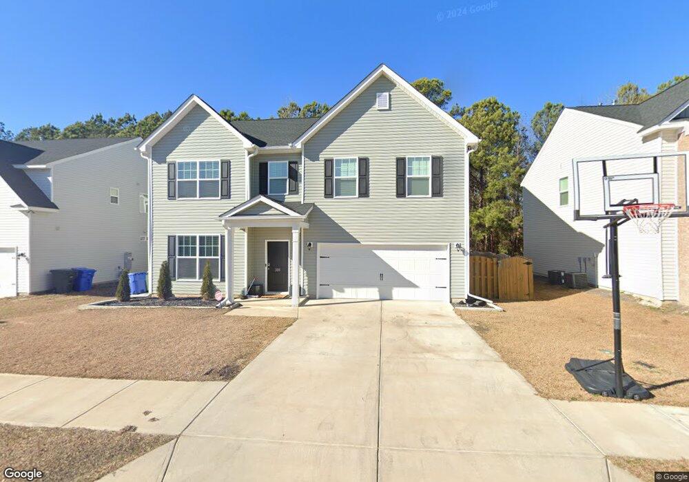
305 Council Loop Columbia, SC 29209
Southeast Columbia NeighborhoodEstimated Value: $312,000 - $386,000
4
Beds
3
Baths
3,592
Sq Ft
$97/Sq Ft
Est. Value
About This Home
This home is located at 305 Council Loop, Columbia, SC 29209 and is currently estimated at $348,478, approximately $97 per square foot. 305 Council Loop is a home with nearby schools including Annie Burnside Elementary School, Crayton Middle School, and A. C. Flora High School.
Ownership History
Date
Name
Owned For
Owner Type
Purchase Details
Closed on
Feb 9, 2021
Sold by
Stanley Martin Companies Llc and Stanley Martin Homes Llc
Bought by
Barud Miguel A and Abujawdeh Nadya T
Current Estimated Value
Home Financials for this Owner
Home Financials are based on the most recent Mortgage that was taken out on this home.
Original Mortgage
$255,862
Outstanding Balance
$228,840
Interest Rate
2.7%
Mortgage Type
VA
Estimated Equity
$119,638
Purchase Details
Closed on
May 21, 2020
Sold by
Burnside Farm Associates Llc
Bought by
Stanley Martin Companies Llc
Create a Home Valuation Report for This Property
The Home Valuation Report is an in-depth analysis detailing your home's value as well as a comparison with similar homes in the area
Home Values in the Area
Average Home Value in this Area
Purchase History
| Date | Buyer | Sale Price | Title Company |
|---|---|---|---|
| Barud Miguel A | $926 | None Listed On Document | |
| Barud Miguel A | $926 | None Listed On Document | |
| Barud Miguel A | $250,110 | Harvey & Vallini Llc | |
| Barud Miguel A | $250,110 | None Listed On Document | |
| Stanley Martin Companies Llc | $207,900 | None Available |
Source: Public Records
Mortgage History
| Date | Status | Borrower | Loan Amount |
|---|---|---|---|
| Open | Barud Miguel A | $255,862 | |
| Closed | Barud Miguel A | $255,862 |
Source: Public Records
Tax History
| Year | Tax Paid | Tax Assessment Tax Assessment Total Assessment is a certain percentage of the fair market value that is determined by local assessors to be the total taxable value of land and additions on the property. | Land | Improvement |
|---|---|---|---|---|
| 2024 | -- | $287,600 | $0 | $0 |
| 2023 | $7,872 | $10,004 | $0 | $0 |
| 2022 | $7,234 | $250,100 | $33,500 | $216,600 |
| 2021 | $977 | $2,010 | $0 | $0 |
| 2020 | $98 | $200 | $0 | $0 |
Source: Public Records
Map
Nearby Homes
- 173 Council Loop
- 300 E Lake Trail
- 225 E Lake Trail
- 174 Preston Green Dr
- 164 Springway Dr
- 1606 Blaine St
- 267 Ashewood Commons Dr
- 11 Paperbark Ct
- 267 Ashewood Lake Dr
- 31 Silverleaf Ct
- 123 Gayle Pond Trace
- 628 Burnside Dr
- 1152 Rockwood Rd
- 25 Willow Hurst Ct
- 1284 Rockwood Rd
- 1191 Rockwood Rd
- 404 Hampton Forest Dr
- 1273 Rockwood Rd
- 759 Burnside Dr
- 231 Forest Green Dr
- 309 Council Loop
- 301 Council Loop
- 313 Council Loop
- 297 Council Loop
- 304 Council Loop
- 300 Council Loop
- 308 Council Loop
- 293 Council Loop
- 317 Council Loop
- 312 Council Loop
- 321 Council Loop
- 320 Council Loop
- 287 Council Loop
- 236 Council Loop
- 228 Council Loop
- 232 Council Loop
- 325 Council Loop
- 240 Council Loop
- 324 Council Loop
- 281 Council Loop
Your Personal Tour Guide
Ask me questions while you tour the home.