Estimated Value: $135,000 - $209,000
5
Beds
3
Baths
2,328
Sq Ft
$72/Sq Ft
Est. Value
About This Home
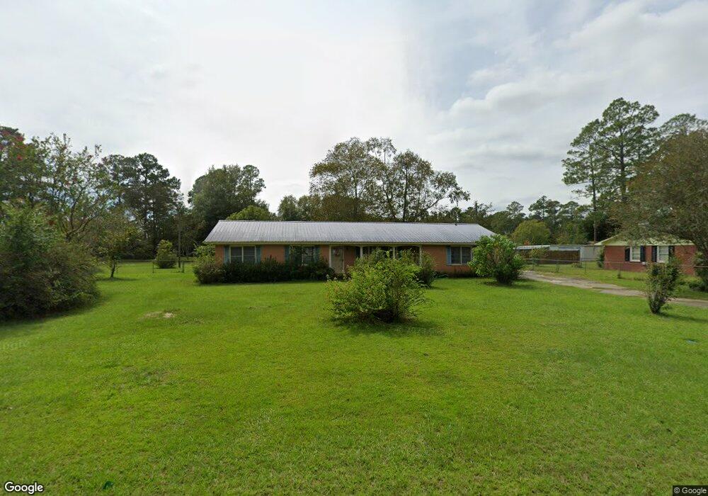
This home is located at 305 Crosby Rd, Alma, GA 31510 and is currently estimated at $167,748, approximately $72 per square foot. 305 Crosby Rd is a home located in Bacon County with nearby schools including Bacon County Primary School, Bacon County Elementary School, and Bacon County Middle School.
Ownership History
Date
Name
Owned For
Owner Type
Purchase Details
Closed on
Jan 29, 2024
Sold by
Norris Bishop Investments Inc
Bought by
Jenkins Sarah
Current Estimated Value
Purchase Details
Closed on
Oct 25, 2023
Sold by
Napier Bonnie Lou
Bought by
Norris Bishop Investments Inc
Purchase Details
Closed on
May 3, 2001
Sold by
Benton Huel and Benton Scher
Bought by
Napier Bonnie Lou
Purchase Details
Closed on
Feb 25, 1999
Sold by
Benton Huel
Bought by
Benton Huel and Benton Scher
Purchase Details
Closed on
Dec 26, 1989
Bought by
Benton Huel
Create a Home Valuation Report for This Property
The Home Valuation Report is an in-depth analysis detailing your home's value as well as a comparison with similar homes in the area
Home Values in the Area
Average Home Value in this Area
Purchase History
| Date | Buyer | Sale Price | Title Company |
|---|---|---|---|
| Jenkins Sarah | $125,000 | -- | |
| Norris Bishop Investments Inc | $86,500 | -- | |
| Napier Bonnie Lou | $65,000 | -- | |
| Benton Huel | -- | -- | |
| Benton Huel | -- | -- |
Source: Public Records
Tax History Compared to Growth
Tax History
| Year | Tax Paid | Tax Assessment Tax Assessment Total Assessment is a certain percentage of the fair market value that is determined by local assessors to be the total taxable value of land and additions on the property. | Land | Improvement |
|---|---|---|---|---|
| 2024 | $2,186 | $60,176 | $3,840 | $56,336 |
| 2023 | $1,929 | $55,096 | $3,840 | $51,256 |
| 2022 | $1,311 | $39,056 | $3,840 | $35,216 |
| 2021 | $1,300 | $38,776 | $3,840 | $34,936 |
| 2020 | $1,169 | $34,065 | $3,503 | $30,562 |
| 2019 | $1,169 | $34,065 | $3,503 | $30,562 |
| 2018 | $1,184 | $34,495 | $3,503 | $30,992 |
| 2017 | $1,389 | $34,495 | $3,503 | $30,992 |
| 2016 | $1,286 | $34,495 | $3,503 | $30,992 |
| 2015 | $1,260 | $36,374 | $3,914 | $32,460 |
| 2014 | $1,143 | $36,374 | $3,914 | $32,460 |
| 2013 | $1,143 | $32,259 | $3,914 | $28,345 |
Source: Public Records
Map
Nearby Homes
- 611 S Bead St
- 403 S Ware St
- 117 Grace Loop Unit 1
- 118 Grace Loop Unit 1
- 122 Grace Loop Unit 1
- 314 W 16th St
- 9TH E 417
- 1348 U S 1
- 113 Brite Blue Dr
- 198 Meadow Rd
- 166 Grace Loop Unit 1
- 907 N Pierce St
- 224 Meadow Rd
- 401 Lee St
- 0 Oriole Rd Unit 1654653
- 0 Oriole Rd Unit 10543585
- 0 Oriole Rd Unit 25773381
- 0 Oriole Rd Unit 160930
- 118 Morris Dr
- 1109 W 4th Street Extension
- 303 Crosby Rd
- 304 Crosby Rd
- 309 Crosby Rd
- 308 Crosby Rd
- 108 Mccrea Ave
- 202 Mccrea Ave
- 506 Townsend Ln
- 306 Taylor Rd
- 308 Taylor Rd
- 310 Crosby Rd
- 204 Mccrea Ave
- 0 Townsend Ln
- 310 Taylor Rd
- 207 Crosby Rd
- 109 Mccrea Ave
- 507 Radio Station Rd
- 507 Townsend Ln
- 1179 S Pierce St
- 511 Radio Station Rd
- 107 Mccrea Ave