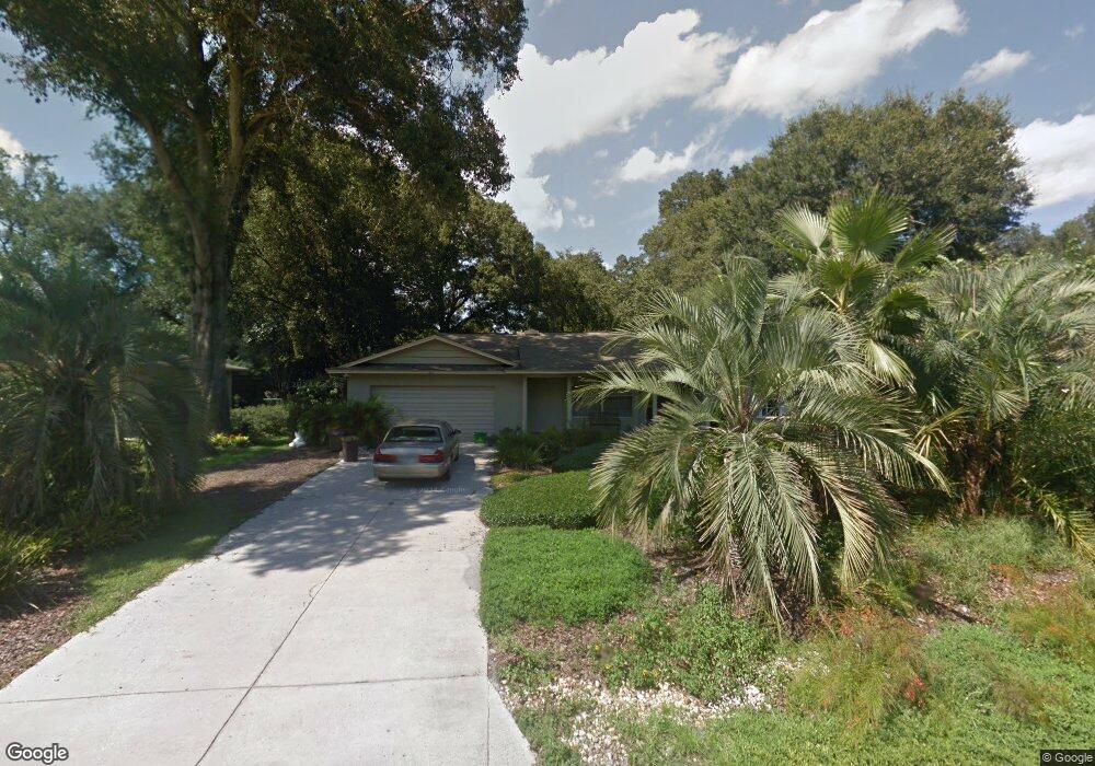
305 Cumberland Rd Deland, FL 32724
North DeLand NeighborhoodEstimated Value: $268,000 - $302,000
3
Beds
2
Baths
1,651
Sq Ft
$176/Sq Ft
Est. Value
About This Home
This home is located at 305 Cumberland Rd, Deland, FL 32724 and is currently estimated at $291,336, approximately $176 per square foot. 305 Cumberland Rd is a home located in Volusia County with nearby schools including George W. Marks Elementary School, Deland High School, and Deland Middle School.
Ownership History
Date
Name
Owned For
Owner Type
Purchase Details
Closed on
Nov 20, 2024
Sold by
Zollinger Fred L and Zollinger Sara H
Bought by
Zollinger Fred L and Zollinger Sara H
Current Estimated Value
Purchase Details
Closed on
Apr 15, 1990
Bought by
Zollinger Fred L and Zollinger Sara H
Purchase Details
Closed on
May 15, 1988
Bought by
Zollinger Fred L and Zollinger Sara H
Purchase Details
Closed on
Dec 15, 1983
Bought by
Zollinger Fred L and Zollinger Sara H
Purchase Details
Closed on
Mar 15, 1982
Bought by
Zollinger Fred L and Zollinger Sara H
Create a Home Valuation Report for This Property
The Home Valuation Report is an in-depth analysis detailing your home's value as well as a comparison with similar homes in the area
Home Values in the Area
Average Home Value in this Area
Purchase History
| Date | Buyer | Sale Price | Title Company |
|---|---|---|---|
| Zollinger Fred L | $100 | None Listed On Document | |
| Zollinger Fred L | $74,500 | -- | |
| Zollinger Fred L | $100 | -- | |
| Zollinger Fred L | $100 | -- | |
| Zollinger Fred L | $100 | -- | |
| Zollinger Fred L | $44,000 | -- |
Source: Public Records
Tax History Compared to Growth
Tax History
| Year | Tax Paid | Tax Assessment Tax Assessment Total Assessment is a certain percentage of the fair market value that is determined by local assessors to be the total taxable value of land and additions on the property. | Land | Improvement |
|---|---|---|---|---|
| 2025 | $1,236 | $97,287 | -- | -- |
| 2024 | $1,236 | $94,546 | -- | -- |
| 2023 | $1,236 | $91,793 | $0 | $0 |
| 2022 | $1,184 | $89,119 | $0 | $0 |
| 2021 | $999 | $76,373 | $0 | $0 |
| 2020 | $975 | $75,319 | $0 | $0 |
| 2019 | $999 | $73,626 | $0 | $0 |
| 2018 | $993 | $72,253 | $0 | $0 |
| 2017 | $982 | $70,767 | $0 | $0 |
| 2016 | $948 | $69,311 | $0 | $0 |
| 2015 | $967 | $68,829 | $0 | $0 |
| 2014 | $965 | $68,283 | $0 | $0 |
Source: Public Records
Map
Nearby Homes
- 1207 N Amelia Ave
- 404 E Kentucky Ave
- 205 E Kentucky Ave
- 1307 Cook St
- 1408 N Garfield Ave
- 1412 N Garfield Ave
- 106 E Rosehill Ave
- 104 E Rosehill Ave
- 516 Grace Ave
- 1500 N Clearview Ave
- 0 North St Unit 1216611
- 0 North St Unit 1211817
- 569 Parkdale Ct
- 528 Compton Ct
- 0 No St Unit MFRV4941771
- 0 No St Unit MFRO6252389
- 0 No St Unit 1121839
- 0 No St Unit MFRV4933386
- 1 Smith Ct
- 325 E Plymouth Ave
- 301 Cumberland Rd
- 320 E Kentucky Ave
- 307 Cumberland Rd
- 326 E Kentucky Ave
- 1205 N Amelia Ave
- 334 Cumberland Rd Unit 32724
- 334 Cumberland Rd
- 336 E Kentucky Ave
- 336 Cumberland Rd
- 338 Cumberland Rd
- 338 E Kentucky Ave
- 303 E Kentucky Ave
- 321 E Parkdale Ave
- 333 E Kentucky Ave
- 335 E Parkdale Ave
- 340 E Kentucky Ave
- 223 E Kentucky Ave
- 301 E Kentucky Ave
- 340 Cumberland Rd
- 1201 N Amelia Ave