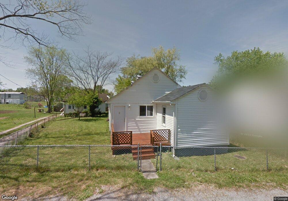
305 Depot St Coal Grove, OH 45638
Estimated Value: $94,000 - $107,000
3
Beds
1
Bath
1,184
Sq Ft
$83/Sq Ft
Est. Value
About This Home
This home is located at 305 Depot St, Coal Grove, OH 45638 and is currently estimated at $98,825, approximately $83 per square foot. 305 Depot St is a home located in Lawrence County with nearby schools including Dawson-Bryant Elementary School, Dawson-Bryant Middle School, and Dawson-Bryant High School.
Ownership History
Date
Name
Owned For
Owner Type
Purchase Details
Closed on
Mar 6, 2014
Sold by
Kelly Cindy L
Bought by
Regional Properties Llc
Current Estimated Value
Purchase Details
Closed on
Oct 4, 2010
Sold by
Kelly Timothy D
Bought by
Kelly Cindy L
Purchase Details
Closed on
Feb 1, 1988
Sold by
Griffith Ruth and Griffith Dorothy
Bought by
Kelley Timothy D and Kelley Cin
Create a Home Valuation Report for This Property
The Home Valuation Report is an in-depth analysis detailing your home's value as well as a comparison with similar homes in the area
Home Values in the Area
Average Home Value in this Area
Purchase History
| Date | Buyer | Sale Price | Title Company |
|---|---|---|---|
| Regional Properties Llc | $8,350 | None Available | |
| Kelly Cindy L | -- | Attorney | |
| Kelley Timothy D | $20,000 | -- |
Source: Public Records
Tax History Compared to Growth
Tax History
| Year | Tax Paid | Tax Assessment Tax Assessment Total Assessment is a certain percentage of the fair market value that is determined by local assessors to be the total taxable value of land and additions on the property. | Land | Improvement |
|---|---|---|---|---|
| 2024 | -- | $24,240 | $5,780 | $18,460 |
| 2023 | $822 | $24,240 | $5,780 | $18,460 |
| 2022 | $820 | $24,240 | $5,780 | $18,460 |
| 2021 | $729 | $23,930 | $5,370 | $18,560 |
| 2020 | $830 | $23,930 | $5,370 | $18,560 |
| 2019 | $827 | $23,930 | $5,370 | $18,560 |
| 2018 | $836 | $23,930 | $5,370 | $18,560 |
| 2017 | $834 | $23,930 | $5,370 | $18,560 |
| 2016 | $780 | $23,930 | $5,370 | $18,560 |
| 2015 | $828 | $23,750 | $5,370 | $18,380 |
| 2014 | $511 | $23,750 | $5,370 | $18,380 |
| 2013 | $511 | $23,750 | $5,370 | $18,380 |
Source: Public Records
Map
Nearby Homes
- 805 1/2 High St
- 519 Lane St
- 514 Lane St
- 125 Center St
- 303 Pike St
- 119 Remy St
- 103 Carrico Dr
- 309 High St
- 309 High St Unit LAO-5
- 1003 Marion Pike
- 0 Central & Mlk
- 508 16th St
- 1824 Carter Ave
- 0 18th Street & Central Ave
- 2088 State Route 243
- 156 Township Road 181
- 0 Carter Ave
- 1100 Price St
- 1409 Hoods Creek Pike
- 0 Amanda Furnace Dr