Estimated Value: $56,000 - $108,000
Studio
2
Baths
1,152
Sq Ft
$73/Sq Ft
Est. Value
About This Home
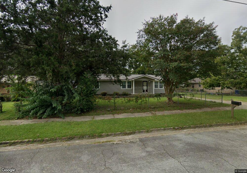
This home is located at 305 E 10th St, Alma, GA 31510 and is currently estimated at $84,234, approximately $73 per square foot. 305 E 10th St is a home located in Bacon County with nearby schools including Bacon County Primary School, Bacon County Elementary School, and Bacon County Middle School.
Ownership History
Date
Name
Owned For
Owner Type
Purchase Details
Closed on
Jun 13, 2022
Sold by
Smith Antonio
Bought by
Smith Antonio and Fairley Kay Cedar
Current Estimated Value
Purchase Details
Closed on
Sep 16, 2010
Sold by
Garrett Brenda G
Bought by
Smith Antonio
Home Financials for this Owner
Home Financials are based on the most recent Mortgage that was taken out on this home.
Original Mortgage
$20,000
Interest Rate
4.31%
Mortgage Type
Purchase Money Mortgage
Purchase Details
Closed on
Apr 3, 2010
Sold by
Chastain Linda
Bought by
Garrett Brenda G
Create a Home Valuation Report for This Property
The Home Valuation Report is an in-depth analysis detailing your home's value as well as a comparison with similar homes in the area
Home Values in the Area
Average Home Value in this Area
Purchase History
| Date | Buyer | Sale Price | Title Company |
|---|---|---|---|
| Smith Antonio | -- | -- | |
| Smith Antonio | $21,500 | -- | |
| Garrett Brenda G | -- | -- |
Source: Public Records
Mortgage History
| Date | Status | Borrower | Loan Amount |
|---|---|---|---|
| Previous Owner | Smith Antonio | $20,000 |
Source: Public Records
Tax History
| Year | Tax Paid | Tax Assessment Tax Assessment Total Assessment is a certain percentage of the fair market value that is determined by local assessors to be the total taxable value of land and additions on the property. | Land | Improvement |
|---|---|---|---|---|
| 2024 | $622 | $18,560 | $2,160 | $16,400 |
| 2023 | $578 | $16,400 | $1,400 | $15,000 |
| 2022 | $416 | $12,200 | $1,400 | $10,800 |
| 2021 | $414 | $12,160 | $1,400 | $10,760 |
| 2020 | $385 | $10,971 | $1,280 | $9,691 |
| 2019 | $385 | $10,971 | $1,280 | $9,691 |
| 2018 | $379 | $10,853 | $1,280 | $9,573 |
| 2017 | $437 | $10,853 | $1,280 | $9,573 |
| 2016 | $380 | $10,853 | $1,280 | $9,573 |
| 2015 | $373 | $10,664 | $1,101 | $9,564 |
| 2014 | $351 | $10,664 | $1,101 | $9,564 |
| 2013 | $351 | $12,512 | $1,100 | $11,411 |
Source: Public Records
Map
Nearby Homes
- 9TH E 417
- 403 S Ware St
- 117 Grace Loop Unit 1
- 118 Grace Loop Unit 1
- 122 Grace Loop Unit 1
- 108 Daughtry Rd
- 907 N Pierce St
- 611 S Bead St
- 118 Morris Dr
- 1109 W 4th Street Extension
- 166 Grace Loop Unit 1
- 113 Brite Blue Dr
- 198 Meadow Rd
- 0 Lake Lure Dr
- 0 W 4th Street Extension Unit 10650393
- 220 Lake Shore Dr
- 220 Lakeshore Dr
- 1348 U S 1
- 1608 W 4th St
- 1813 W 12th St
Your Personal Tour Guide
Ask me questions while you tour the home.