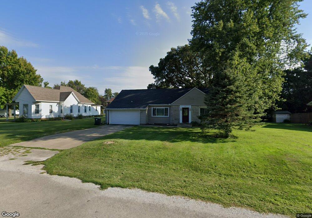
305 E Adams St Pesotum, IL 61863
Estimated Value: $177,000 - $227,000
--
Bed
1
Bath
1,030
Sq Ft
$196/Sq Ft
Est. Value
About This Home
This home is located at 305 E Adams St, Pesotum, IL 61863 and is currently estimated at $201,576, approximately $195 per square foot. 305 E Adams St is a home with nearby schools including Unity High School.
Ownership History
Date
Name
Owned For
Owner Type
Purchase Details
Closed on
May 1, 2008
Sold by
Mobley William and Mobley Cristina
Bought by
Owen Tina L
Current Estimated Value
Home Financials for this Owner
Home Financials are based on the most recent Mortgage that was taken out on this home.
Original Mortgage
$141,000
Outstanding Balance
$89,295
Interest Rate
5.88%
Mortgage Type
Purchase Money Mortgage
Estimated Equity
$112,281
Purchase Details
Closed on
Aug 8, 2007
Sold by
Champaign County
Bought by
Mobley William and Mobley Cristina
Purchase Details
Closed on
Jun 23, 2003
Sold by
Hefley Richard D and Hefley Christine L
Bought by
Hefley Christine L
Create a Home Valuation Report for This Property
The Home Valuation Report is an in-depth analysis detailing your home's value as well as a comparison with similar homes in the area
Home Values in the Area
Average Home Value in this Area
Purchase History
| Date | Buyer | Sale Price | Title Company |
|---|---|---|---|
| Owen Tina L | $142,000 | None Available | |
| Mobley William | -- | None Available | |
| Hefley Christine L | -- | -- |
Source: Public Records
Mortgage History
| Date | Status | Borrower | Loan Amount |
|---|---|---|---|
| Open | Owen Tina L | $141,000 |
Source: Public Records
Tax History Compared to Growth
Tax History
| Year | Tax Paid | Tax Assessment Tax Assessment Total Assessment is a certain percentage of the fair market value that is determined by local assessors to be the total taxable value of land and additions on the property. | Land | Improvement |
|---|---|---|---|---|
| 2024 | $2,629 | $54,700 | $10,570 | $44,130 |
| 2023 | $2,629 | $51,220 | $9,900 | $41,320 |
| 2022 | $2,535 | $47,960 | $9,270 | $38,690 |
| 2021 | $2,423 | $45,680 | $8,830 | $36,850 |
| 2020 | $2,379 | $44,220 | $8,550 | $35,670 |
| 2019 | $2,529 | $42,930 | $8,300 | $34,630 |
| 2018 | $2,445 | $42,170 | $8,150 | $34,020 |
| 2017 | $2,451 | $40,350 | $7,800 | $32,550 |
| 2016 | $2,393 | $38,990 | $7,540 | $31,450 |
| 2015 | $2,339 | $37,560 | $7,260 | $30,300 |
| 2014 | $2,302 | $36,970 | $7,150 | $29,820 |
| 2013 | $2,328 | $36,970 | $7,150 | $29,820 |
Source: Public Records
Map
Nearby Homes
- 6 Harness Ln
- 1102 County Road 600 N
- 203 S Whitehead St
- 614 E Larmon St
- 106 N Elizabeth St
- 310 N Bourne St
- 309 N Watson St
- 407 W Walnut St
- 505 N Calhoun St
- 108 W Church St
- 112 W North Front St
- 466 County Road 100 N
- 492 County Road 0 N
- 508 Timothy Dr
- 506 W Wilson St
- 514 W Harrison St
- LOT 41 Possum Trail
- 1018 N Possum Trail
- 212 W Vine St
- 1005 N Fox Run
- 309 E Adams St
- 301 E Adams St
- 304 E Adams St
- 300 E Adams St
- 12 N Walnut St
- 302 E Adams St
- 11 Church St
- 401 E Adams St
- 16 Church St
- 18 N Locust St
- 116 S Locust St
- 302 E Lincoln St
- 14 N Church St
- 114 S Locust St
- 112 S Locust St
- 10 Church St Unit 1
- 10 Church St
- 200 E Adams St
- 405 E Adams St
- 303 E Lincoln St