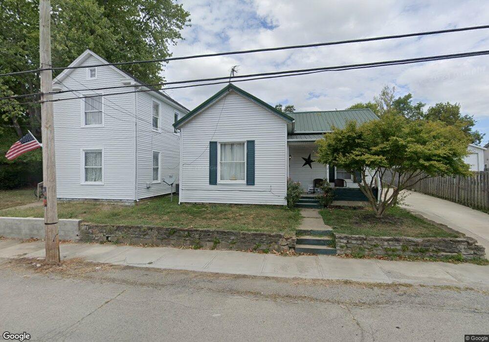
305 E North St Georgetown, OH 45121
Estimated Value: $132,625 - $178,000
2
Beds
1
Bath
1,036
Sq Ft
$148/Sq Ft
Est. Value
About This Home
This home is located at 305 E North St, Georgetown, OH 45121 and is currently estimated at $152,906, approximately $147 per square foot. 305 E North St is a home located in Brown County with nearby schools including Georgetown Elementary School and Georgetown Jr/Sr High School.
Ownership History
Date
Name
Owned For
Owner Type
Purchase Details
Closed on
Nov 26, 2025
Sold by
Wolfe Steven A and Wolfe Victoria L
Bought by
Wolfe Steven A and Wolfe Victoria L
Current Estimated Value
Home Financials for this Owner
Home Financials are based on the most recent Mortgage that was taken out on this home.
Original Mortgage
$93,000
Outstanding Balance
$92,333
Interest Rate
5.54%
Mortgage Type
New Conventional
Estimated Equity
$60,573
Purchase Details
Closed on
Apr 26, 2001
Sold by
Barnes Clarence
Bought by
Wolfe Steven A
Home Financials for this Owner
Home Financials are based on the most recent Mortgage that was taken out on this home.
Original Mortgage
$59,500
Interest Rate
7.03%
Mortgage Type
New Conventional
Purchase Details
Closed on
Jul 6, 1998
Sold by
Barnes Clarence
Bought by
Wolfe Steven A
Purchase Details
Closed on
Sep 7, 1994
Sold by
Village Properties
Bought by
Clarence and Barnes Ruth
Create a Home Valuation Report for This Property
The Home Valuation Report is an in-depth analysis detailing your home's value as well as a comparison with similar homes in the area
Home Values in the Area
Average Home Value in this Area
Purchase History
| Date | Buyer | Sale Price | Title Company |
|---|---|---|---|
| Wolfe Steven A | -- | Radian Settlement Services | |
| Wolfe Steven A | $39,000 | -- | |
| Wolfe Steven A | $39,000 | -- | |
| Clarence | $25,000 | -- |
Source: Public Records
Mortgage History
| Date | Status | Borrower | Loan Amount |
|---|---|---|---|
| Open | Wolfe Steven A | $93,000 | |
| Previous Owner | Wolfe Steven A | $59,500 | |
| Closed | Wolfe Steven A | $0 |
Source: Public Records
Tax History
| Year | Tax Paid | Tax Assessment Tax Assessment Total Assessment is a certain percentage of the fair market value that is determined by local assessors to be the total taxable value of land and additions on the property. | Land | Improvement |
|---|---|---|---|---|
| 2024 | $994 | $27,430 | $3,000 | $24,430 |
| 2023 | $995 | $17,500 | $2,530 | $14,970 |
| 2022 | $690 | $17,500 | $2,530 | $14,970 |
| 2021 | $684 | $17,500 | $2,530 | $14,970 |
| 2020 | $604 | $14,580 | $2,110 | $12,470 |
| 2019 | $600 | $14,580 | $2,110 | $12,470 |
| 2018 | $596 | $14,580 | $2,110 | $12,470 |
| 2017 | $449 | $12,940 | $2,320 | $10,620 |
| 2016 | $448 | $12,940 | $2,320 | $10,620 |
| 2015 | $454 | $12,940 | $2,320 | $10,620 |
| 2014 | $466 | $12,730 | $2,110 | $10,620 |
| 2013 | $464 | $12,730 | $2,110 | $10,620 |
Source: Public Records
Map
Nearby Homes
- 406 E North St
- 399 Elmwood Ct
- 405 N Main St
- 60 New St
- 508 Mount Orab Pike
- 505 S Water St
- 427 Kenwood Ave
- 1 N Kenwood Ave
- 666 E State St
- 2 N Kenwood Ave
- 510 W State St
- 708 E State St
- 25 Douglas Ln
- 155 Free Soil Rd
- 0 St Rt 221 & Footbridge Unit 1826509
- 175 Douglas Cir
- 20 Heritage Hill Dr
- 38 Dell Acres Dr
- 470 Free Soil Rd
- 3486 Barnes Rd
Your Personal Tour Guide
Ask me questions while you tour the home.