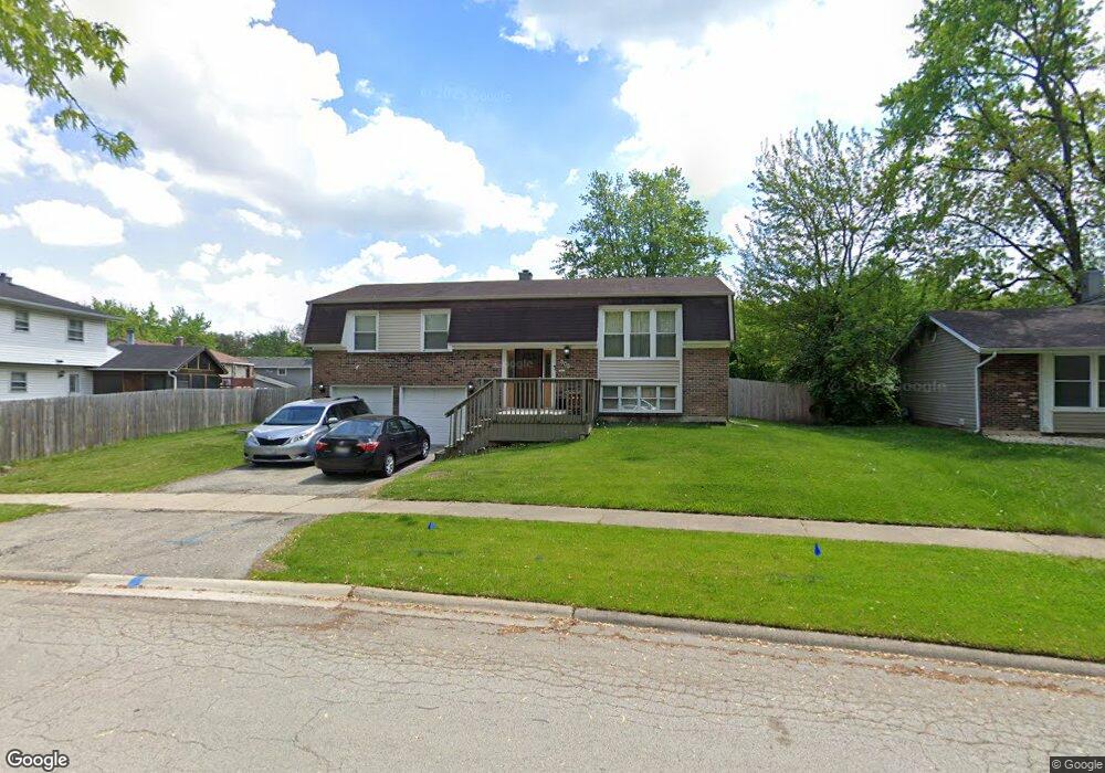
305 Ennis Ln Bolingbrook, IL 60440
Winston Woods NeighborhoodEstimated Value: $345,154 - $387,000
4
Beds
2
Baths
1,950
Sq Ft
$187/Sq Ft
Est. Value
About This Home
This home is located at 305 Ennis Ln, Bolingbrook, IL 60440 and is currently estimated at $364,789, approximately $187 per square foot. 305 Ennis Ln is a home located in Will County with nearby schools including Wood View Elementary School, Bolingbrook High School, and Furqaan Academy.
Ownership History
Date
Name
Owned For
Owner Type
Purchase Details
Closed on
Mar 2, 1999
Sold by
Okazaki Kaye F
Bought by
Cavazos Vidal I and Cavazos Araceli D
Current Estimated Value
Home Financials for this Owner
Home Financials are based on the most recent Mortgage that was taken out on this home.
Original Mortgage
$123,364
Outstanding Balance
$30,061
Interest Rate
6.83%
Mortgage Type
FHA
Estimated Equity
$334,728
Purchase Details
Closed on
Nov 5, 1990
Bought by
Cavazos Vidal I
Create a Home Valuation Report for This Property
The Home Valuation Report is an in-depth analysis detailing your home's value as well as a comparison with similar homes in the area
Home Values in the Area
Average Home Value in this Area
Purchase History
| Date | Buyer | Sale Price | Title Company |
|---|---|---|---|
| Cavazos Vidal I | $124,000 | -- | |
| Cavazos Vidal I | $111,000 | -- |
Source: Public Records
Mortgage History
| Date | Status | Borrower | Loan Amount |
|---|---|---|---|
| Open | Cavazos Vidal I | $123,364 |
Source: Public Records
Tax History Compared to Growth
Tax History
| Year | Tax Paid | Tax Assessment Tax Assessment Total Assessment is a certain percentage of the fair market value that is determined by local assessors to be the total taxable value of land and additions on the property. | Land | Improvement |
|---|---|---|---|---|
| 2024 | $8,033 | $94,975 | $19,228 | $75,747 |
| 2023 | $8,033 | $85,456 | $17,301 | $68,155 |
| 2022 | $7,022 | $77,043 | $15,598 | $61,445 |
| 2021 | $6,648 | $72,036 | $14,584 | $57,452 |
| 2020 | $6,440 | $69,667 | $14,104 | $55,563 |
| 2019 | $6,226 | $66,349 | $13,432 | $52,917 |
| 2018 | $5,973 | $63,504 | $12,856 | $50,648 |
| 2017 | $5,680 | $60,194 | $12,186 | $48,008 |
| 2016 | $5,509 | $57,300 | $11,600 | $45,700 |
| 2015 | $5,427 | $54,900 | $11,100 | $43,800 |
| 2014 | $5,427 | $54,900 | $11,100 | $43,800 |
| 2013 | $5,427 | $51,800 | $10,500 | $41,300 |
Source: Public Records
Map
Nearby Homes
- 725 N Ashbury Ave
- 800 N Ashbury Ave Unit 8
- 5 Derbyshire Ct
- 419 Charlestown Dr
- 601 Derbyshire Ln
- 427 Charlestown Dr
- 231 Charlotte Ln
- 8521 State Route 53
- 226 Hampshire Ln
- 2921 Autumn Dr
- 557 Monroe Rd
- 209 Monroe Rd Unit 66
- 1018 Rain Tree Dr
- 550 Piccadilly Ln
- 451 Alcester Ct
- 597 Eric Way
- 149 Thomas Rd
- 208 Porter Ln
- 556 Leslie Ln
- 3435 83rd St Unit C18
- 303 Ennis Ln
- 715 Westchester Ln
- 9 Westchester Ct
- 713 Westchester Ln
- 10 Westchester Ct
- 717 Westchester Ln
- 8 Westchester Ct
- 301 Ennis Ln
- 711 Westchester Ln
- 828 Tam o Shanter Cir
- 7 Westchester Ct
- 719 Westchester Ln
- 714 Westchester Ln
- 10 Ennis Ct
- 712 Westchester Ln Unit 3
- 716 Westchester Ln
- 824 Tam o Shanter Cir
- 710 Westchester Ln
- 4 Westchester Ct
- 6 Westchester Ct