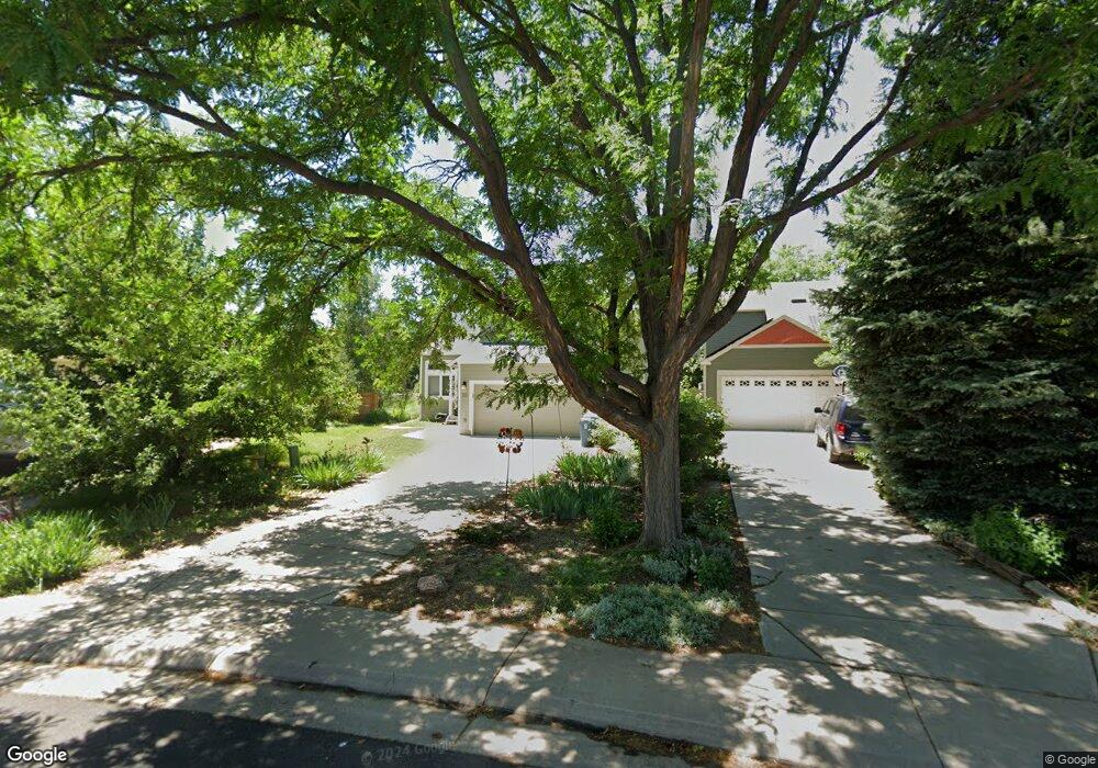
305 Grouse Ct Louisville, CO 80027
Estimated Value: $820,000 - $978,000
3
Beds
2
Baths
1,942
Sq Ft
$469/Sq Ft
Est. Value
About This Home
This home is located at 305 Grouse Ct, Louisville, CO 80027 and is currently estimated at $911,108, approximately $469 per square foot. 305 Grouse Ct is a home located in Boulder County with nearby schools including Fireside Elementary School, Monarch K-8 School, and Monarch High School.
Ownership History
Date
Name
Owned For
Owner Type
Purchase Details
Closed on
Aug 16, 2018
Sold by
Smythe Stephanie
Bought by
Smythe Stephanie and Smythe Trust
Current Estimated Value
Purchase Details
Closed on
Jun 29, 2010
Sold by
City Of Louisville
Bought by
Schomer James M
Purchase Details
Closed on
Dec 21, 1987
Bought by
Smyth Stephanie
Purchase Details
Closed on
Mar 6, 1984
Bought by
Smyth Stephanie
Create a Home Valuation Report for This Property
The Home Valuation Report is an in-depth analysis detailing your home's value as well as a comparison with similar homes in the area
Home Values in the Area
Average Home Value in this Area
Purchase History
| Date | Buyer | Sale Price | Title Company |
|---|---|---|---|
| Smythe Stephanie | -- | None Available | |
| Schomer James M | $4,036 | None Available | |
| Smyth Stephanie | $99,500 | -- | |
| Smyth Stephanie | -- | -- |
Source: Public Records
Tax History Compared to Growth
Tax History
| Year | Tax Paid | Tax Assessment Tax Assessment Total Assessment is a certain percentage of the fair market value that is determined by local assessors to be the total taxable value of land and additions on the property. | Land | Improvement |
|---|---|---|---|---|
| 2025 | $4,508 | $58,788 | $25,769 | $33,019 |
| 2024 | $4,508 | $58,788 | $25,769 | $33,019 |
| 2023 | $4,432 | $56,856 | $27,939 | $32,602 |
| 2022 | $4,342 | $45,119 | $21,406 | $23,713 |
| 2021 | $4,478 | $48,348 | $22,937 | $25,411 |
| 2020 | $3,941 | $42,114 | $19,234 | $22,880 |
| 2019 | $3,885 | $42,114 | $19,234 | $22,880 |
| 2018 | $3,521 | $39,406 | $9,720 | $29,686 |
| 2017 | $3,450 | $43,565 | $10,746 | $32,819 |
| 2016 | $3,017 | $34,292 | $14,567 | $19,725 |
| 2015 | $2,860 | $28,417 | $15,522 | $12,895 |
| 2014 | $2,430 | $28,417 | $15,522 | $12,895 |
Source: Public Records
Map
Nearby Homes
- 408 Fillmore Ct
- 159 S Polk Ave
- 592 Spruce Cir
- 494 Owl Dr Unit 4
- 118 S Tanager Ct
- 641 W Dahlia St
- 291 W Sycamore Ln
- 426 W Spruce Ln
- 812 W Mulberry St
- 593 Wildrose Way
- 279 S Taft Ct Unit 53
- 284 S Taft Ct Unit 76
- 323 S Taft Ct Unit 26
- 810 Trail Ridge Dr
- 513 Adams Ave
- 305 S Taft Ct Unit 33
- 362 S Taft Ct Unit 108
- 474 W Spruce St
- 823 Trail Ridge Dr
- 310 W Spruce St
- 309 Grouse Ct
- 301 Grouse Ct
- 313 Grouse Ct
- 568 W Sycamore St
- 100 S Polk Ave
- 317 Grouse Ct
- 566 W Sycamore St
- 314 Grouse Ct
- 101 S Buchanan Ct
- 562 W Sycamore St
- 327 Grouse Ct
- 576 W Sandbar Cir
- 326 Grouse Ct
- 311 Buchanan Ct
- 102 S Polk Ave
- 105 S Buchanan Ct
- 580 W Sandbar Cir
- 100 S Buchanan Ct
- 575 W Mulberry St
- 325 Buchanan Ct