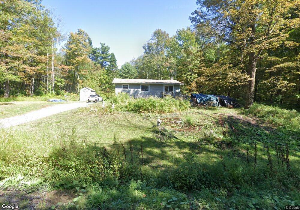
305 Johnson Rd Becket, MA 01223
Estimated Value: $308,496 - $330,000
3
Beds
2
Baths
1,268
Sq Ft
$252/Sq Ft
Est. Value
About This Home
This home is located at 305 Johnson Rd, Becket, MA 01223 and is currently estimated at $319,124, approximately $251 per square foot. 305 Johnson Rd is a home located in Berkshire County with nearby schools including Wahconah Regional High School.
Ownership History
Date
Name
Owned For
Owner Type
Purchase Details
Closed on
Jul 31, 1996
Sold by
Aurigemma Thomas C and Aurigemma Patricia A
Bought by
Hoctor Timothy D and Hoctor Kathryn D
Current Estimated Value
Home Financials for this Owner
Home Financials are based on the most recent Mortgage that was taken out on this home.
Original Mortgage
$86,000
Outstanding Balance
$6,834
Interest Rate
8.27%
Mortgage Type
Purchase Money Mortgage
Estimated Equity
$312,290
Create a Home Valuation Report for This Property
The Home Valuation Report is an in-depth analysis detailing your home's value as well as a comparison with similar homes in the area
Home Values in the Area
Average Home Value in this Area
Purchase History
| Date | Buyer | Sale Price | Title Company |
|---|---|---|---|
| Hoctor Timothy D | $86,000 | -- |
Source: Public Records
Mortgage History
| Date | Status | Borrower | Loan Amount |
|---|---|---|---|
| Open | Hoctor Timothy D | $86,000 |
Source: Public Records
Tax History
| Year | Tax Paid | Tax Assessment Tax Assessment Total Assessment is a certain percentage of the fair market value that is determined by local assessors to be the total taxable value of land and additions on the property. | Land | Improvement |
|---|---|---|---|---|
| 2025 | $1,751 | $199,900 | $18,200 | $181,700 |
| 2024 | $1,953 | $199,900 | $18,700 | $181,200 |
| 2023 | $1,959 | $182,100 | $16,200 | $165,900 |
| 2022 | $1,383 | $128,100 | $21,900 | $106,200 |
| 2020 | $1,578 | $142,400 | $21,900 | $120,500 |
| 2019 | $1,569 | $141,700 | $21,900 | $119,800 |
| 2018 | $1,540 | $141,700 | $21,900 | $119,800 |
| 2017 | $1,494 | $141,700 | $21,900 | $119,800 |
| 2016 | $1,520 | $145,300 | $21,900 | $123,400 |
| 2015 | $1,518 | $145,300 | $21,900 | $123,400 |
| 2014 | $1,517 | $145,300 | $21,900 | $123,400 |
Source: Public Records
Map
Nearby Homes
- 376 Long Bow Ln W
- 0 Long Bow Ln E Unit 73445571
- 173 King Richard Dr
- 0 Trail Cir
- 223 Silver Leaf Dr
- 455 King Richard Dr
- 102 Wells Rd
- 0 Gentian Hollow Rd
- Lot 26 Stoney Brook Rd
- 0 Stoney Brook Rd Unit 245266
- 95 Sugar House Rd
- 859 Moberg Rd
- 0 Winter Dr
- 0 Moberg Rd
- Lot 155 Chippewa Dr
- 593 Woodmere Rd
- 973 Fred Snow Rd
- 554 Main St
- 289 Algerie Rd
- 327 Chester Rd
- 271 Johnson Rd
- 345 Johnson Rd
- 78 Johnson Rd
- 7 Johnson Rd
- 245 Johnson Rd
- 462 Long Bow Ln E
- 569 Longbow Ln W
- 569 Long Bow Ln W
- 569 Long Bow Lane West --
- 0 Squires Ln W
- Lot 7 Johnson Rd
- 9 Johnson Rd
- Lot9 Johnson Rd
- LOTS5&6 Johnson Rd
- 547 Long Bow Ln W
- 0 Johnson Rd L:12
- Lot 81 Johnson Rd
- 410 Long Bow Ln E
Your Personal Tour Guide
Ask me questions while you tour the home.