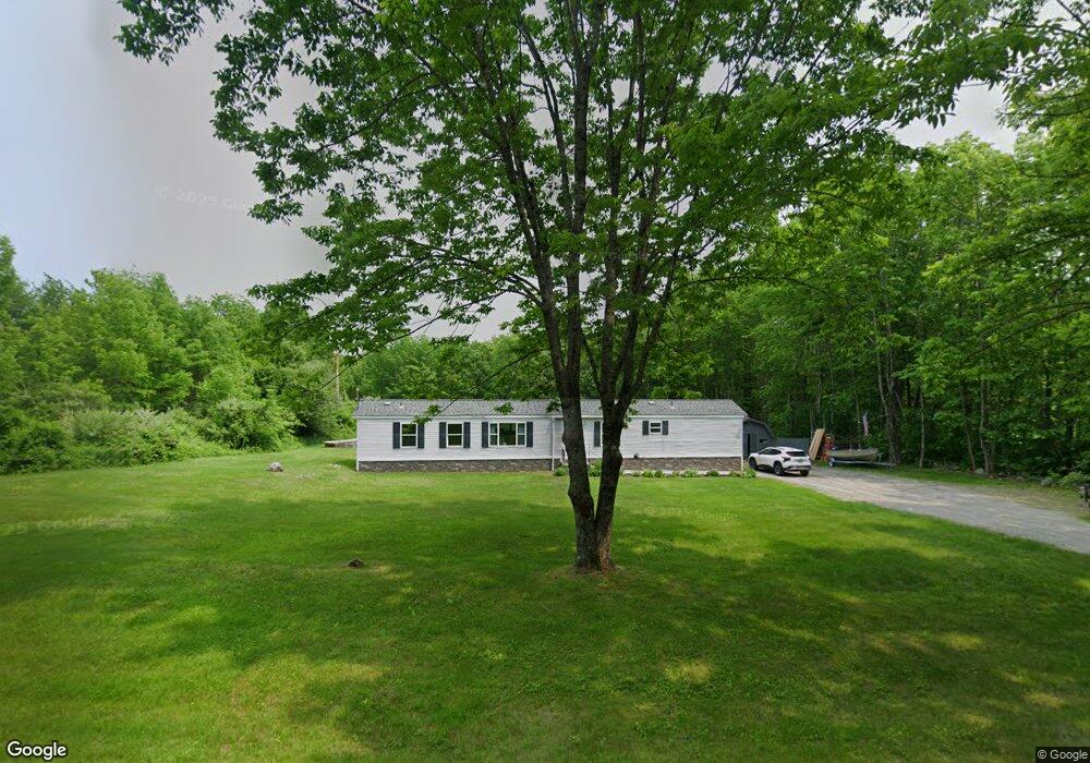
305 Millay Rd Bowdoinham, ME 04008
Estimated Value: $220,000 - $431,000
--
Bed
--
Bath
1,472
Sq Ft
$219/Sq Ft
Est. Value
About This Home
This home is located at 305 Millay Rd, Bowdoinham, ME 04008 and is currently estimated at $322,039, approximately $218 per square foot. 305 Millay Rd is a home with nearby schools including Mt Ararat High School.
Ownership History
Date
Name
Owned For
Owner Type
Purchase Details
Closed on
Sep 17, 2020
Sold by
Pelletier Roger J and Pelletier Linda E
Bought by
Plourde Kenneth P and Plourde Kathy R
Current Estimated Value
Home Financials for this Owner
Home Financials are based on the most recent Mortgage that was taken out on this home.
Original Mortgage
$90,000
Outstanding Balance
$79,721
Interest Rate
2.8%
Mortgage Type
New Conventional
Estimated Equity
$242,318
Purchase Details
Closed on
Sep 19, 2014
Sold by
Pray Daniel E and Pray Charlene A
Bought by
Pelletier Roger J and Pelletier Linda R
Create a Home Valuation Report for This Property
The Home Valuation Report is an in-depth analysis detailing your home's value as well as a comparison with similar homes in the area
Home Values in the Area
Average Home Value in this Area
Purchase History
| Date | Buyer | Sale Price | Title Company |
|---|---|---|---|
| Plourde Kenneth P | -- | None Available | |
| Plourde Kenneth P | -- | None Available | |
| Plourde Kenneth P | -- | None Available | |
| Pelletier Roger J | -- | -- | |
| Pelletier Roger J | -- | -- |
Source: Public Records
Mortgage History
| Date | Status | Borrower | Loan Amount |
|---|---|---|---|
| Open | Plourde Kenneth P | $90,000 | |
| Closed | Plourde Kenneth P | $90,000 |
Source: Public Records
Tax History Compared to Growth
Tax History
| Year | Tax Paid | Tax Assessment Tax Assessment Total Assessment is a certain percentage of the fair market value that is determined by local assessors to be the total taxable value of land and additions on the property. | Land | Improvement |
|---|---|---|---|---|
| 2024 | $2,293 | $109,200 | $61,000 | $48,200 |
| 2023 | $2,129 | $109,200 | $61,000 | $48,200 |
| 2022 | $1,453 | $80,300 | $50,800 | $29,500 |
| 2021 | $1,249 | $73,600 | $50,800 | $22,800 |
| 2020 | $1,242 | $73,600 | $50,800 | $22,800 |
| 2019 | $1,212 | $73,600 | $50,800 | $22,800 |
| 2018 | $1,197 | $69,800 | $50,800 | $19,000 |
| 2017 | $1,176 | $69,800 | $50,800 | $19,000 |
| 2016 | $1,155 | $69,800 | $50,800 | $19,000 |
| 2015 | $1,148 | $69,800 | $50,800 | $19,000 |
| 2014 | $1,134 | $69,800 | $50,800 | $19,000 |
| 2013 | $1,095 | $71,100 | $50,800 | $20,300 |
Source: Public Records
Map
Nearby Homes
- 175 Main St
- 83 Hemlock Hill Ln
- 744 Ridge Rd
- 1239 Main St
- TBD Dingley Rd
- 0 White Rd
- 51 Mountain View Cir
- 8 Lucas Ln
- 143 White Rd
- 45A-A Hornbeck Cross
- 64 Litchfield Rd
- 1116 Post Rd
- 1146 Post Rd
- Lot 08 Sara's Way
- 47 Bradstreet Dr
- Lot 46C Post Rd
- 1226 Post Rd
- 258 Dingley Rd
- 7 Billington Ln
- 45A-B Augusta Rd