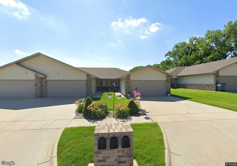
305 N 32nd St Unit C Norfolk, NE 68701
Estimated Value: $200,000 - $286,000
2
Beds
2
Baths
1,224
Sq Ft
$203/Sq Ft
Est. Value
About This Home
This home is located at 305 N 32nd St Unit C, Norfolk, NE 68701 and is currently estimated at $248,593, approximately $203 per square foot. 305 N 32nd St Unit C is a home located in Madison County with nearby schools including Norfolk Senior High School, Sacred Heart Elementary School, and Norfolk Catholic School.
Ownership History
Date
Name
Owned For
Owner Type
Purchase Details
Closed on
Nov 20, 2024
Sold by
Dale E Bethune E and Dale Yvonne M
Bought by
Palmer Family Enterprises Llc
Current Estimated Value
Purchase Details
Closed on
Oct 31, 2008
Sold by
Miller Lisa A
Bought by
Bethune Tr Dale E and Bethune Yvonne M
Purchase Details
Closed on
Jul 10, 2007
Sold by
M B H Investments Inc
Bought by
Miller Lisa A
Create a Home Valuation Report for This Property
The Home Valuation Report is an in-depth analysis detailing your home's value as well as a comparison with similar homes in the area
Home Values in the Area
Average Home Value in this Area
Purchase History
| Date | Buyer | Sale Price | Title Company |
|---|---|---|---|
| Palmer Family Enterprises Llc | $190,000 | Stewart Title | |
| Palmer Family Enterprises Llc | $190,000 | Stewart Title | |
| Bethune Tr Dale E | $117,500 | -- | |
| Miller Lisa A | $120,000 | -- |
Source: Public Records
Tax History Compared to Growth
Tax History
| Year | Tax Paid | Tax Assessment Tax Assessment Total Assessment is a certain percentage of the fair market value that is determined by local assessors to be the total taxable value of land and additions on the property. | Land | Improvement |
|---|---|---|---|---|
| 2024 | $2,325 | $187,753 | $9,354 | $178,399 |
| 2023 | $3,244 | $175,455 | $11,786 | $163,669 |
| 2022 | $3,424 | $184,737 | $11,786 | $172,951 |
| 2021 | $3,154 | $170,457 | $11,786 | $158,671 |
| 2020 | $3,144 | $170,457 | $11,786 | $158,671 |
| 2019 | $3,006 | $157,356 | $11,786 | $145,570 |
| 2018 | $2,753 | $146,573 | $11,786 | $134,787 |
| 2017 | $2,757 | $146,573 | $11,786 | $134,787 |
| 2016 | $2,631 | $139,594 | $11,225 | $128,369 |
| 2015 | $2,631 | $139,594 | $11,225 | $128,369 |
| 2014 | $2,591 | $133,481 | $11,225 | $122,256 |
| 2013 | $2,515 | $125,483 | $11,225 | $114,258 |
Source: Public Records
Map
Nearby Homes
- 803 N 34th St
- 1201 N 34th St
- 1103 N 34th St
- 506 N 34th St
- 3403 Portia Place
- 507 Valley Rd
- 3302 MacH 1 Dr
- 2510 Westside Ave
- 2508 Westside Ave
- 3605 MacH I Dr
- 3603 MacH I Dr
- 3900 Madison Ave
- 2604 W Cooper Dr**
- 1207 Parkhill Dr
- 2301 Random Rd
- 2500 W Cooper Dr **
- 1703 Miles Dr
- 1613 Miles Dr
- 1607 Miles Dr
- 1609 Miles Dr
- 305 N 32nd St Unit B
- 305 N 32nd St Unit A
- 305 N 32nd St
- 309 N 32nd St Unit C
- 309 N 32nd St Unit B
- 309 N 32nd St Unit A
- 303 N 32nd St Unit C
- 303 N 32nd St Unit B
- 303 N 32nd St Unit A
- 303 N 32nd St
- 303 N 32nd St Unit C
- 3206 Koenigstein Ave
- 3112 Green Meadow Ave
- 3208 Koenigstein Ave
- 306 N 33rd St Unit B
- 306 N 33rd St Unit A
- 306 N 33rd St
- 3109 Green Meadow Ave
- 3210 Koenigstein Ave
- 308 N 33rd St Unit A