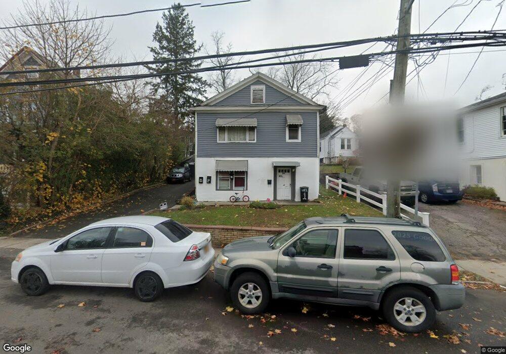
305 Nassau Rd Huntington, NY 11743
Estimated Value: $667,581 - $852,000
--
Bed
--
Bath
--
Sq Ft
5,227
Sq Ft Lot
About This Home
This home is located at 305 Nassau Rd, Huntington, NY 11743 and is currently estimated at $799,895. 305 Nassau Rd is a home located in Suffolk County with nearby schools including Woodhull Intermediate School, Washington School, and J Taylor Finley Middle School.
Ownership History
Date
Name
Owned For
Owner Type
Purchase Details
Closed on
Sep 23, 2016
Sold by
Vengroff Joe
Bought by
Beam Unlimited Llc
Current Estimated Value
Purchase Details
Closed on
Feb 24, 2015
Sold by
Beam Unlimited Llc
Bought by
Vengroff Joe
Purchase Details
Closed on
Dec 29, 2005
Purchase Details
Closed on
Nov 3, 2003
Sold by
Vengroff Harvey
Bought by
Vengroff Joe
Home Financials for this Owner
Home Financials are based on the most recent Mortgage that was taken out on this home.
Original Mortgage
$194,250
Interest Rate
5.35%
Mortgage Type
Purchase Money Mortgage
Create a Home Valuation Report for This Property
The Home Valuation Report is an in-depth analysis detailing your home's value as well as a comparison with similar homes in the area
Home Values in the Area
Average Home Value in this Area
Purchase History
| Date | Buyer | Sale Price | Title Company |
|---|---|---|---|
| Beam Unlimited Llc | -- | Madison Title Agency Llc | |
| Vengroff Joe | -- | None Available | |
| -- | -- | -- | |
| Vengroff Joe | $277,500 | -- |
Source: Public Records
Mortgage History
| Date | Status | Borrower | Loan Amount |
|---|---|---|---|
| Previous Owner | Vengroff Joe | $194,250 |
Source: Public Records
Tax History Compared to Growth
Tax History
| Year | Tax Paid | Tax Assessment Tax Assessment Total Assessment is a certain percentage of the fair market value that is determined by local assessors to be the total taxable value of land and additions on the property. | Land | Improvement |
|---|---|---|---|---|
| 2024 | $13,379 | $3,000 | $400 | $2,600 |
| 2023 | $6,689 | $3,000 | $400 | $2,600 |
| 2022 | $13,329 | $3,000 | $400 | $2,600 |
| 2021 | $13,280 | $3,000 | $400 | $2,600 |
| 2020 | $13,108 | $3,000 | $400 | $2,600 |
| 2019 | $26,215 | $0 | $0 | $0 |
| 2018 | $12,526 | $3,000 | $400 | $2,600 |
| 2017 | $12,526 | $3,000 | $400 | $2,600 |
| 2016 | $12,308 | $3,000 | $400 | $2,600 |
| 2015 | -- | $3,000 | $400 | $2,600 |
| 2014 | -- | $3,000 | $400 | $2,600 |
Source: Public Records
Map
Nearby Homes
- 62 Lowndes Ave
- 11 Spring Ct
- 2 Spring Ct
- 0 Tower St
- 49 Tower St
- 62 Fairmount St
- 11 Horizon Ct
- 26 Townhouse Rd S Unit 26
- 200 Lowndes Ave Unit A
- 71 Biltmore Cir
- 128 Winding St
- 280 Lowndes Ave Unit 208
- 280 Lowndes Ave Unit 305G
- 280 Lowndes Ave Unit 111G
- 24 Columbia St
- 12 Foxdale Ct
- 39 Lewis Ct
- 92 Columbia St
- 11 Sammis St
- 12 Terrace Dr
- 307 Nassau Rd
- 303 Nassau Rd Unit 1
- 303 Nassau Rd Unit B
- 303 Nassau Rd
- 35 Tuthill St
- 50 Hemlock Ave
- 32 Tuthill St
- 311 Nassau Rd
- 27 Tuthill St
- 46 Hemlock Ave
- 2 Frank Place
- 44 Hemlock Ave
- 49 Hemlock Ave
- 23 Tuthill St Unit 2nd Floor
- 23 Tuthill St
- 47 Hemlock Ave
- 297 Nassau Rd
- 28 Tuthill St
- 42 Hemlock Ave
- 45 Hemlock Ave