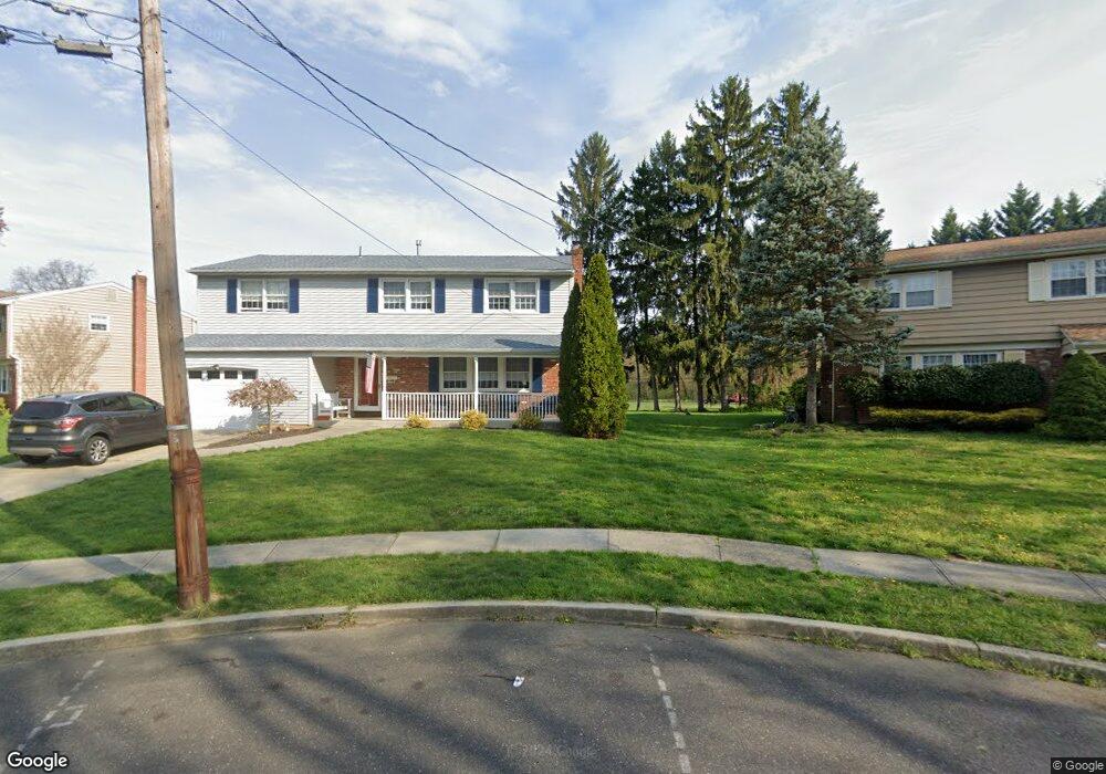
305 Provincetown Cir Cherry Hill, NJ 08034
Estimated Value: $461,897 - $555,000
--
Bed
--
Bath
2,257
Sq Ft
$221/Sq Ft
Est. Value
About This Home
This home is located at 305 Provincetown Cir, Cherry Hill, NJ 08034 and is currently estimated at $499,474, approximately $221 per square foot. 305 Provincetown Cir is a home located in Camden County with nearby schools including James H. Johnson School, John A Carusi Middle School, and Cherry Hill High-West High School.
Ownership History
Date
Name
Owned For
Owner Type
Purchase Details
Closed on
Feb 28, 1997
Sold by
Babb Jeffrey J
Bought by
Jablonski Dennis M and Jablonski Bernadette M
Current Estimated Value
Home Financials for this Owner
Home Financials are based on the most recent Mortgage that was taken out on this home.
Original Mortgage
$107,000
Outstanding Balance
$13,010
Interest Rate
7.77%
Estimated Equity
$486,464
Create a Home Valuation Report for This Property
The Home Valuation Report is an in-depth analysis detailing your home's value as well as a comparison with similar homes in the area
Home Values in the Area
Average Home Value in this Area
Purchase History
| Date | Buyer | Sale Price | Title Company |
|---|---|---|---|
| Jablonski Dennis M | $137,750 | -- |
Source: Public Records
Mortgage History
| Date | Status | Borrower | Loan Amount |
|---|---|---|---|
| Open | Jablonski Dennis M | $107,000 |
Source: Public Records
Tax History Compared to Growth
Tax History
| Year | Tax Paid | Tax Assessment Tax Assessment Total Assessment is a certain percentage of the fair market value that is determined by local assessors to be the total taxable value of land and additions on the property. | Land | Improvement |
|---|---|---|---|---|
| 2025 | $10,684 | $239,600 | $69,100 | $170,500 |
| 2024 | $10,068 | $239,600 | $69,100 | $170,500 |
| 2023 | $10,068 | $239,600 | $69,100 | $170,500 |
| 2022 | $9,790 | $239,600 | $69,100 | $170,500 |
| 2021 | $9,821 | $239,600 | $69,100 | $170,500 |
| 2020 | $9,701 | $239,600 | $69,100 | $170,500 |
| 2019 | $9,697 | $239,600 | $69,100 | $170,500 |
| 2018 | $9,670 | $239,600 | $69,100 | $170,500 |
| 2017 | $9,538 | $239,600 | $69,100 | $170,500 |
| 2016 | $9,411 | $239,600 | $69,100 | $170,500 |
| 2015 | $9,263 | $239,600 | $69,100 | $170,500 |
| 2014 | $9,160 | $239,600 | $69,100 | $170,500 |
Source: Public Records
Map
Nearby Homes
- 300 Portsmouth Rd
- 318 Provincetown Rd
- 175 Mansfield Blvd N
- 307 Provincetown Cir
- 140 Uxbridge Unit C0140
- 31 Moore Ave
- 16 Moore Ave
- 1010 Salem Rd
- 9 Maplebrook Ct
- 195 Pearlcroft Rd
- 204 Tavistock
- 290 Tavistock
- 316 N Woodstock Dr
- 515 Kresson Rd
- 205 Park Ln
- 412 E Summit Ave
- 116 Split Rail Dr
- 203 Horse Shoe Ct
- 127 Oakdale Rd
- 505 Fern Ave
- 303 Provincetown Cir
- 307 Provincetown Rd
- 309 Provincetown Rd
- 306 Provincetown Cir
- 302 Portsmouth Rd
- 308 Provincetown Rd
- 304 Provincetown Cir
- 304 Portsmouth Rd
- 311 Provincetown Rd
- 310 Provincetown Rd
- 312 Provincetown Rd
- 302 Provincetown Cir
- 314 Provincetown Rd
- 302 Provincetown Rd
- 306 Portsmouth Rd
- 313 Provincetown Rd
- 316 Provincetown Rd
- 216 Provincetown Rd
- 303 Portsmouth Rd
- 301 Portsmouth Rd