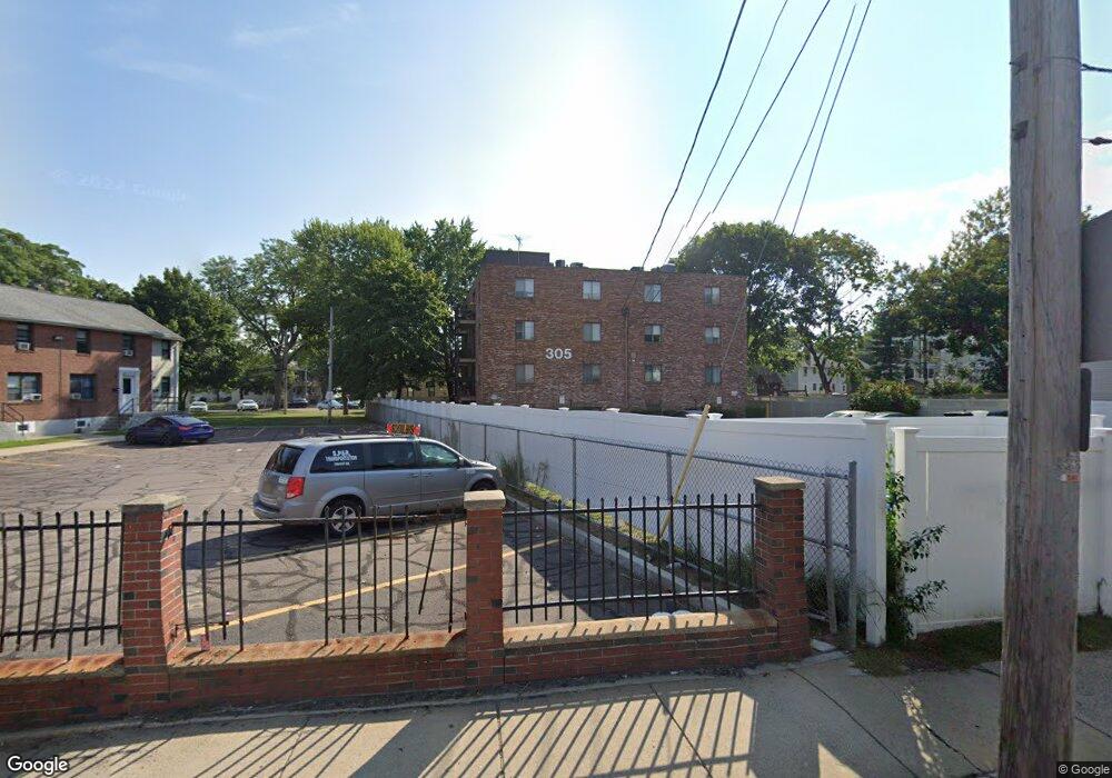
305 Riverside Ave Unit 21 Medford, MA 02155
Glenwood NeighborhoodEstimated Value: $379,000 - $421,000
2
Beds
1
Bath
735
Sq Ft
$543/Sq Ft
Est. Value
About This Home
This home is located at 305 Riverside Ave Unit 21, Medford, MA 02155 and is currently estimated at $399,415, approximately $543 per square foot. 305 Riverside Ave Unit 21 is a home located in Middlesex County with nearby schools including Medford High School, St. Joseph School, and St. Clement Elementary School.
Ownership History
Date
Name
Owned For
Owner Type
Purchase Details
Closed on
Jun 3, 2010
Sold by
Perrone Dora
Bought by
Hsng Medford Cmnty
Current Estimated Value
Home Financials for this Owner
Home Financials are based on the most recent Mortgage that was taken out on this home.
Original Mortgage
$35,000
Outstanding Balance
$23,539
Interest Rate
5.12%
Mortgage Type
Purchase Money Mortgage
Estimated Equity
$375,876
Purchase Details
Closed on
May 30, 1997
Sold by
Cooper Elizabeth A
Bought by
Perrone Dora
Home Financials for this Owner
Home Financials are based on the most recent Mortgage that was taken out on this home.
Original Mortgage
$65,550
Interest Rate
8.09%
Mortgage Type
Purchase Money Mortgage
Create a Home Valuation Report for This Property
The Home Valuation Report is an in-depth analysis detailing your home's value as well as a comparison with similar homes in the area
Home Values in the Area
Average Home Value in this Area
Purchase History
| Date | Buyer | Sale Price | Title Company |
|---|---|---|---|
| Hsng Medford Cmnty | $166,000 | -- | |
| Perrone Dora | $69,500 | -- |
Source: Public Records
Mortgage History
| Date | Status | Borrower | Loan Amount |
|---|---|---|---|
| Open | Hsng Medford Cmnty | $35,000 | |
| Previous Owner | Perrone Dora | $65,550 |
Source: Public Records
Tax History Compared to Growth
Tax History
| Year | Tax Paid | Tax Assessment Tax Assessment Total Assessment is a certain percentage of the fair market value that is determined by local assessors to be the total taxable value of land and additions on the property. | Land | Improvement |
|---|---|---|---|---|
| 2025 | $3,090 | $351,100 | $0 | $351,100 |
| 2024 | $2,927 | $343,600 | $0 | $343,600 |
| 2023 | $2,842 | $328,500 | $0 | $328,500 |
| 2022 | $2,535 | $281,300 | $0 | $281,300 |
| 2021 | $2,557 | $271,700 | $0 | $271,700 |
| 2020 | $2,532 | $275,800 | $0 | $275,800 |
| 2019 | $2,676 | $278,700 | $0 | $278,700 |
| 2018 | $2,274 | $222,100 | $0 | $222,100 |
| 2017 | $2,440 | $231,100 | $0 | $231,100 |
| 2016 | $2,240 | $200,200 | $0 | $200,200 |
| 2015 | $2,231 | $190,700 | $0 | $190,700 |
Source: Public Records
Map
Nearby Homes
- 305 Riverside Ave Unit 41
- 20 Ship Ave Unit 8
- 14 Park St
- 42 Gibson St
- 3 Pleasant St Unit 1
- 45 Grant Ave
- 55 Evans St
- 3920 Mystic Valley Pkwy Unit 217W
- 3920 Mystic Valley Pkwy Unit 1119W
- 3920 Mystic Valley Pkwy Unit 620
- 3920 Mystic Valley Pkwy Unit 817
- 3920 Mystic Valley Pkwy Unit 303
- 3920 Mystic Valley Pkwy Unit 115
- 830 Fellsway
- 179 Park St Unit 201
- 216 Central Ave Unit 218
- 9 Trout Ave
- 9 Trout Ave Unit 2
- 124 Grant Ave
- 55 Surrey St
- 305 Riverside Ave Unit 1
- 305 Riverside Ave Unit 2
- 305 Riverside Ave Unit 3
- 305 Riverside Ave Unit 4
- 305 Riverside Ave Unit 22
- 305 Riverside Ave Unit 23
- 305 Riverside Ave Unit 24
- 305 Riverside Ave Unit 31
- 305 Riverside Ave Unit 32
- 305 Riverside Ave Unit 33
- 305 Riverside Ave Unit 34
- 305 Riverside Ave Unit 43
- 305 Riverside Ave Unit 44
- 305 Riverside Ave Unit 12
- 305 Riverside Ave Unit 21,1
- 305 Riverside Ave Unit 41,305
- 305 Riverside Ave Unit 13
- 303 Riverside Ave
- 299 Riverside Ave
- 299 Riverside Ave Unit 2