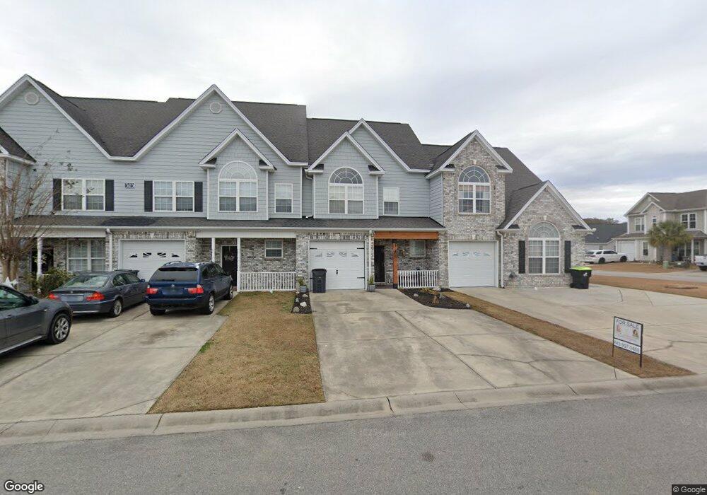
305 Rung Rd Unit B2 Myrtle Beach, SC 29588
Estimated Value: $206,000 - $231,534
3
Beds
3
Baths
1,561
Sq Ft
$138/Sq Ft
Est. Value
About This Home
This home is located at 305 Rung Rd Unit B2, Myrtle Beach, SC 29588 and is currently estimated at $215,384, approximately $137 per square foot. 305 Rung Rd Unit B2 is a home located in Horry County with nearby schools including Socastee Elementary School, Forestbrook Middle School, and Socastee High School.
Ownership History
Date
Name
Owned For
Owner Type
Purchase Details
Closed on
Jun 10, 2022
Sold by
Ferron Carl L
Bought by
Casari Gerald M
Current Estimated Value
Purchase Details
Closed on
Jan 6, 2021
Sold by
Venditto Kris
Bought by
Ferron Randy Lee
Home Financials for this Owner
Home Financials are based on the most recent Mortgage that was taken out on this home.
Original Mortgage
$104,800
Interest Rate
2.71%
Mortgage Type
New Conventional
Purchase Details
Closed on
Mar 27, 2013
Sold by
Bank Of North Carolina
Bought by
Saldo Stephen T
Create a Home Valuation Report for This Property
The Home Valuation Report is an in-depth analysis detailing your home's value as well as a comparison with similar homes in the area
Home Values in the Area
Average Home Value in this Area
Purchase History
| Date | Buyer | Sale Price | Title Company |
|---|---|---|---|
| Casari Gerald M | $220,000 | -- | |
| Ferron Randy Lee | $131,000 | -- | |
| Saldo Stephen T | $88,000 | -- |
Source: Public Records
Mortgage History
| Date | Status | Borrower | Loan Amount |
|---|---|---|---|
| Previous Owner | Ferron Randy Lee | $104,800 |
Source: Public Records
Tax History
| Year | Tax Paid | Tax Assessment Tax Assessment Total Assessment is a certain percentage of the fair market value that is determined by local assessors to be the total taxable value of land and additions on the property. | Land | Improvement |
|---|---|---|---|---|
| 2025 | -- | $0 | $0 | $0 |
| 2024 | -- | $9,747 | $2,200 | $7,547 |
| 2023 | $985 | $4,397 | $879 | $3,518 |
| 2021 | $671 | $15,310 | $2,930 | $12,380 |
| 2020 | $1,398 | $15,310 | $2,930 | $12,380 |
| 2019 | $1,398 | $15,310 | $2,930 | $12,380 |
| 2018 | $1,265 | $10,038 | $1,995 | $8,043 |
| 2017 | $1,250 | $8,803 | $760 | $8,043 |
| 2016 | -- | $8,803 | $760 | $8,043 |
| 2015 | $1,261 | $3,824 | $760 | $3,064 |
| 2014 | $1,219 | $3,824 | $760 | $3,064 |
Source: Public Records
Map
Nearby Homes
- 240 Foxpath Loop
- 209 Foxpath Loop
- 209 Stonebrook Dr
- 407 Meadowbrook Dr
- 252 Stonebrook Dr
- 800 Geddings Dr
- 202 Luttie Rd
- 400 Meadowbrook Dr
- 607 Geddings Dr
- 525 Sims Dr Unit MB
- 101 Horizon River Dr Unit H8
- 105 Old Carriage Ct
- 403 Brandymill Blvd
- 111 Horizon River Dr Unit F-8
- 303 Clear Creek Cir
- 244 Colby Ct
- 432 Brandymill Blvd
- 245 Colby Ct
- 124 Manor Cir
- 1412 Reid Ct
- 305 Rung Rd Unit 6
- 305 Rung Rd
- 305 Rung Rd Unit 5
- 305 Rung Rd Unit B6
- 305 Rung Rd Unit B5
- 305 Rung Rd Unit B4
- 305 Rung Rd Unit B3
- 305 Rung Rd Unit B1
- 305 Rung Rd Unit 4
- 305 Rung Rd Unit 1
- 305 Rung Rd Unit 2
- 153 Rung Rd
- Lot 152 Rung Rd
- 300 Foxpath Loop
- 304 Rung Rd
- 144 Foxpath Loop
- 296 Foxpath Loop
- 306 Rung Rd
- 150 Foxpath Loop
- 150 Foxpath Loop Unit D4
Your Personal Tour Guide
Ask me questions while you tour the home.