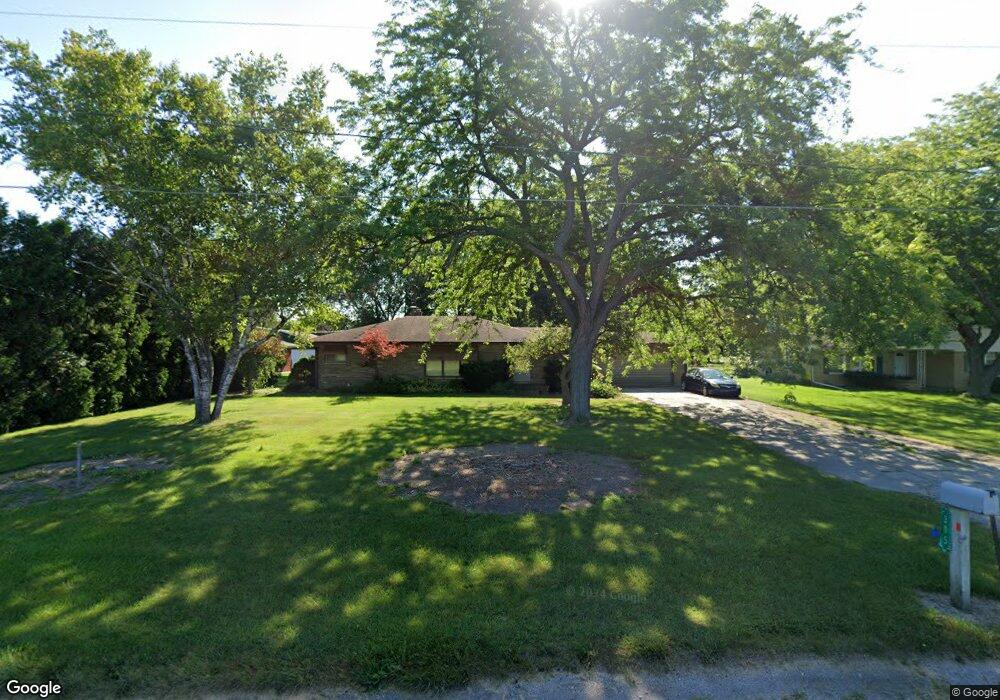
305 S Airport Rd Saginaw, MI 48601
Estimated Value: $145,000 - $182,000
3
Beds
1
Bath
1,176
Sq Ft
$136/Sq Ft
Est. Value
About This Home
This home is located at 305 S Airport Rd, Saginaw, MI 48601 and is currently estimated at $160,208, approximately $136 per square foot. 305 S Airport Rd is a home located in Saginaw County with nearby schools including Thompson Middle School, Saginaw United High School, and Saginaw Preparatory Academy.
Ownership History
Date
Name
Owned For
Owner Type
Purchase Details
Closed on
Dec 13, 2024
Sold by
Beard Alex and Beard Brenda
Bought by
Bb Blessed Llc
Current Estimated Value
Purchase Details
Closed on
Dec 20, 2019
Sold by
Bayviewloan Servicing Llc
Bought by
Bayviewloan Servicing Llc
Purchase Details
Closed on
Feb 4, 2011
Sold by
Colmus Timothy J and Colmus Yolanda
Bought by
Federal National Mortgage Association
Purchase Details
Closed on
Nov 30, 1999
Sold by
Gulliver Richard R and Thornton Joan M
Bought by
Colmus Timothy J and Colmus Yolanda
Home Financials for this Owner
Home Financials are based on the most recent Mortgage that was taken out on this home.
Original Mortgage
$80,750
Interest Rate
7.97%
Mortgage Type
Purchase Money Mortgage
Create a Home Valuation Report for This Property
The Home Valuation Report is an in-depth analysis detailing your home's value as well as a comparison with similar homes in the area
Home Values in the Area
Average Home Value in this Area
Purchase History
| Date | Buyer | Sale Price | Title Company |
|---|---|---|---|
| Bb Blessed Llc | -- | None Listed On Document | |
| Bayviewloan Servicing Llc | $56,600 | None Available | |
| Federal National Mortgage Association | $81,271 | -- | |
| Colmus Timothy J | $85,000 | -- | |
| -- | $85,000 | -- |
Source: Public Records
Mortgage History
| Date | Status | Borrower | Loan Amount |
|---|---|---|---|
| Previous Owner | -- | $80,750 |
Source: Public Records
Tax History Compared to Growth
Tax History
| Year | Tax Paid | Tax Assessment Tax Assessment Total Assessment is a certain percentage of the fair market value that is determined by local assessors to be the total taxable value of land and additions on the property. | Land | Improvement |
|---|---|---|---|---|
| 2025 | $3,685 | $60,600 | $0 | $0 |
| 2024 | $971 | $60,800 | $0 | $0 |
| 2023 | $924 | $52,200 | $0 | $0 |
| 2022 | $2,557 | $45,100 | $0 | $0 |
| 2021 | $2,493 | $40,200 | $0 | $0 |
| 2020 | $1,631 | $36,800 | $0 | $0 |
| 2019 | $1,574 | $36,900 | $1,600 | $35,300 |
| 2018 | $529 | $36,250 | $0 | $0 |
| 2017 | $1,423 | $36,200 | $0 | $0 |
| 2016 | $1,334 | $35,400 | $0 | $0 |
| 2014 | -- | $34,100 | $0 | $32,500 |
| 2013 | -- | $33,100 | $0 | $0 |
Source: Public Records
Map
Nearby Homes
- 1579 Joy St
- 5050 Carnegie St
- 3810 Janes Rd
- 5032 Akron St
- 1765 Ribble St
- 3730 Janes Rd
- 1840 Ribble St
- 1815 Mack Rd
- 6050 Wadsworth Rd
- 1408 S Outer Dr
- 1910 S Outer Dr
- 1932 S Outer Dr
- 3172 Mysylvia Dr
- 1337 Woodside St
- 3299 Mysylvia Dr
- 4764 Hess Rd
- 1380 Woodside St
- 612 S 31st St
- 3289 Westbrook St
- 2950 Arlington Dr
- 341 S Airport Rd
- 275 S Airport Rd
- 275 S Airport Rd
- 5061 Wakefield Rd
- 241 S Airport Rd
- 5085 Wakefield Rd
- 338 Homestead Ln
- 5022 Wakefield Rd
- 5042 Wakefield Rd
- 300 Homestead Ln
- 203 S Airport Rd
- 5066 Wakefield Rd
- 264 Homestead Ln
- 5090 Wakefield Rd
- 441 S Airport Rd
- 163 S Airport Rd
- 234 Homestead Ln
- 194 Homestead Ln
- 337 Homestead Ln
- 5119 Wakefield Rd