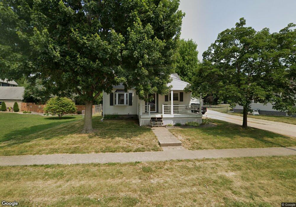
305 S Monroe St MacKinaw, IL 61755
Estimated Value: $103,000 - $140,705
3
Beds
1
Bath
1,109
Sq Ft
$116/Sq Ft
Est. Value
About This Home
This home is located at 305 S Monroe St, MacKinaw, IL 61755 and is currently estimated at $128,426, approximately $115 per square foot. 305 S Monroe St is a home located in Tazewell County with nearby schools including Dee-Mack Primary/Junior High School, Dee-Mack Intermediate School, and Dee-Mack High School.
Ownership History
Date
Name
Owned For
Owner Type
Purchase Details
Closed on
Sep 20, 2022
Sold by
Mathis Joshua C
Bought by
Mathis Holly
Current Estimated Value
Purchase Details
Closed on
Feb 7, 2007
Sold by
Mathis Joshua C
Bought by
Mathis Joshua C and Mathis Holly
Home Financials for this Owner
Home Financials are based on the most recent Mortgage that was taken out on this home.
Original Mortgage
$70,000
Interest Rate
6.27%
Mortgage Type
New Conventional
Create a Home Valuation Report for This Property
The Home Valuation Report is an in-depth analysis detailing your home's value as well as a comparison with similar homes in the area
Home Values in the Area
Average Home Value in this Area
Purchase History
| Date | Buyer | Sale Price | Title Company |
|---|---|---|---|
| Mathis Holly | -- | None Listed On Document | |
| Mathis Joshua C | -- | None Available |
Source: Public Records
Mortgage History
| Date | Status | Borrower | Loan Amount |
|---|---|---|---|
| Previous Owner | Mathis Joshua C | $70,000 |
Source: Public Records
Tax History Compared to Growth
Tax History
| Year | Tax Paid | Tax Assessment Tax Assessment Total Assessment is a certain percentage of the fair market value that is determined by local assessors to be the total taxable value of land and additions on the property. | Land | Improvement |
|---|---|---|---|---|
| 2024 | $2,217 | $35,830 | $4,150 | $31,680 |
| 2023 | $2,217 | $32,960 | $3,820 | $29,140 |
| 2022 | $2,053 | $30,370 | $3,520 | $26,850 |
| 2021 | $1,972 | $29,200 | $3,380 | $25,820 |
| 2020 | $1,918 | $28,350 | $3,280 | $25,070 |
| 2019 | $1,925 | $28,350 | $3,280 | $25,070 |
| 2018 | $1,905 | $28,350 | $3,280 | $25,070 |
| 2017 | $1,877 | $28,070 | $3,250 | $24,820 |
| 2016 | $1,855 | $28,070 | $3,250 | $24,820 |
| 2015 | $1,745 | $0 | $0 | $0 |
| 2013 | $1,625 | $27,200 | $3,160 | $24,040 |
Source: Public Records
Map
Nearby Homes
- 103 S Monroe St
- 111 W Fast Ave
- 0 Illinois 9
- 204 Tulip Dr
- 988 Heritage Dr
- 29724 Allentown Rd
- 10 Summit Dr
- 801 Heritage Dr
- 6 Raleigh Ave
- 29875 White Oak Dr
- 11283 Illinois 9
- 30403 Hancock Rd
- 16555 Mclean Rd
- 18196 River Rd
- 118 Bryant St
- 1209 Whippoorwill Dr
- 1263 Wheatfield Dr
- 101 N Oregon Ave
- 1156 Brentwood Rd
- 324 S Kansas Ave