Estimated Value: $71,000 - $84,038
3
Beds
1
Bath
1,040
Sq Ft
$73/Sq Ft
Est. Value
About This Home
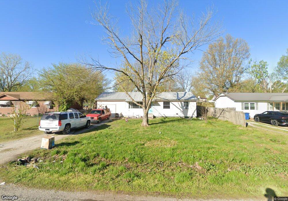
This home is located at 305 S Ross Ave, Afton, OK 74331 and is currently estimated at $76,260, approximately $73 per square foot. 305 S Ross Ave is a home located in Ottawa County with nearby schools including Afton Elementary School and Afton High School.
Ownership History
Date
Name
Owned For
Owner Type
Purchase Details
Closed on
Apr 14, 2017
Sold by
Peck Ed and Peck Luanna
Bought by
Peck Edward and Peck Luanna
Current Estimated Value
Purchase Details
Closed on
Jan 18, 2006
Sold by
Mcdonald Marion E
Bought by
Peck Ed and Peck Luanna
Home Financials for this Owner
Home Financials are based on the most recent Mortgage that was taken out on this home.
Original Mortgage
$20,000
Interest Rate
6.24%
Mortgage Type
Purchase Money Mortgage
Purchase Details
Closed on
Oct 20, 1995
Bought by
Mcdonald Marion E
Create a Home Valuation Report for This Property
The Home Valuation Report is an in-depth analysis detailing your home's value as well as a comparison with similar homes in the area
Home Values in the Area
Average Home Value in this Area
Purchase History
| Date | Buyer | Sale Price | Title Company |
|---|---|---|---|
| Peck Edward | -- | None Available | |
| Peck Ed | $25,000 | None Available | |
| Mcdonald Marion E | $30,000 | -- |
Source: Public Records
Mortgage History
| Date | Status | Borrower | Loan Amount |
|---|---|---|---|
| Closed | Peck Ed | $20,000 |
Source: Public Records
Tax History Compared to Growth
Tax History
| Year | Tax Paid | Tax Assessment Tax Assessment Total Assessment is a certain percentage of the fair market value that is determined by local assessors to be the total taxable value of land and additions on the property. | Land | Improvement |
|---|---|---|---|---|
| 2024 | $390 | $5,016 | $178 | $4,838 |
| 2023 | $390 | $4,777 | $173 | $4,604 |
| 2022 | $325 | $4,549 | $170 | $4,379 |
| 2021 | $310 | $4,333 | $168 | $4,165 |
| 2020 | $295 | $4,126 | $165 | $3,961 |
| 2019 | $281 | $3,930 | $162 | $3,768 |
| 2018 | $267 | $3,744 | $159 | $3,585 |
| 2017 | $255 | $3,565 | $155 | $3,410 |
| 2016 | $243 | $3,396 | $153 | $3,243 |
| 2015 | $201 | $2,933 | $187 | $2,746 |
| 2014 | $220 | $3,079 | $138 | $2,941 |
Source: Public Records
Map
Nearby Homes
- 113 S Downing Ave
- 803 1 St SW
- 200 Mulberry
- 403 Mulberry
- 085 E 220 Rd
- 450521 Lake Shore Dr
- 21889 S 520 Rd
- 0000 S 520 Rd
- 52990 E 220 Rd
- 0 U S 59
- 0 Tbd S 520 Rd
- TBD Us-59
- 0 520 Rd Unit 2539307
- 52990 E 260 Rd
- 54791 E Highway 59
- 54230 E 249 Rd
- 820 Cherokee Dr
- 25325 S 542 Rd
- 24336 S Hilltop Dr
- 705 Chickasaw St
- 303 S Ross Ave
- 307 S Ross Ave
- 402 SW 3rd St
- 309 S Ross Ave
- 302 S Downing Ave
- 306 S Downing Ave
- 308 S Ross Ave
- 503 SW 3rd St
- 304 S Ross Ave
- 311 S Ross Ave
- 310 S Downing Ave
- 305 SW 3rd St
- 450432 Lake Shore Dr
- 310 S Ross Ave
- 305 S Maple Ave
- 315 S Ross Ave
- 210 S Downing Ave
- 313 S Downing Ave
- 303 SW 3rd St
- 215 S Downing Ave