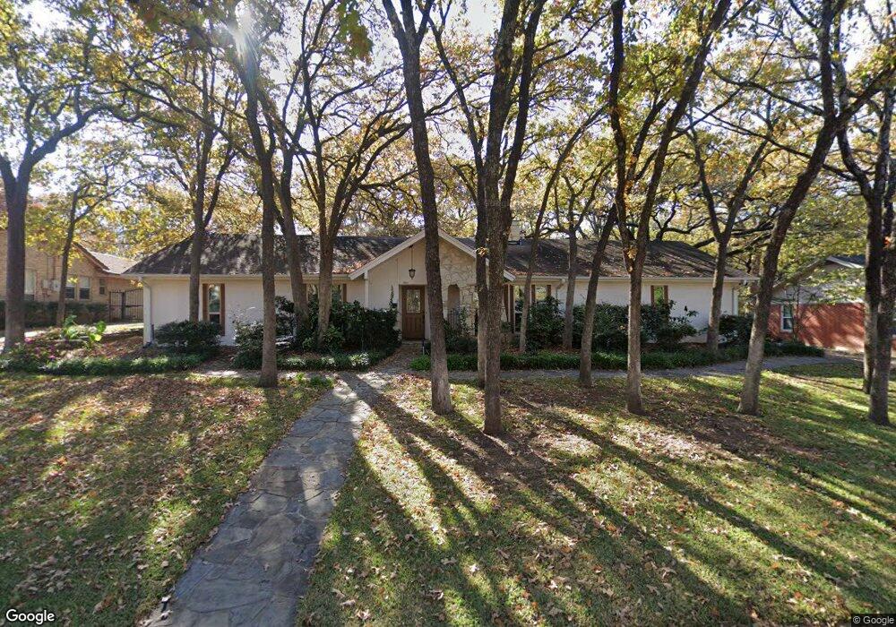
305 Shadow Ln Euless, TX 76039
Estimated Value: $330,000 - $405,000
3
Beds
2
Baths
1,685
Sq Ft
$219/Sq Ft
Est. Value
About This Home
This home is located at 305 Shadow Ln, Euless, TX 76039 and is currently estimated at $368,845, approximately $218 per square foot. 305 Shadow Ln is a home located in Tarrant County with nearby schools including Lakewood Elementary School, Harwood Junior High School, and Trinity High School.
Ownership History
Date
Name
Owned For
Owner Type
Purchase Details
Closed on
Aug 25, 2006
Sold by
Rogers Duane C and Rogers Dona E
Bought by
Scales Donald O and Connaghan Daisy L
Current Estimated Value
Home Financials for this Owner
Home Financials are based on the most recent Mortgage that was taken out on this home.
Original Mortgage
$69,000
Outstanding Balance
$41,494
Interest Rate
6.79%
Mortgage Type
Purchase Money Mortgage
Estimated Equity
$327,351
Create a Home Valuation Report for This Property
The Home Valuation Report is an in-depth analysis detailing your home's value as well as a comparison with similar homes in the area
Home Values in the Area
Average Home Value in this Area
Purchase History
| Date | Buyer | Sale Price | Title Company |
|---|---|---|---|
| Scales Donald O | -- | Sendera Title Inc |
Source: Public Records
Mortgage History
| Date | Status | Borrower | Loan Amount |
|---|---|---|---|
| Open | Scales Donald O | $69,000 |
Source: Public Records
Tax History
| Year | Tax Paid | Tax Assessment Tax Assessment Total Assessment is a certain percentage of the fair market value that is determined by local assessors to be the total taxable value of land and additions on the property. | Land | Improvement |
|---|---|---|---|---|
| 2025 | $973 | $240,364 | $80,000 | $160,364 |
| 2024 | $973 | $240,364 | $80,000 | $160,364 |
| 2023 | $4,448 | $236,621 | $60,000 | $176,621 |
| 2022 | $4,853 | $225,898 | $60,000 | $165,898 |
| 2021 | $5,150 | $228,989 | $60,000 | $168,989 |
| 2020 | $5,598 | $246,495 | $60,000 | $186,495 |
| 2019 | $5,308 | $235,402 | $60,000 | $175,402 |
| 2018 | $2,379 | $207,104 | $60,000 | $147,104 |
| 2017 | $4,528 | $252,243 | $25,000 | $227,243 |
| 2016 | $4,117 | $245,693 | $25,000 | $220,693 |
| 2015 | $2,402 | $155,600 | $25,000 | $130,600 |
| 2014 | $2,402 | $155,600 | $25,000 | $130,600 |
Source: Public Records
Map
Nearby Homes
- 916 Snapdragon Dr
- 906 Snapdragon Dr
- 1004 Pilot Hill Dr
- 1008 Pilot Hill Dr
- 503 Summit Ridge Dr
- 1900 Cripple Creek Dr
- 966 Pilot Hill Dr
- 325 Bluestem Dr
- 327 Bluestem Dr
- 204 Trailwood Dr
- 1505 Cedar Ridge Terrace
- 112 Churchill Ln
- 801 Bent Tree Dr
- 73 Winchester Dr
- 79 Winchester Dr
- 203 Oak Forest Trail
- 151 Winchester Dr
- 118 Sunshine Dr
- 17 Abbey Rd
- 504 Anthony Dr
- 303 Shadow Ln
- 307 Shadow Ln
- 304 Shadow Ln
- 306 Shadow Ln
- 301 Shadow Ln
- 302 Shadow Ln
- 401 Shadow Ln
- 308 Shadow Ln
- 204 Oak Ln
- 209 Shadow Ln
- 300 Shadow Ln
- 202 Oak Ln
- 303 Timberlane Terrace
- 1806 Summit Ridge Dr
- 403 Summit Ridge Dr
- 301 Timberlane Terrace
- 207 Shadow Ln
- 208 Shadow Ln
- 1808 Summit Ridge Dr
- 405 Summit Ridge Dr
Your Personal Tour Guide
Ask me questions while you tour the home.