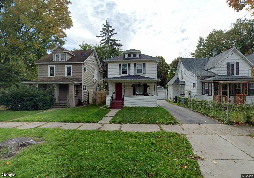
305 Smith Ave Lansing, MI 48910
Moores Park NeighborhoodEstimated Value: $124,138 - $176,000
4
Beds
1
Bath
1,498
Sq Ft
$97/Sq Ft
Est. Value
About This Home
This home is located at 305 Smith Ave, Lansing, MI 48910 and is currently estimated at $145,535, approximately $97 per square foot. 305 Smith Ave is a home located in Ingham County with nearby schools including Averill Elementary School, Pattengill Academy, and J.W. Sexton High School.
Ownership History
Date
Name
Owned For
Owner Type
Purchase Details
Closed on
Feb 18, 2013
Sold by
Generous Jenny and Generous Johnson Jenny
Bought by
Sandal Exchange Llc
Current Estimated Value
Purchase Details
Closed on
Apr 23, 2012
Sold by
Howie Cameron G and Generous Jenny
Bought by
Generous Jenny
Purchase Details
Closed on
Dec 30, 2003
Sold by
Perkins Mizga Debra Lynn
Bought by
Howie Cameron G and Generous Howie Jenny
Home Financials for this Owner
Home Financials are based on the most recent Mortgage that was taken out on this home.
Original Mortgage
$68,400
Interest Rate
5.91%
Mortgage Type
Purchase Money Mortgage
Create a Home Valuation Report for This Property
The Home Valuation Report is an in-depth analysis detailing your home's value as well as a comparison with similar homes in the area
Home Values in the Area
Average Home Value in this Area
Purchase History
| Date | Buyer | Sale Price | Title Company |
|---|---|---|---|
| Sandal Exchange Llc | -- | None Available | |
| Generous Jenny | -- | None Available | |
| Howie Cameron G | $76,000 | Transnation |
Source: Public Records
Mortgage History
| Date | Status | Borrower | Loan Amount |
|---|---|---|---|
| Previous Owner | Howie Cameron G | $68,400 |
Source: Public Records
Tax History Compared to Growth
Tax History
| Year | Tax Paid | Tax Assessment Tax Assessment Total Assessment is a certain percentage of the fair market value that is determined by local assessors to be the total taxable value of land and additions on the property. | Land | Improvement |
|---|---|---|---|---|
| 2025 | $2,551 | $48,800 | $3,300 | $45,500 |
| 2024 | $21 | $50,100 | $3,300 | $46,800 |
| 2023 | $2,401 | $43,500 | $3,300 | $40,200 |
| 2022 | $2,193 | $32,900 | $4,600 | $28,300 |
| 2021 | $2,143 | $30,000 | $3,300 | $26,700 |
| 2020 | $2,127 | $28,900 | $3,300 | $25,600 |
| 2019 | $2,055 | $26,300 | $3,300 | $23,000 |
| 2018 | $1,949 | $25,700 | $3,300 | $22,400 |
| 2017 | $1,876 | $25,700 | $3,300 | $22,400 |
| 2016 | $1,814 | $25,200 | $3,300 | $21,900 |
| 2015 | $1,814 | $24,100 | $6,678 | $17,422 |
| 2014 | $1,814 | $23,900 | $3,774 | $20,126 |
Source: Public Records
Map
Nearby Homes
- 1722 S Washington Ave
- 1723 Osband Ave
- 511 W Mount Hope Ave
- 139 Woodlawn Ave
- 1836 Osband Ave
- 202 Woodlawn Ave
- 2011 Osband Ave
- 147 Isbell St
- 1927 Teel Ave
- 1408 Reo Ave
- 1406 Reo Ave
- 1800 Herbert St
- 2107 Teel Ave
- 712 Lenore Ave
- 1731 Herbert St
- 2406 Markley Place
- 2230 Maplewood Ave
- 907 Lenore Ave
- 917 W Barnes Ave
- 525 E Mount Hope Ave