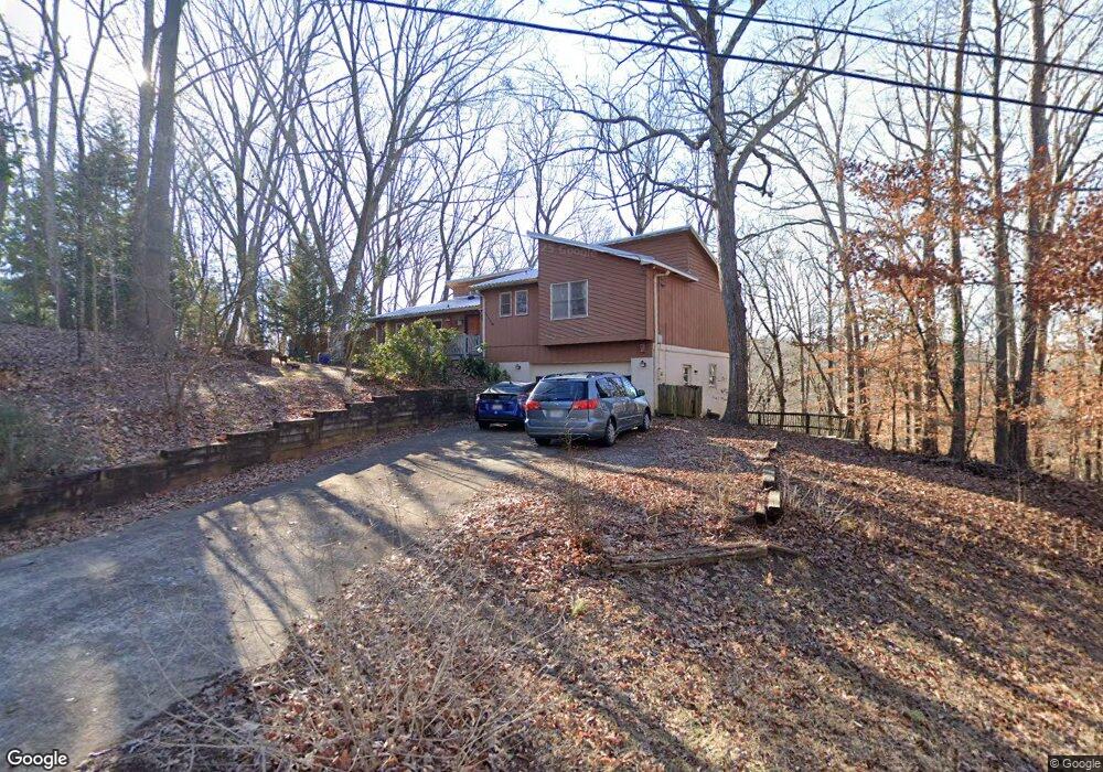
305 Spalding Cir Athens, GA 30605
Estimated Value: $278,000 - $323,000
3
Beds
2
Baths
1,443
Sq Ft
$207/Sq Ft
Est. Value
About This Home
This home is located at 305 Spalding Cir, Athens, GA 30605 and is currently estimated at $299,199, approximately $207 per square foot. 305 Spalding Cir is a home located in Clarke County with nearby schools including Barnett Shoals Elementary School, Hilsman Middle School, and Cedar Shoals High School.
Ownership History
Date
Name
Owned For
Owner Type
Purchase Details
Closed on
Nov 21, 2011
Sold by
Federal National Mortgage Association
Current Estimated Value
Purchase Details
Closed on
Jul 5, 2011
Sold by
Bank Of America
Bought by
Federal National Mtg
Purchase Details
Closed on
Mar 22, 1996
Sold by
Bagnall James A and Bagnall Andrea R
Bought by
Riley Robert James and Mary Joanne
Purchase Details
Closed on
Apr 26, 1990
Sold by
Trippi Charles and Trippi Carla
Bought by
Bagnall James A and Bagnall Andrea R
Create a Home Valuation Report for This Property
The Home Valuation Report is an in-depth analysis detailing your home's value as well as a comparison with similar homes in the area
Home Values in the Area
Average Home Value in this Area
Purchase History
| Date | Buyer | Sale Price | Title Company |
|---|---|---|---|
| -- | $89,000 | -- | |
| Federal National Mtg | $103,767 | -- | |
| Bank Of America | $103,767 | -- | |
| Riley Robert James | $93,000 | -- | |
| Bagnall James A | $74,500 | -- |
Source: Public Records
Tax History Compared to Growth
Tax History
| Year | Tax Paid | Tax Assessment Tax Assessment Total Assessment is a certain percentage of the fair market value that is determined by local assessors to be the total taxable value of land and additions on the property. | Land | Improvement |
|---|---|---|---|---|
| 2025 | $3,409 | $109,788 | $12,000 | $97,788 |
| 2024 | $3,409 | $101,643 | $12,000 | $89,643 |
| 2023 | $3,176 | $95,926 | $12,000 | $83,926 |
| 2022 | $2,642 | $82,808 | $12,000 | $70,808 |
| 2021 | $2,251 | $66,802 | $12,000 | $54,802 |
| 2020 | $2,097 | $62,218 | $12,000 | $50,218 |
| 2019 | $2,025 | $59,644 | $12,000 | $47,644 |
| 2018 | $1,938 | $57,087 | $12,000 | $45,087 |
| 2017 | $1,676 | $49,355 | $12,000 | $37,355 |
| 2016 | $1,690 | $49,778 | $12,000 | $37,778 |
| 2015 | $1,697 | $49,925 | $12,000 | $37,925 |
| 2014 | $1,736 | $50,994 | $12,000 | $38,994 |
Source: Public Records
Map
Nearby Homes
- 315 Spalding Cir
- 315 Caldwell Cir
- 320 Caldwell Cir
- 300 Spalding Cir
- 325 Caldwell Cir
- 325 Spalding Cir
- 280 Spalding Cir
- 275 Spalding Cir
- 335 Spalding Cir
- 270 Spalding Cir
- 162 Spalding Ct
- 345 Caldwell Cir
- 265 Spalding Cir
- 172 Spalding Ct
- 355 Caldwell Cir
- 345 Spalding Cir
- 735 Riverbend Pkwy
- 260 Spalding Cir
- 142 Spalding Ct
- 255 Spalding Cir Unit n/a