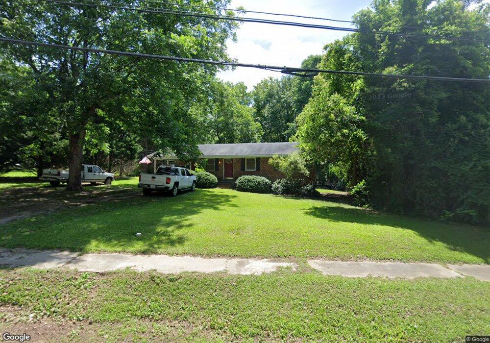
305 Thornton St Union Point, GA 30669
Estimated Value: $112,899 - $221,000
3
Beds
1
Bath
1,049
Sq Ft
$153/Sq Ft
Est. Value
About This Home
This home is located at 305 Thornton St, Union Point, GA 30669 and is currently estimated at $160,225, approximately $152 per square foot. 305 Thornton St is a home located in Greene County with nearby schools including Greene County High School.
Ownership History
Date
Name
Owned For
Owner Type
Purchase Details
Closed on
Feb 24, 2005
Sold by
Ohalloran Kevin
Bought by
Luna Properties Llc
Current Estimated Value
Purchase Details
Closed on
Jan 1, 2005
Bought by
Stewart Family Inv
Purchase Details
Closed on
Feb 8, 2001
Sold by
Stewart John B
Bought by
Stewart Family Investments Lp
Purchase Details
Closed on
Mar 26, 1998
Sold by
Hanner Hanner M and Hanner Stanhope
Bought by
Stewart John B
Purchase Details
Closed on
Jan 1, 1986
Sold by
Wheeler Willie C
Bought by
Hanner Hanner M and Hanner Stanhope
Purchase Details
Closed on
Jan 1, 1983
Sold by
Wheeler Katie S and Wheeler Willie C
Bought by
Wheeler Willie C
Purchase Details
Closed on
Jun 10, 1969
Bought by
Wheeler Katie S and Wheeler Willie C
Create a Home Valuation Report for This Property
The Home Valuation Report is an in-depth analysis detailing your home's value as well as a comparison with similar homes in the area
Home Values in the Area
Average Home Value in this Area
Purchase History
| Date | Buyer | Sale Price | Title Company |
|---|---|---|---|
| Luna Properties Llc | $271,000 | -- | |
| Stewart Family Inv | -- | -- | |
| Stewart Family Investments Lp | -- | -- | |
| Stewart John B | $35,000 | -- | |
| Hanner Hanner M | -- | -- | |
| Wheeler Willie C | -- | -- | |
| Wheeler Katie S | -- | -- |
Source: Public Records
Tax History Compared to Growth
Tax History
| Year | Tax Paid | Tax Assessment Tax Assessment Total Assessment is a certain percentage of the fair market value that is determined by local assessors to be the total taxable value of land and additions on the property. | Land | Improvement |
|---|---|---|---|---|
| 2025 | $688 | $19,840 | $5,280 | $14,560 |
| 2024 | $681 | $19,840 | $5,280 | $14,560 |
| 2023 | $537 | $19,680 | $4,802 | $14,878 |
| 2022 | $512 | $19,680 | $4,802 | $14,878 |
| 2021 | $590 | $27,200 | $5,280 | $21,920 |
| 2020 | $415 | $12,400 | $2,680 | $9,720 |
| 2019 | $426 | $12,400 | $2,680 | $9,720 |
| 2018 | $287 | $12,400 | $2,680 | $9,720 |
| 2017 | $382 | $12,452 | $2,700 | $9,752 |
| 2016 | $398 | $13,010 | $2,700 | $10,310 |
| 2015 | $367 | $13,009 | $2,700 | $10,310 |
| 2014 | $354 | $12,002 | $2,700 | $9,302 |
Source: Public Records
Map
Nearby Homes
- 324 N Rhodes St
- 202 Veazey St
- 0 Woodland Ct Unit 10543600
- 215 Hunter St
- 112 Hendry St
- 0 S Rhodes St Unit 10618488
- 0 Washington Hwy Unit 7276060
- 1041 Hillcrest Dr
- 1241 Old Siloam Rd
- 1860 Washington Hwy
- 5401 Union Point Hwy
- 1581 Highway 77 S Hwy
- 1581 Highway 77 S
- 1201 Buffalo Lick Rd
- 0 Buffalo Lick Rd Unit 10551234
- 0 Buffalo Lick Rd Unit 10551325
- 1251 Adams Rd
- 0 Old Union Point Rd Unit 1 10557753
- 1251 Brick House Rd
- 1251 Brickhouse Rd
- 405 Thornton St
- 303 Thornton St
- 713 Park Ave
- 302 Thornton St
- 607 Bryan Ave
- 300 Thornton St
- 605 Bryan Ave
- 416 Thornton St
- 715 Park Ave
- 610 Bryan Ave
- 718 Crawford Rd
- 415 Thornton St
- 603 Bryan Ave
- 405 N Rhodes St
- 210 Thornton St
- 608 Bryan Ave
- 718 Crawfordville Rd
- 400 N Rhodes St
- 604 Bryan Ave
- 304 Veazey St