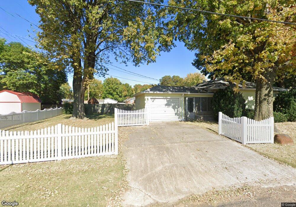
305 Tower Dr East Alton, IL 62024
Estimated Value: $144,000 - $158,000
2
Beds
1
Bath
952
Sq Ft
$161/Sq Ft
Est. Value
About This Home
This home is located at 305 Tower Dr, East Alton, IL 62024 and is currently estimated at $153,290, approximately $161 per square foot. 305 Tower Dr is a home located in Madison County with nearby schools including Eastwood Elementary School, East Alton Middle School, and East Alton-Wood River High School.
Ownership History
Date
Name
Owned For
Owner Type
Purchase Details
Closed on
Sep 29, 2003
Sold by
Stimac Andrew F and Stimac Sheri D
Bought by
Ricci Glenna L
Current Estimated Value
Home Financials for this Owner
Home Financials are based on the most recent Mortgage that was taken out on this home.
Original Mortgage
$45,000
Interest Rate
6.4%
Mortgage Type
Purchase Money Mortgage
Create a Home Valuation Report for This Property
The Home Valuation Report is an in-depth analysis detailing your home's value as well as a comparison with similar homes in the area
Home Values in the Area
Average Home Value in this Area
Purchase History
| Date | Buyer | Sale Price | Title Company |
|---|---|---|---|
| Ricci Glenna L | $80,000 | Community Title & Escrow |
Source: Public Records
Mortgage History
| Date | Status | Borrower | Loan Amount |
|---|---|---|---|
| Closed | Ricci Glenna L | $45,000 |
Source: Public Records
Tax History Compared to Growth
Tax History
| Year | Tax Paid | Tax Assessment Tax Assessment Total Assessment is a certain percentage of the fair market value that is determined by local assessors to be the total taxable value of land and additions on the property. | Land | Improvement |
|---|---|---|---|---|
| 2024 | $3,492 | $45,130 | $5,200 | $39,930 |
| 2023 | $3,492 | $42,070 | $4,850 | $37,220 |
| 2022 | $3,754 | $38,830 | $4,480 | $34,350 |
| 2021 | $3,462 | $36,200 | $4,180 | $32,020 |
| 2020 | $3,333 | $34,870 | $4,030 | $30,840 |
| 2019 | $3,280 | $33,830 | $3,910 | $29,920 |
| 2018 | $3,202 | $32,160 | $3,720 | $28,440 |
| 2017 | $3,005 | $31,390 | $3,630 | $27,760 |
| 2016 | $2,950 | $31,390 | $3,630 | $27,760 |
| 2015 | $2,824 | $31,060 | $3,590 | $27,470 |
| 2014 | $2,824 | $31,060 | $3,590 | $27,470 |
| 2013 | $2,824 | $31,510 | $3,640 | $27,870 |
Source: Public Records
Map
Nearby Homes
- 283 Hi Pointe Place
- 345 Illinois Ave
- 250 Hi Pointe Place
- 104 Whitelaw Ave
- 959 Cedar Dr
- 121 Whitelaw Ave
- 604 Wood River Ave
- 98 Wood River Ave
- 523 Wilson Ave
- 523 Lincoln Ave
- 133 Lincoln Ave
- 830 N Wood River Ave
- 211 S 9th St
- 141 S 9th St
- 420 Bowman Ave
- 144 S 9th St
- 777 Condit St
- 833 State St
- 641 Leslie Ave
- 225 Lakeside Ave