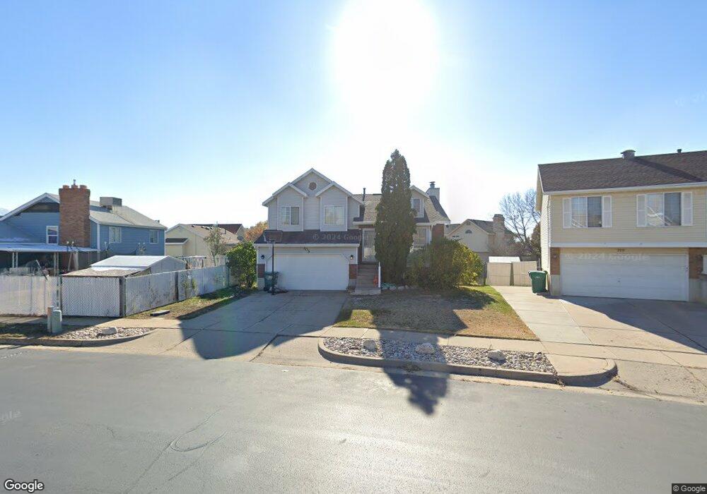
305 W 1900 N Layton, UT 84041
Estimated Value: $437,000 - $453,000
4
Beds
3
Baths
1,725
Sq Ft
$257/Sq Ft
Est. Value
About This Home
This home is located at 305 W 1900 N, Layton, UT 84041 and is currently estimated at $442,689, approximately $256 per square foot. 305 W 1900 N is a home located in Davis County with nearby schools including Lincoln Elementary School, North Layton Junior High School, and Northridge High School.
Ownership History
Date
Name
Owned For
Owner Type
Purchase Details
Closed on
Apr 20, 2002
Sold by
Mcquirk Shaun T and Mcquirk Jill M
Bought by
Gerrish Linda G
Current Estimated Value
Home Financials for this Owner
Home Financials are based on the most recent Mortgage that was taken out on this home.
Original Mortgage
$123,420
Outstanding Balance
$51,382
Interest Rate
6.87%
Mortgage Type
VA
Estimated Equity
$391,307
Create a Home Valuation Report for This Property
The Home Valuation Report is an in-depth analysis detailing your home's value as well as a comparison with similar homes in the area
Home Values in the Area
Average Home Value in this Area
Purchase History
| Date | Buyer | Sale Price | Title Company |
|---|---|---|---|
| Gerrish Linda G | -- | Mountain View Title & Escrow |
Source: Public Records
Mortgage History
| Date | Status | Borrower | Loan Amount |
|---|---|---|---|
| Open | Gerrish Linda G | $123,420 |
Source: Public Records
Tax History Compared to Growth
Tax History
| Year | Tax Paid | Tax Assessment Tax Assessment Total Assessment is a certain percentage of the fair market value that is determined by local assessors to be the total taxable value of land and additions on the property. | Land | Improvement |
|---|---|---|---|---|
| 2025 | $2,018 | $221,650 | $87,361 | $134,289 |
| 2024 | $2,018 | $213,400 | $102,610 | $110,790 |
| 2023 | $2,012 | $375,000 | $129,836 | $245,164 |
| 2022 | $2,038 | $206,250 | $66,274 | $139,976 |
| 2021 | $1,868 | $282,000 | $86,997 | $195,003 |
| 2020 | $1,685 | $244,000 | $75,671 | $168,329 |
| 2019 | $1,650 | $234,000 | $74,193 | $159,807 |
| 2018 | $1,475 | $210,000 | $74,193 | $135,807 |
| 2016 | $1,382 | $101,530 | $22,084 | $79,446 |
| 2015 | $1,319 | $91,960 | $22,084 | $69,876 |
| 2014 | $1,297 | $92,468 | $22,084 | $70,384 |
| 2013 | -- | $93,688 | $19,034 | $74,654 |
Source: Public Records
Map
Nearby Homes
- 247 W 1925 N
- 1837 N 440 W
- 1644 N 160 W
- 1966 N 50 W
- 2044 Evans Cove Loop
- 2048 Evans Cove Loop
- 1676 Forbes Ave W
- 2187 N 450 W
- 1490 N 175 W
- 2211 N 525 W
- 2248 N 500 W
- 23 E 2150 N
- 160 W 1350 N
- 1553 N 250 E
- 255 E 1500 N
- 2378 N 675 W
- 2402 N 725 W
- 2500 N Fort Ln Unit 238
- 2500 N Fort Ln Unit 189
- 2600 N Hill Field Rd Unit 4