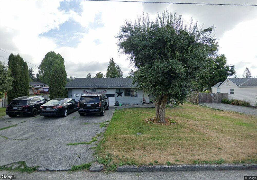
3051 Division St Enumclaw, WA 98022
Estimated Value: $522,000 - $580,000
3
Beds
2
Baths
1,380
Sq Ft
$394/Sq Ft
Est. Value
About This Home
This home is located at 3051 Division St, Enumclaw, WA 98022 and is currently estimated at $543,268, approximately $393 per square foot. 3051 Division St is a home located in King County with nearby schools including Byron Kibler Elementary School, Enumclaw Middle School, and Enumclaw Senior High School.
Ownership History
Date
Name
Owned For
Owner Type
Purchase Details
Closed on
Oct 11, 2002
Sold by
Stone Thomas C and Stone Susan C
Bought by
Wenderoth Christopher L and Wenderoth Janet M
Current Estimated Value
Home Financials for this Owner
Home Financials are based on the most recent Mortgage that was taken out on this home.
Original Mortgage
$110,000
Outstanding Balance
$42,600
Interest Rate
5.12%
Estimated Equity
$500,668
Purchase Details
Closed on
Oct 21, 1997
Sold by
Ralphs Barbetta M
Bought by
Stone Thomas C and Stone Susan C
Home Financials for this Owner
Home Financials are based on the most recent Mortgage that was taken out on this home.
Original Mortgage
$121,735
Interest Rate
7.49%
Purchase Details
Closed on
Mar 20, 1996
Sold by
Ralphs Arthur M
Bought by
Ralphs Barbetta M
Create a Home Valuation Report for This Property
The Home Valuation Report is an in-depth analysis detailing your home's value as well as a comparison with similar homes in the area
Home Values in the Area
Average Home Value in this Area
Purchase History
| Date | Buyer | Sale Price | Title Company |
|---|---|---|---|
| Wenderoth Christopher L | $154,950 | Washington Title Company | |
| Stone Thomas C | $125,500 | Washington Title Company | |
| Ralphs Barbetta M | -- | -- |
Source: Public Records
Mortgage History
| Date | Status | Borrower | Loan Amount |
|---|---|---|---|
| Open | Wenderoth Christopher L | $110,000 | |
| Previous Owner | Stone Thomas C | $121,735 |
Source: Public Records
Tax History
| Year | Tax Paid | Tax Assessment Tax Assessment Total Assessment is a certain percentage of the fair market value that is determined by local assessors to be the total taxable value of land and additions on the property. | Land | Improvement |
|---|---|---|---|---|
| 2024 | $4,580 | $477,000 | $180,000 | $297,000 |
| 2023 | $4,247 | $409,000 | $155,000 | $254,000 |
| 2022 | $3,805 | $467,000 | $178,000 | $289,000 |
| 2021 | $3,372 | $379,000 | $154,000 | $225,000 |
| 2020 | $3,081 | $306,000 | $107,000 | $199,000 |
| 2018 | $3,077 | $277,000 | $99,000 | $178,000 |
| 2017 | $2,732 | $251,000 | $90,000 | $161,000 |
| 2016 | $2,606 | $230,000 | $83,000 | $147,000 |
| 2015 | $2,622 | $216,000 | $79,000 | $137,000 |
| 2014 | -- | $208,000 | $81,000 | $127,000 |
| 2013 | -- | $160,000 | $65,000 | $95,000 |
Source: Public Records
Map
Nearby Homes
- 43128 260th Ave SE
- 2921 Frederickson St
- 1705 Marshall Ave
- 1722 Harding St
- 1720 Garfield St Unit 4
- 1471 Florence St
- 1107 Griffin Ave
- 27008 SE & 27012 432nd St
- 2881 Initial Ave
- 1101 Wells St
- 1234 Lincoln Ave Unit A
- 1234 Lincoln Ave Unit B
- 42102 264th Ave SE
- 2054 Roosevelt Ave
- 1137 Spruce Dr
- 1170 Cedar Dr
- 806 Pine Dr
- 823 Cottonwood Dr
- 3189 Roosevelt Ave
- 3183 Roosevelt Ave
- 3035 Division St
- 1986 Lowell Ave
- 3021 Division St
- 3105 Division St
- 3011 Division St
- 1966 Lowell Ave
- 3040 Division St
- 1989 Lowell Ave
- 1975 Wilson Ave
- 3100 Division St
- 3003 Division St
- 1969 Wilson Ave
- 3104 Division St
- 1956 Lowell Ave
- 1973 Lowell Ave
- 3120 Division St
- 1957 Wilson Ave
- 3143 Division St
- 1946 Lowell Ave
- 3004 Division St
Your Personal Tour Guide
Ask me questions while you tour the home.