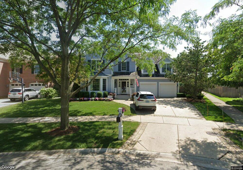
3051 Independence Ave Unit 2 Glenview, IL 60026
The Glen NeighborhoodEstimated Value: $1,820,434 - $2,471,000
5
Beds
5
Baths
4,618
Sq Ft
$459/Sq Ft
Est. Value
About This Home
This home is located at 3051 Independence Ave Unit 2, Glenview, IL 60026 and is currently estimated at $2,118,609, approximately $458 per square foot. 3051 Independence Ave Unit 2 is a home located in Cook County with nearby schools including Westbrook Elementary School, Glen Grove Elementary School, and Attea Middle School.
Ownership History
Date
Name
Owned For
Owner Type
Purchase Details
Closed on
Nov 1, 2013
Sold by
Durchin Lisa M
Bought by
Golden Robert D and Golden Dina R
Current Estimated Value
Purchase Details
Closed on
Oct 22, 2013
Sold by
Durchin Ronald A and Durchin Lisa M
Bought by
Durchin Lisa M
Purchase Details
Closed on
Nov 19, 2002
Sold by
Glenbase Venture
Bought by
Durchin Ronald A and Durchin Lisa M
Home Financials for this Owner
Home Financials are based on the most recent Mortgage that was taken out on this home.
Original Mortgage
$550,000
Interest Rate
6.22%
Create a Home Valuation Report for This Property
The Home Valuation Report is an in-depth analysis detailing your home's value as well as a comparison with similar homes in the area
Home Values in the Area
Average Home Value in this Area
Purchase History
| Date | Buyer | Sale Price | Title Company |
|---|---|---|---|
| Golden Robert D | $1,430,000 | Saturn Title Llc | |
| Durchin Lisa M | -- | Mutliple | |
| Durchin Ronald A | $1,075,000 | Chicago Title Insurance Co |
Source: Public Records
Mortgage History
| Date | Status | Borrower | Loan Amount |
|---|---|---|---|
| Previous Owner | Durchin Ronald A | $550,000 |
Source: Public Records
Tax History
| Year | Tax Paid | Tax Assessment Tax Assessment Total Assessment is a certain percentage of the fair market value that is determined by local assessors to be the total taxable value of land and additions on the property. | Land | Improvement |
|---|---|---|---|---|
| 2025 | $28,704 | $154,000 | $13,664 | $140,336 |
| 2024 | $28,704 | $133,000 | $11,562 | $121,438 |
| 2023 | $27,872 | $133,000 | $11,562 | $121,438 |
| 2022 | $27,872 | $133,000 | $11,562 | $121,438 |
| 2021 | $27,563 | $110,743 | $7,883 | $102,860 |
| 2020 | $27,237 | $110,743 | $7,883 | $102,860 |
| 2019 | $25,666 | $123,048 | $7,883 | $115,165 |
| 2018 | $29,796 | $129,552 | $6,832 | $122,720 |
| 2017 | $29,002 | $129,552 | $6,832 | $122,720 |
| 2016 | $27,404 | $129,552 | $6,832 | $122,720 |
| 2015 | $19,776 | $83,044 | $5,518 | $77,526 |
| 2014 | $19,414 | $83,044 | $5,518 | $77,526 |
| 2013 | $18,226 | $83,044 | $5,518 | $77,526 |
Source: Public Records
Map
Nearby Homes
- 3212 Lindenwood Ln
- 1615 Greenwood Rd
- 3415 Ralmark Ln
- 2710 Langley Cir Unit 201003
- 1605 Elmdale Ave
- 1725 Greenwood Rd
- 1028 Highland Ln
- 2701 Commons Dr Unit 210
- 911 Elmdale Rd
- 1813 Admiral Ct Unit 118
- 1619 Patriot Blvd
- 705 Glendale Rd
- 1088 Shermer Rd Unit DW
- 3843 Springdale Ave
- 3505 Linneman St
- 602 Glenshire Rd
- 606 Greendale Rd
- 525 Glenshire Rd
- 2238 Prairie St
- 524 Hazelwood Ln
- 3041 Independence Ave
- 1349 Huber Ln Unit B
- 3061 Independence Ave
- 3031 Independence Ave
- 1416 Kittyhawk Ln
- 1333 Huber Ln
- 3109 Bellwood Ln
- 1334 Huber Ln
- 3021 Independence Ave Unit 2
- 1327 Huber Ln
- 1428 Kittyhawk Ln
- 3113 Bellwood Ln
- 3105 Bellwood Ln
- 3016 Peachgate Ln
- 3014 Peachgate Ln
- 1413 Kittyhawk Ln
- 1330 Huber Ln
- 3011 Independence Ave
- 1321 Huber Ln Unit B
- 1440 Kittyhawk Ln
Your Personal Tour Guide
Ask me questions while you tour the home.