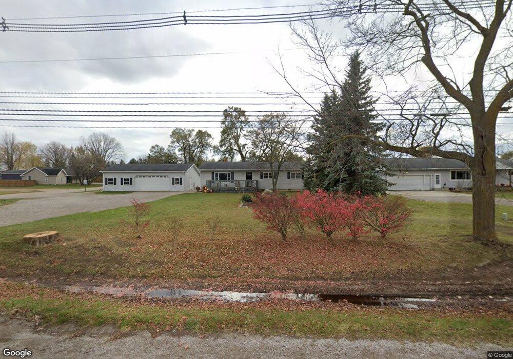
3051 W M 21 Owosso, MI 48867
Estimated Value: $166,000 - $263,000
--
Bed
--
Bath
--
Sq Ft
0.34
Acres
About This Home
This home is located at 3051 W M 21, Owosso, MI 48867 and is currently estimated at $210,861. 3051 W M 21 is a home located in Shiawassee County with nearby schools including Owosso High School, Spring Vale Christian School, and Salem Lutheran School.
Ownership History
Date
Name
Owned For
Owner Type
Purchase Details
Closed on
Dec 23, 2021
Sold by
Morris Sean M
Bought by
Ralston William L
Current Estimated Value
Home Financials for this Owner
Home Financials are based on the most recent Mortgage that was taken out on this home.
Original Mortgage
$147,250
Outstanding Balance
$135,194
Interest Rate
2.98%
Mortgage Type
New Conventional
Estimated Equity
$75,667
Purchase Details
Closed on
Mar 21, 2018
Sold by
Michele Reschke
Bought by
Morris Sean
Home Financials for this Owner
Home Financials are based on the most recent Mortgage that was taken out on this home.
Original Mortgage
$80,000
Interest Rate
4.44%
Purchase Details
Closed on
Aug 26, 2016
Sold by
Dean Morris Kenneth Michael and Morris Sean M
Bought by
Morris Sean M
Home Financials for this Owner
Home Financials are based on the most recent Mortgage that was taken out on this home.
Original Mortgage
$50,800
Interest Rate
3.43%
Mortgage Type
Purchase Money Mortgage
Create a Home Valuation Report for This Property
The Home Valuation Report is an in-depth analysis detailing your home's value as well as a comparison with similar homes in the area
Home Values in the Area
Average Home Value in this Area
Purchase History
| Date | Buyer | Sale Price | Title Company |
|---|---|---|---|
| Ralston William L | $155,000 | Ata National Title Group Llc | |
| Morris Sean | $100,000 | -- | |
| Morris Sean M | -- | None Available |
Source: Public Records
Mortgage History
| Date | Status | Borrower | Loan Amount |
|---|---|---|---|
| Open | Ralston William L | $147,250 | |
| Previous Owner | Morris Sean | $80,000 | |
| Previous Owner | Morris Sean | -- | |
| Previous Owner | Morris Sean M | $50,800 |
Source: Public Records
Tax History Compared to Growth
Tax History
| Year | Tax Paid | Tax Assessment Tax Assessment Total Assessment is a certain percentage of the fair market value that is determined by local assessors to be the total taxable value of land and additions on the property. | Land | Improvement |
|---|---|---|---|---|
| 2025 | $2,277 | $101,900 | $0 | $0 |
| 2024 | $2,321 | $82,400 | $0 | $0 |
| 2023 | $847 | $77,000 | $0 | $0 |
| 2022 | $806 | $69,900 | $0 | $0 |
| 2021 | $1,424 | $60,600 | $0 | $0 |
| 2020 | $1,411 | $51,300 | $0 | $0 |
| 2019 | $1,393 | $44,300 | $0 | $0 |
| 2018 | $1,519 | $44,600 | $0 | $0 |
| 2017 | $1,143 | $44,100 | $0 | $0 |
| 2016 | -- | $44,100 | $0 | $0 |
| 2015 | -- | $43,800 | $0 | $0 |
| 2014 | $5 | $42,300 | $0 | $0 |
Source: Public Records
Map
Nearby Homes
- 3006 W M 21
- N Chestnut Street N Chestnut St
- 982 S Chestnut St
- 1444 W King St
- Vacant Ash St
- 411 Robbins St
- 1318 W Stewart St
- 440 Curwood Dr
- 309 State St
- 539 W Wildwood Dr
- 818 S Lyon St
- 1510 S Chipman St
- 821 Fletcher St
- V/L W South St
- 1610 W South St
- 725 River St
- 810 Grace St
- Vacant W Oliver St
- 802 W Stewart St
- 607 S Cedar St