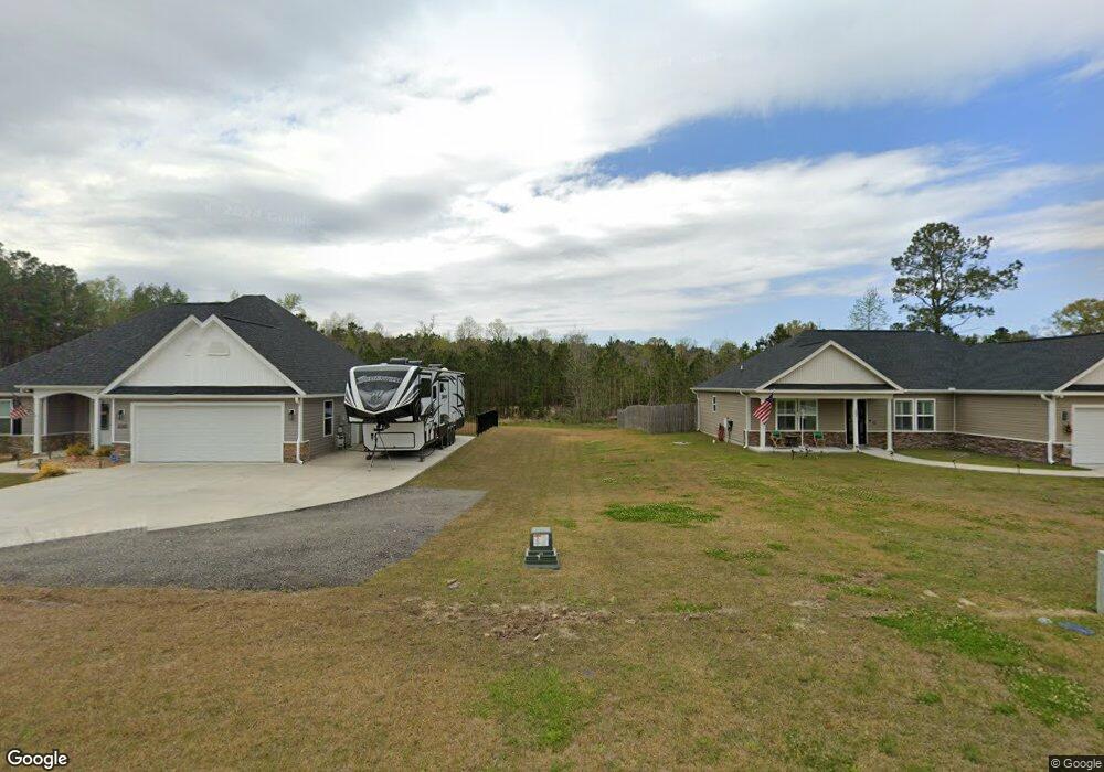
3053 Highway 19 Conway, SC 29526
Estimated Value: $207,646
--
Bed
--
Bath
1,738
Sq Ft
$119/Sq Ft
Est. Value
About This Home
This home is located at 3053 Highway 19, Conway, SC 29526 and is currently estimated at $207,646, approximately $119 per square foot. 3053 Highway 19 is a home located in Horry County with nearby schools including Kingston Elementary School, Conway Middle School, and Conway High School.
Ownership History
Date
Name
Owned For
Owner Type
Purchase Details
Closed on
Aug 29, 2022
Sold by
Dried Right Llc
Bought by
Melton Larry
Current Estimated Value
Purchase Details
Closed on
Jan 27, 2021
Sold by
Chestnut Eva C
Bought by
Dried Right Llc
Home Financials for this Owner
Home Financials are based on the most recent Mortgage that was taken out on this home.
Original Mortgage
$116,000
Interest Rate
2.6%
Mortgage Type
New Conventional
Purchase Details
Closed on
Dec 31, 1998
Sold by
Roberts Stacy and Roberts Cathie
Bought by
Chestnut Eva C
Create a Home Valuation Report for This Property
The Home Valuation Report is an in-depth analysis detailing your home's value as well as a comparison with similar homes in the area
Home Values in the Area
Average Home Value in this Area
Purchase History
| Date | Buyer | Sale Price | Title Company |
|---|---|---|---|
| Melton Larry | $200,000 | -- | |
| Dried Right Llc | $145,000 | -- | |
| Chestnut Eva C | -- | -- |
Source: Public Records
Mortgage History
| Date | Status | Borrower | Loan Amount |
|---|---|---|---|
| Previous Owner | Dried Right Llc | $116,000 |
Source: Public Records
Tax History Compared to Growth
Tax History
| Year | Tax Paid | Tax Assessment Tax Assessment Total Assessment is a certain percentage of the fair market value that is determined by local assessors to be the total taxable value of land and additions on the property. | Land | Improvement |
|---|---|---|---|---|
| 2024 | $2,797 | $15,608 | $12,684 | $2,924 |
| 2023 | $2,797 | $8,881 | $4,375 | $4,506 |
| 2021 | $1,938 | $8,958 | $4,452 | $4,506 |
| 2020 | $1,591 | $7,709 | $3,203 | $4,506 |
| 2019 | $1,857 | $12,587 | $4,703 | $7,884 |
| 2018 | $0 | $7,403 | $4,703 | $2,700 |
| 2017 | $1,769 | $9,503 | $4,703 | $4,800 |
| 2016 | -- | $6,205 | $4,999 | $1,206 |
| 2015 | $1,052 | $6,205 | $4,999 | $1,206 |
| 2014 | $1,020 | $6,205 | $4,999 | $1,206 |
Source: Public Records
Map
Nearby Homes
- TBD Old Reaves Ferry Rd Unit TBD Old Highway 90
- TBD Old Reaves Ferry Rd
- TBD Old Reaves Ferry Rd Unit 147.38 Acres
- 2835 Pecan Ln
- 274 Morris Rd Unit 284 Morris Rd
- 270 Morris Rd
- 2763 Highway 905
- TBD Morris Rd
- 270/274/284 Morris Rd
- TBD 22.66 Berley Mc Rd
- 3390 Highway 19
- TBD88 Old Reaves Ferry Rd
- 121 Oak Log Lake Rd
- 319 Pickney Ct
- 3695 S Carolina 905
- 1274 Rodney Rd
- Lot 4 Kellys Cove Dr
- 709 Bull Farm Ct
- 3700 Highway 19
- 183 Kellys Cove Dr
- 3053 Highway 19
- 3049 Highway 19
- 3049 Highway 19
- 3045 Highway 19
- 3048 Highway 19
- 3046 Highway 19
- 3090 Highway 19
- 3041 Highway 19
- 3080 Highway 19
- 3112 Highway 19
- 3038 Highway 19
- 3116 Highway 19
- 3120 Highway 19
- 2973 Highway 19
- 3125 Highway 19
- 2872 Rebel Ridge Rd
- 2830 Rebel Ridge Rd
- 3128 Highway 19
- 2831 Rebel Ridge Rd
- 3136 Highway 19