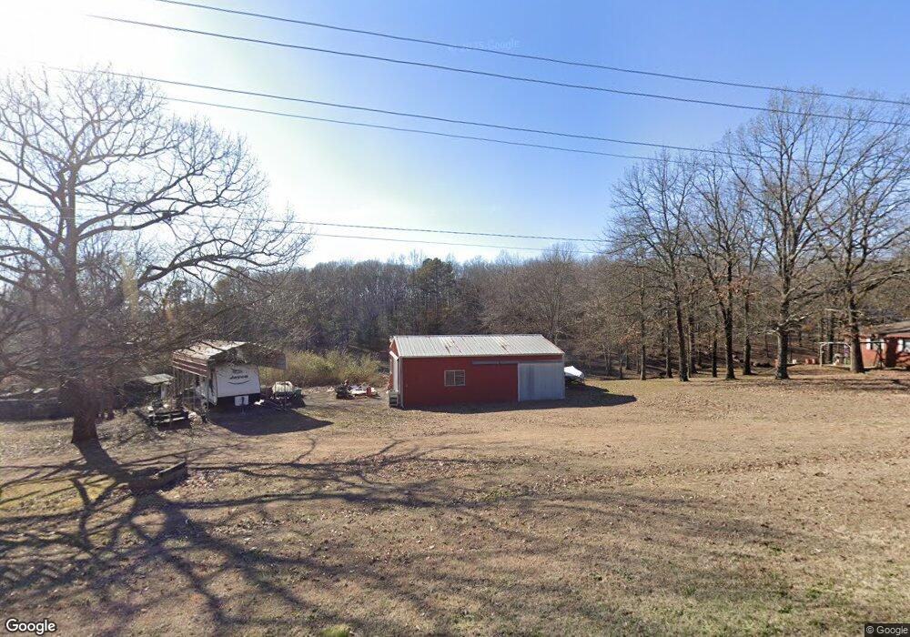
3054 Little Rock Rd Rose Bud, AR 72137
Estimated Value: $207,000 - $260,770
--
Bed
2
Baths
2,175
Sq Ft
$107/Sq Ft
Est. Value
About This Home
This home is located at 3054 Little Rock Rd, Rose Bud, AR 72137 and is currently estimated at $231,943, approximately $106 per square foot. 3054 Little Rock Rd is a home located in Cleburne County with nearby schools including Rose Bud Elementary School, Rose Bud High School, and Triple S Christian School.
Ownership History
Date
Name
Owned For
Owner Type
Purchase Details
Closed on
Oct 7, 2019
Sold by
Nestor David M
Bought by
Ballard Justin and Ballard Alanda
Current Estimated Value
Purchase Details
Closed on
Oct 22, 2008
Sold by
Nestor David M and Nestor Sara M
Bought by
Nestor David M
Purchase Details
Closed on
Sep 8, 2004
Bought by
Nestor David Michael
Purchase Details
Closed on
Jan 31, 2003
Bought by
Nestor David Michael and Nestor Jennifer
Purchase Details
Closed on
Dec 14, 2001
Bought by
Long Iris E
Purchase Details
Closed on
Jul 1, 1993
Bought by
Long Frederick E and Long Iris E
Create a Home Valuation Report for This Property
The Home Valuation Report is an in-depth analysis detailing your home's value as well as a comparison with similar homes in the area
Home Values in the Area
Average Home Value in this Area
Purchase History
| Date | Buyer | Sale Price | Title Company |
|---|---|---|---|
| Ballard Justin | -- | None Available | |
| Nestor David M | -- | None Available | |
| Nestor David Michael | -- | -- | |
| Nestor David Michael | -- | -- | |
| Long Iris E | -- | -- | |
| Long Frederick E | $66,500 | -- |
Source: Public Records
Tax History Compared to Growth
Tax History
| Year | Tax Paid | Tax Assessment Tax Assessment Total Assessment is a certain percentage of the fair market value that is determined by local assessors to be the total taxable value of land and additions on the property. | Land | Improvement |
|---|---|---|---|---|
| 2024 | $896 | $35,174 | $3,001 | $32,173 |
| 2023 | $910 | $35,174 | $3,001 | $32,173 |
| 2022 | $899 | $35,174 | $3,001 | $32,173 |
| 2021 | $839 | $27,336 | $1,801 | $25,535 |
| 2020 | $839 | $27,336 | $1,801 | $25,535 |
| 2019 | $839 | $27,336 | $1,801 | $25,535 |
| 2018 | $1,214 | $27,336 | $1,801 | $25,535 |
| 2017 | $1,201 | $27,336 | $1,801 | $25,535 |
| 2016 | $1,092 | $28,192 | $6,002 | $22,190 |
| 2015 | $1,252 | $28,192 | $6,002 | $22,190 |
| 2014 | $902 | $28,192 | $6,002 | $22,190 |
Source: Public Records
Map
Nearby Homes
- 00 Morgan Rd
- 4 Simmons Loop
- 359 Pin Oak Dr W
- 545 Firehouse Rd
- 606 Firehouse Rd
- 1450 Goff Rd
- 738 Lone Star Rd
- 935 lot 15 Goff Rd
- 935 lot 21 Goff Rd
- 935 lot 3 Goff Rd
- 935 lot 22 Goff Rd
- 935 lot 4 Goff Rd
- 935 lot 23 Goff Rd
- 935 lot 24 Goff Rd
- 935 lot 25 Goff Rd
- 935 lot 2 Goff Rd
- 935 lot 9 Goff Rd
- 000 Goff Rd Via Easement
- 000 Easement Unit Goff Rd
- 271 County Line Rd
- 3030 Little Rock Rd
- 3059 Little Rock Rd
- 3024 Little Rock Rd
- 3000 Little Rock Rd
- 3194 Little Rock Rd
- 2975 Little Rock Rd
- 109 W Pin Oak
- 50 Pin Oak Dr W
- 2929 Little Rock Rd
- 74 Hatfield Dr
- 104 Hatfield Dr
- 2900 Little Rock Rd
- 50 Hatfield Dr
- 40 Hatfield Dr
- 109 Friendship
- 124 Pin Oak Dr E
- 4 Friendship
- 0 Friendship
- 10 Hatfield Dr
- 75 Hatfield Dr