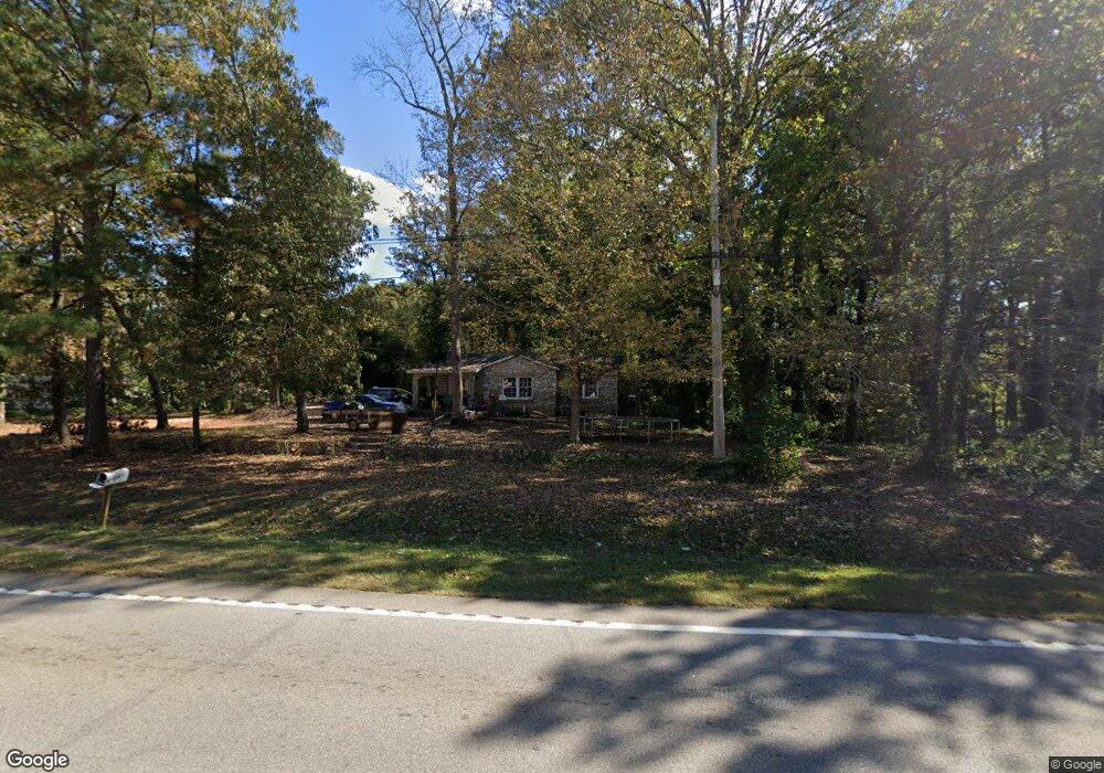
3055 West Point Rd Lagrange, GA 30240
Estimated Value: $137,000 - $244,000
3
Beds
1
Bath
1,412
Sq Ft
$144/Sq Ft
Est. Value
About This Home
This home is located at 3055 West Point Rd, Lagrange, GA 30240 and is currently estimated at $203,002, approximately $143 per square foot. 3055 West Point Rd is a home located in Troup County with nearby schools including Berta Weathersbee Elementary School, Long Cane Elementary School, and Whitesville Road Elementary School.
Ownership History
Date
Name
Owned For
Owner Type
Purchase Details
Closed on
Jun 29, 2020
Sold by
Allen H I
Bought by
Allen Craig
Current Estimated Value
Purchase Details
Closed on
Dec 4, 2019
Sold by
Allen H I
Bought by
Allen Craig
Purchase Details
Closed on
Dec 29, 1980
Sold by
Sloan Dr Fred
Bought by
Allen Hubert I
Purchase Details
Closed on
Aug 14, 1975
Sold by
Reeves Gurtrude and J W
Bought by
Sloan Dr Fred
Purchase Details
Closed on
Sep 26, 1957
Sold by
Reeves J W
Bought by
Reeves Gurtrude and J W
Purchase Details
Closed on
Oct 1, 1943
Sold by
Meadows L L
Bought by
Reeves J W
Create a Home Valuation Report for This Property
The Home Valuation Report is an in-depth analysis detailing your home's value as well as a comparison with similar homes in the area
Purchase History
| Date | Buyer | Sale Price | Title Company |
|---|---|---|---|
| Allen Craig | -- | -- | |
| Allen Craig | -- | -- | |
| Allen Hubert I | $21,200 | -- | |
| Sloan Dr Fred | -- | -- | |
| Reeves Gurtrude | -- | -- | |
| Reeves J W | -- | -- |
Source: Public Records
Tax History
| Year | Tax Paid | Tax Assessment Tax Assessment Total Assessment is a certain percentage of the fair market value that is determined by local assessors to be the total taxable value of land and additions on the property. | Land | Improvement |
|---|---|---|---|---|
| 2025 | $1,052 | $38,560 | $10,000 | $28,560 |
| 2024 | $902 | $33,080 | $10,000 | $23,080 |
| 2023 | $938 | $34,400 | $10,000 | $24,400 |
| 2022 | $864 | $30,960 | $8,000 | $22,960 |
| 2021 | $907 | $30,080 | $4,000 | $26,080 |
| 2020 | $812 | $26,920 | $4,360 | $22,560 |
| 2019 | $665 | $22,060 | $3,700 | $18,360 |
| 2018 | $615 | $20,380 | $3,700 | $16,680 |
| 2017 | $615 | $20,380 | $3,700 | $16,680 |
| 2016 | $601 | $19,915 | $3,700 | $16,215 |
| 2015 | $602 | $19,915 | $3,700 | $16,215 |
| 2014 | $600 | $19,822 | $3,700 | $16,122 |
| 2013 | -- | $21,211 | $3,700 | $17,511 |
Source: Public Records
Map
Nearby Homes
- 808 S Fling Rd
- 509 Connie Dr
- 0 Glass Bridge Rd Unit 10679358
- 427 Fling Rd
- 8 Horace Carter Rd
- 0 Bradfield Dr Unit 10568803
- 275 Hanson Dr
- 2239 Pegasus Pkwy
- 0 Hanson Dr Unit 10641272
- 112 Foxdale Dr
- 124 Foxdale Dr
- 266 Glass Bridge Rd
- 22 Freeman Rd
- 105 Redwood Dr
- 104 Bridlewood Dr
- 640 Hudson Rd
- 135 Planters Ridge Dr
- 3 Reed Dr
- 336 Whitaker Rd
- 119 Plymouth Dr
- 3017 W Point Rd
- 116 Westover Trail
- 10 Pop Reeses Rd
- 118 Westover Trail
- 3097 West Point Rd
- 11 Pop Reeses Rd
- 3092 West Point Rd
- 3009 W Point Rd
- 120 Westover Trail
- 114 W Gate Dr
- 114 West Gate Dr
- 112 Westgate Dr
- 112 West Gate Dr
- 122 Westover Trail
- 112 W Gate Dr
- 3116 W Point Rd
- 3116 West Point Rd
- 109 W Gate Dr
- 109 West Gate Dr
- 110 West Gate Dr
Your Personal Tour Guide
Ask me questions while you tour the home.