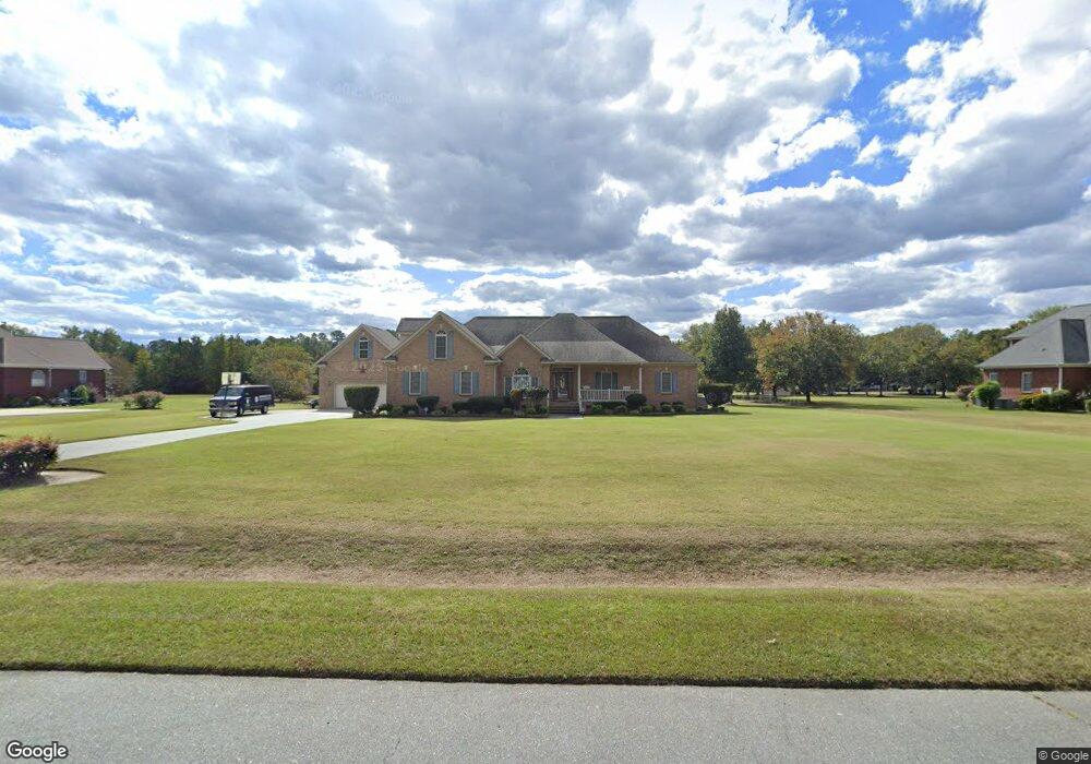
306 Ashworth Dr Goldsboro, NC 27530
Estimated Value: $418,000 - $450,518
3
Beds
3
Baths
2,474
Sq Ft
$175/Sq Ft
Est. Value
About This Home
This home is located at 306 Ashworth Dr, Goldsboro, NC 27530 and is currently estimated at $433,880, approximately $175 per square foot. 306 Ashworth Dr is a home located in Wayne County with nearby schools including Northwest Elementary School, Norwayne Middle School, and Charles B. Aycock High School.
Ownership History
Date
Name
Owned For
Owner Type
Purchase Details
Closed on
Feb 26, 2008
Sold by
Benchmark Builders Of Wayne County Inc
Bought by
Mcnair Benjamin F and Mcnair Pamela B
Current Estimated Value
Home Financials for this Owner
Home Financials are based on the most recent Mortgage that was taken out on this home.
Original Mortgage
$215,000
Outstanding Balance
$133,293
Interest Rate
5.65%
Mortgage Type
Unknown
Estimated Equity
$300,587
Create a Home Valuation Report for This Property
The Home Valuation Report is an in-depth analysis detailing your home's value as well as a comparison with similar homes in the area
Home Values in the Area
Average Home Value in this Area
Purchase History
| Date | Buyer | Sale Price | Title Company |
|---|---|---|---|
| Mcnair Benjamin F | $275,000 | None Available |
Source: Public Records
Mortgage History
| Date | Status | Borrower | Loan Amount |
|---|---|---|---|
| Open | Mcnair Benjamin F | $215,000 |
Source: Public Records
Tax History Compared to Growth
Tax History
| Year | Tax Paid | Tax Assessment Tax Assessment Total Assessment is a certain percentage of the fair market value that is determined by local assessors to be the total taxable value of land and additions on the property. | Land | Improvement |
|---|---|---|---|---|
| 2025 | $2,801 | $440,320 | $52,500 | $387,820 |
| 2024 | $1,988 | $280,550 | $49,000 | $231,550 |
| 2023 | $1,929 | $280,550 | $49,000 | $231,550 |
| 2022 | $2,289 | $280,550 | $49,000 | $231,550 |
| 2021 | $2,191 | $280,550 | $49,000 | $231,550 |
| 2020 | $2,067 | $280,550 | $49,000 | $231,550 |
| 2018 | $2,220 | $301,720 | $40,250 | $261,470 |
| 2017 | $2,220 | $301,720 | $40,250 | $261,470 |
| 2016 | $2,220 | $301,720 | $40,250 | $261,470 |
| 2015 | $2,225 | $301,720 | $40,250 | $261,470 |
| 2014 | $2,229 | $301,720 | $40,250 | $261,470 |
Source: Public Records
Map
Nearby Homes
- 626 Adler Ln
- 203 Lane Tree Dr
- 220 Creek Ridge Dr
- 101 Mcwood Place
- 103 Poplar Knoll Rd
- 479 Perkins Rd
- 455 Perkins Rd
- 408 Perkins Rd
- 220 Airport Rd NE
- 176 Perkins Rd
- 302 Morgan Trace Ln
- 276 Buck Swamp Rd
- 205 Carlyle Cir
- 3418 U S 117
- 1179 Buck Swamp Rd
- 106 Yelverton Place
- 216 Koufax Dr
- 303 Woodview Dr
- 104 Pear Tree Ln
- Lot 14 Pony Dr
- 308 Ashworth Dr
- 311 Ashworth Dr
- 302 Ashworth Dr
- 123 Cliffwell Dr
- 313 Ashworth Dr
- 310 Ashworth Dr
- 125 Cliffwell Dr
- 309 Ashworth Dr
- 121 Cliffwell Dr
- 119 Cliffwell Dr
- 300 Ashworth Dr
- 315 Ashworth Dr
- 307 Ashworth Dr
- 305 Ashworth Dr
- 312 Ashworth Dr
- 117 Cliffwell Dr
- 317 Ashworth Dr
- 301 Ashworth Dr
- 126 Cliffwell Dr
- 303 Ashworth Dr