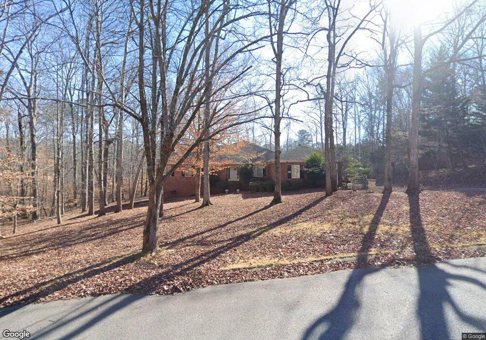
306 Chesterfield Rd Bogart, GA 30622
Estimated Value: $447,000 - $461,567
--
Bed
1
Bath
2,887
Sq Ft
$158/Sq Ft
Est. Value
About This Home
This home is located at 306 Chesterfield Rd, Bogart, GA 30622 and is currently estimated at $455,142, approximately $157 per square foot. 306 Chesterfield Rd is a home located in Clarke County with nearby schools including Cleveland Road Elementary School, Burney-Harris-Lyons Middle School, and Clarke Central High School.
Ownership History
Date
Name
Owned For
Owner Type
Purchase Details
Closed on
Sep 17, 2019
Sold by
Hayes Essie
Bought by
Hayes Essie Mae and Hennigan Alfonzo Lionel
Current Estimated Value
Purchase Details
Closed on
Mar 24, 1997
Sold by
Hayes Troy Essie Hayes Willie E Craw
Bought by
Hayes Troy and Essie Hayes
Purchase Details
Closed on
Apr 17, 1996
Sold by
Diaz Guillermo
Bought by
Hayes Troy Essie Hayes Willie E Cra
Purchase Details
Closed on
Sep 17, 1990
Sold by
Platt Frank and Bernice Platt
Bought by
Diaz Guillermo
Create a Home Valuation Report for This Property
The Home Valuation Report is an in-depth analysis detailing your home's value as well as a comparison with similar homes in the area
Home Values in the Area
Average Home Value in this Area
Purchase History
| Date | Buyer | Sale Price | Title Company |
|---|---|---|---|
| Hayes Essie Mae | -- | -- | |
| Hayes Troy | -- | -- | |
| Hayes Troy Essie Hayes Willie E Cra | $189,000 | -- | |
| Diaz Guillermo | $154,800 | -- |
Source: Public Records
Tax History Compared to Growth
Tax History
| Year | Tax Paid | Tax Assessment Tax Assessment Total Assessment is a certain percentage of the fair market value that is determined by local assessors to be the total taxable value of land and additions on the property. | Land | Improvement |
|---|---|---|---|---|
| 2025 | $5,134 | $165,332 | $18,000 | $147,332 |
| 2024 | $5,134 | $157,613 | $18,000 | $139,613 |
| 2023 | $4,925 | $147,132 | $18,000 | $129,132 |
| 2022 | $4,034 | $126,459 | $18,000 | $108,459 |
| 2021 | $3,145 | $118,696 | $16,000 | $102,696 |
| 2020 | $3,106 | $115,786 | $16,000 | $99,786 |
| 2019 | $3,010 | $107,035 | $16,000 | $91,035 |
| 2018 | $2,966 | $103,868 | $16,000 | $87,868 |
| 2017 | $2,880 | $97,696 | $16,000 | $81,696 |
| 2016 | $2,849 | $95,520 | $16,000 | $79,520 |
| 2015 | $2,824 | $93,698 | $16,000 | $77,698 |
| 2014 | $2,877 | $97,520 | $16,000 | $81,520 |
Source: Public Records
Map
Nearby Homes
- 212 Huntington Shoals Dr
- 141 Huntington Shoals Dr
- 240 W Huntington Rd
- 637 Huntington Rd Unit B1
- 532 Huntington Rd Unit 7
- 190 W Huntington Rd
- 470 Huntington Rd Unit 5
- 682 Chesterfield Rd
- 241 Meeler Cir
- 256 Cherokee Ridge
- 212 Meeler Cir
- 450 River Bottom Rd
- 150 Callaway Dr
- 170 Huntington Ct
- 575 Vaughn Rd
- 100 Hanover Dr
- 115 Woodhaven St
- 211 Littleton Way
- 302 Chesterfield Rd
- 193 Huntington Shoals Dr
- 189 Huntington Shoals Dr
- 185 Huntington Shoals Dr
- 275 W Huntington Rd
- 197 Huntington Shoals Dr
- 181 Huntington Shoals Dr
- 0 Huntington Shoals Dr Unit 7520462
- 0 Huntington Shoals Dr Unit 7417683
- 0 Huntington Shoals Dr Unit 7348374
- 0 Huntington Shoals Dr Unit 8731125
- 0 Huntington Shoals Dr Unit 8298904
- 0 Huntington Shoals Dr Unit 8057406
- 0 Huntington Shoals Dr Unit 8010264
- 0 Huntington Shoals Dr Unit 7624540
- 0 Huntington Shoals Dr Unit 3208122
- 0 Huntington Shoals Dr Unit 3100818
- 0 Huntington Shoals Dr Unit 3062805
- 0 Huntington Shoals Dr Unit 2696026
- 311 Chesterfield Rd