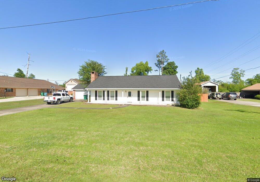
306 E Presidential Cir Lake Charles, LA 70611
Moss Bluff NeighborhoodEstimated Value: $258,000 - $282,000
3
Beds
2
Baths
1,900
Sq Ft
$145/Sq Ft
Est. Value
About This Home
This home is located at 306 E Presidential Cir, Lake Charles, LA 70611 and is currently estimated at $275,474, approximately $144 per square foot. 306 E Presidential Cir is a home located in Calcasieu Parish with nearby schools including Moss Bluff Elementary School, Moss Bluff Middle School, and Sam Houston High School.
Ownership History
Date
Name
Owned For
Owner Type
Purchase Details
Closed on
May 15, 2009
Sold by
Sonnier Matthew James
Bought by
Lanier Andrew Warren and Lanier Tiffany Lynette
Current Estimated Value
Home Financials for this Owner
Home Financials are based on the most recent Mortgage that was taken out on this home.
Original Mortgage
$185,576
Outstanding Balance
$116,745
Interest Rate
4.77%
Mortgage Type
FHA
Estimated Equity
$158,729
Purchase Details
Closed on
Sep 8, 2006
Sold by
Arabie Carl Andrew and Arabie Heather Christine
Bought by
Sonnier Mathew James
Home Financials for this Owner
Home Financials are based on the most recent Mortgage that was taken out on this home.
Original Mortgage
$171,000
Interest Rate
6.55%
Mortgage Type
New Conventional
Create a Home Valuation Report for This Property
The Home Valuation Report is an in-depth analysis detailing your home's value as well as a comparison with similar homes in the area
Home Values in the Area
Average Home Value in this Area
Purchase History
| Date | Buyer | Sale Price | Title Company |
|---|---|---|---|
| Lanier Andrew Warren | $189,000 | None Available | |
| Sonnier Mathew James | $171,000 | None Available |
Source: Public Records
Mortgage History
| Date | Status | Borrower | Loan Amount |
|---|---|---|---|
| Open | Lanier Andrew Warren | $185,576 | |
| Previous Owner | Sonnier Mathew James | $171,000 |
Source: Public Records
Tax History Compared to Growth
Tax History
| Year | Tax Paid | Tax Assessment Tax Assessment Total Assessment is a certain percentage of the fair market value that is determined by local assessors to be the total taxable value of land and additions on the property. | Land | Improvement |
|---|---|---|---|---|
| 2024 | $1,386 | $20,390 | $2,540 | $17,850 |
| 2023 | $1,386 | $20,390 | $2,540 | $17,850 |
| 2022 | $1,362 | $20,390 | $2,540 | $17,850 |
| 2021 | $1,275 | $19,000 | $2,540 | $16,460 |
| 2020 | $1,878 | $17,250 | $2,440 | $14,810 |
| 2019 | $2,055 | $18,810 | $2,350 | $16,460 |
| 2018 | $1,238 | $18,810 | $2,350 | $16,460 |
| 2017 | $2,087 | $18,810 | $2,350 | $16,460 |
| 2016 | $2,057 | $18,810 | $2,350 | $16,460 |
| 2015 | $2,101 | $18,810 | $2,350 | $16,460 |
Source: Public Records
Map
Nearby Homes
- 231 N Presidential Cir
- 231 W Presidential Cir
- 442 Armistead Ln
- 231a Armistead Ln
- 179 Armistead Ln
- 201 Armistead Ln
- 616 Josh St
- 627 Sam Houston Jones Hwy
- 290 Morrow Rd
- TBD Talon Ln Unit Lot 10
- 276 Vickie Ln
- 276 School St
- 0 Vickie Ln
- 0 Parish Rd Unit 45-679
- 0 Parish Rd Unit SWL24004393
- 333 Champagne Cir
- 179 Sam Houston Jones Pkwy
- 0 Champagne Cir Unit SWL23007471
- 158 Mandolin Dr
- 647 Morrow Rd
- 324 E Presidential Cir
- 284 E Presidential Cir
- 0 E Presidential Cir
- 220 Congressman Ln
- 342 E Presidential Cir
- 270 E Presidential Cir
- 193 Iles Rd
- 211 Senator Ln
- 221 Congressman Ln
- 224 Congressman Ln
- 252 E Presidential Cir
- 170 Iles Rd
- 165 Iles Rd
- 215 Senator Ln
- 360 E Presidential Cir
- 189 Silvia Ln
- 251 E Presidential Cir
- 225 Congressman Ln
- 226 Congressman Ln
- 248 E Presidential Cir