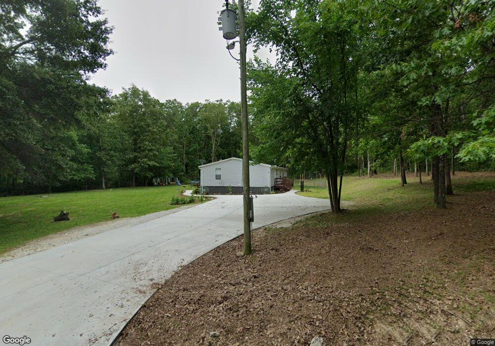
306 East West Rd Sullivan, MO 63080
Estimated Value: $186,338 - $189,000
3
Beds
1
Bath
1,782
Sq Ft
$105/Sq Ft
Est. Value
About This Home
This home is located at 306 East West Rd, Sullivan, MO 63080 and is currently estimated at $187,669, approximately $105 per square foot. 306 East West Rd is a home located in Franklin County with nearby schools including Sullivan Primary School, Sullivan Elementary School, and Sullivan Middle School.
Ownership History
Date
Name
Owned For
Owner Type
Purchase Details
Closed on
Apr 25, 2024
Sold by
Franklin Financial Inc
Bought by
Leuthauser Alfred and Leuthauser Bessie
Current Estimated Value
Home Financials for this Owner
Home Financials are based on the most recent Mortgage that was taken out on this home.
Original Mortgage
$176,641
Outstanding Balance
$174,097
Interest Rate
6.74%
Mortgage Type
New Conventional
Estimated Equity
$13,572
Purchase Details
Closed on
Nov 18, 2015
Sold by
Bosworth Dennis
Bought by
Bosworth Lisa H
Purchase Details
Closed on
May 1, 2008
Sold by
Bosworth Dennis J and Bosworth Lisa H
Bought by
Loveless John B
Purchase Details
Closed on
Apr 11, 2008
Sold by
Wilson Anthony M and Wilson Jennifer L
Bought by
Franklin Financial Corp
Create a Home Valuation Report for This Property
The Home Valuation Report is an in-depth analysis detailing your home's value as well as a comparison with similar homes in the area
Home Values in the Area
Average Home Value in this Area
Purchase History
| Date | Buyer | Sale Price | Title Company |
|---|---|---|---|
| Leuthauser Alfred | -- | None Listed On Document | |
| Bosworth Lisa H | -- | -- | |
| Loveless John B | -- | None Available | |
| Bosworth Dennis J | -- | None Available | |
| Franklin Financial Corp | -- | None Available |
Source: Public Records
Mortgage History
| Date | Status | Borrower | Loan Amount |
|---|---|---|---|
| Open | Leuthauser Alfred | $176,641 |
Source: Public Records
Tax History Compared to Growth
Tax History
| Year | Tax Paid | Tax Assessment Tax Assessment Total Assessment is a certain percentage of the fair market value that is determined by local assessors to be the total taxable value of land and additions on the property. | Land | Improvement |
|---|---|---|---|---|
| 2024 | $583 | $10,769 | $0 | $0 |
| 2023 | $583 | $10,769 | $0 | $0 |
| 2022 | $510 | $9,447 | $0 | $0 |
| 2021 | $513 | $9,447 | $0 | $0 |
| 2020 | $537 | $9,717 | $0 | $0 |
| 2019 | $537 | $9,717 | $0 | $0 |
| 2018 | $508 | $9,078 | $0 | $0 |
| 2017 | $513 | $9,078 | $0 | $0 |
| 2016 | $509 | $9,131 | $0 | $0 |
| 2015 | $511 | $9,131 | $0 | $0 |
| 2014 | $524 | $9,673 | $0 | $0 |
Source: Public Records
Map
Nearby Homes
- 982 Huntington Meadows Ln
- 1116 E Springfield Rd
- 1019 E Springfield Rd
- 311 S Highway 185
- 9 Karen Ann Cir
- 1243 N and South Rd S
- 430 Scottsdale Dr
- 0 Mesa Dr
- 6 Fig St Unit 16
- 6 Fig St Unit 8
- 107 Glaser Rd
- 215 Meramec Dr
- 306 E Euclid Ave
- 132 Virginia St
- 621 Tipton St
- 56 E Euclid Ave
- 3 Modern St
- 2 Modern St
- 321 E Vine St
- 237 Pine St
- 306 E West Rd
- 336 East West Rd
- 315 East West Rd
- 275 East West Rd
- 350 East West Rd
- 350 East West Rd
- 335 East-West Rd
- 275 E West Rd
- 260 East West Rd
- 255 East West Rd
- 05 Acres E West Rd
- 395 East West Rd
- 217 East West Rd
- 180 East West Rd
- 180 East-West Rd
- 1103 Acid Mine Rd
- 1101 Acid Mine Rd
- 550 Bell Rd
- 151 East West Rd
- 1247 Acid Mine Rd