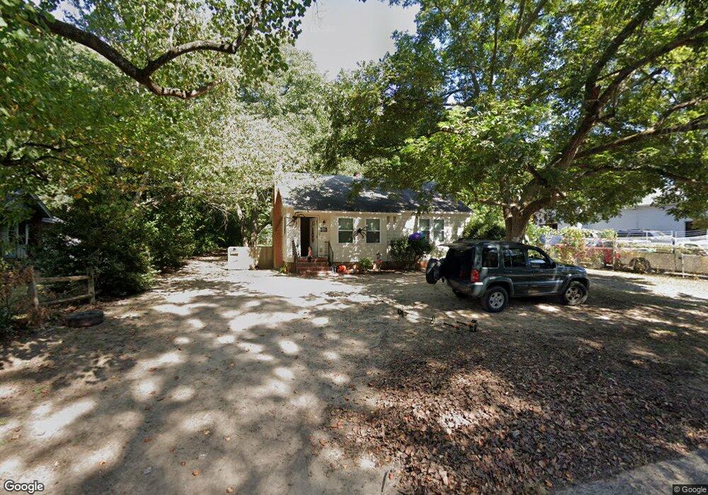
306 N Firestone St Gastonia, NC 28052
Estimated Value: $146,000 - $548,000
2
Beds
1
Bath
860
Sq Ft
$290/Sq Ft
Est. Value
About This Home
This home is located at 306 N Firestone St, Gastonia, NC 28052 and is currently estimated at $248,984, approximately $289 per square foot. 306 N Firestone St is a home located in Gaston County with nearby schools including Bessemer City Primary School, W P Grier Middle School, and Ashbrook High School.
Ownership History
Date
Name
Owned For
Owner Type
Purchase Details
Closed on
Jan 16, 1992
Bought by
Watkins Reginald W
Current Estimated Value
Create a Home Valuation Report for This Property
The Home Valuation Report is an in-depth analysis detailing your home's value as well as a comparison with similar homes in the area
Home Values in the Area
Average Home Value in this Area
Purchase History
| Date | Buyer | Sale Price | Title Company |
|---|---|---|---|
| Watkins Reginald W | -- | -- |
Source: Public Records
Tax History Compared to Growth
Tax History
| Year | Tax Paid | Tax Assessment Tax Assessment Total Assessment is a certain percentage of the fair market value that is determined by local assessors to be the total taxable value of land and additions on the property. | Land | Improvement |
|---|---|---|---|---|
| 2025 | $1,389 | $129,950 | $12,500 | $117,450 |
| 2024 | $1,389 | $129,950 | $12,500 | $117,450 |
| 2023 | $1,403 | $129,950 | $12,500 | $117,450 |
| 2022 | $606 | $45,590 | $5,000 | $40,590 |
| 2021 | $615 | $45,590 | $5,000 | $40,590 |
| 2019 | $541 | $45,590 | $5,000 | $40,590 |
| 2018 | $112 | $8,030 | $6,000 | $2,030 |
| 2017 | $277 | $8,030 | $6,000 | $2,030 |
| 2016 | $277 | $19,807 | $0 | $0 |
| 2014 | $526 | $37,581 | $12,000 | $25,581 |
Source: Public Records
Map
Nearby Homes
- 209 S Ransom St
- 406 N Boyd St
- 208 S Ransom St
- 1205 W Mauney Ave
- 907 W Mauney Ave
- 412 N Scruggs St
- 0 Linwood Rd
- 1406 W Walnut Ave
- 1002 W 2nd Ave
- 215 S King St
- 307 S Ransom St
- 1426 Beechwood Dr
- 809 W Mauney Ave
- 309 S Ransom St
- 506 N Scruggs St
- 1210 Ware Ave
- 217 S Highland St
- 714 Apple Blossom Cir
- 318 S Liberty St
- 1213 Essex Ave
- 308 N Firestone St
- 1030 Little Ave
- 1031 Little Ave
- 314 N Firestone St
- 1100 Little Ave
- 1027 Little Ave Unit B
- 1027 Little Ave Unit C
- 1027 Little Ave Unit D
- 1027 Little Ave
- 1036 Gaston Ave
- 313 N Firestone St
- 1024 Little Ave
- 402 N Firestone St
- 1101 Gaston Ave
- 1107 Little Ave
- 404 N Firestone St
- 1108 Little Ave
- 1109 Rankin Ave
- 1110 Little Ave
- 1113 Little Ave