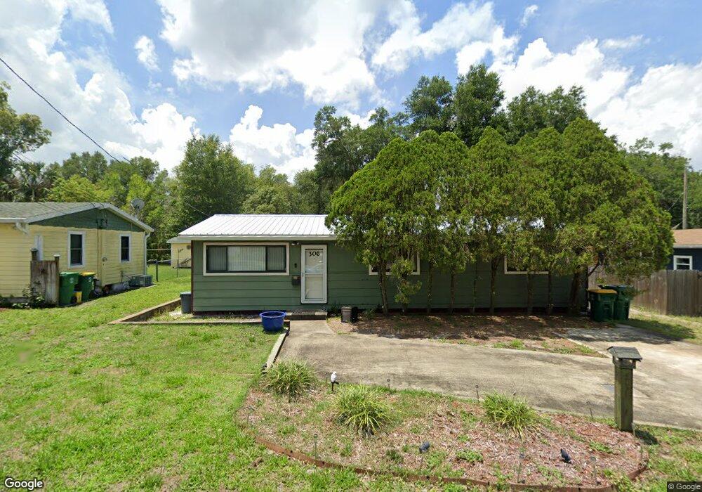
306 N High St Deland, FL 32720
Estimated Value: $213,018 - $229,000
3
Beds
1
Bath
1,012
Sq Ft
$216/Sq Ft
Est. Value
About This Home
This home is located at 306 N High St, Deland, FL 32720 and is currently estimated at $219,005, approximately $216 per square foot. 306 N High St is a home located in Volusia County with nearby schools including Woodward Avenue Elementary School, Deland High School, and Southwestern Middle School.
Ownership History
Date
Name
Owned For
Owner Type
Purchase Details
Closed on
Apr 10, 2023
Sold by
Boggs Harlan
Bought by
Mcclure Thomas Edward
Current Estimated Value
Purchase Details
Closed on
Mar 14, 2006
Sold by
Fish Mary Eileen and Shaw Mary Eileen
Bought by
Boggs Harlan
Purchase Details
Closed on
Aug 2, 2005
Sold by
Fish Mary Eileen and Shaw Mary Eileen
Bought by
Boggs Harlan
Purchase Details
Closed on
Jul 16, 2002
Sold by
Clerk Circuit Court
Bought by
Bosi Ronald
Purchase Details
Closed on
May 28, 1997
Sold by
Glanzer Harvey W
Bought by
Taft Harry J and Taft Linda L
Purchase Details
Closed on
Sep 15, 1994
Sold by
Furse Myrtle A
Bought by
Platt Joni K
Purchase Details
Closed on
Aug 15, 1979
Bought by
Boggs Harlan
Purchase Details
Closed on
Nov 15, 1976
Bought by
Boggs Harlan
Create a Home Valuation Report for This Property
The Home Valuation Report is an in-depth analysis detailing your home's value as well as a comparison with similar homes in the area
Home Values in the Area
Average Home Value in this Area
Purchase History
| Date | Buyer | Sale Price | Title Company |
|---|---|---|---|
| Mcclure Thomas Edward | $100 | None Listed On Document | |
| Mcclure Thomas Edward | $100 | None Listed On Document | |
| Boggs Harlan | -- | Attorney | |
| Boggs Harlan | -- | -- | |
| Shaw Mary E | -- | -- | |
| Bosi Ronald | $28,200 | -- | |
| Taft Harry J | -- | -- | |
| Platt Joni K | $30,000 | -- | |
| Boggs Harlan | $16,700 | -- | |
| Boggs Harlan | $16,600 | -- |
Source: Public Records
Tax History Compared to Growth
Tax History
| Year | Tax Paid | Tax Assessment Tax Assessment Total Assessment is a certain percentage of the fair market value that is determined by local assessors to be the total taxable value of land and additions on the property. | Land | Improvement |
|---|---|---|---|---|
| 2025 | $2,673 | $157,797 | $28,665 | $129,132 |
| 2024 | $2,673 | $160,312 | $28,665 | $131,647 |
| 2023 | $2,673 | $142,549 | $23,205 | $119,344 |
| 2022 | $348 | $43,242 | $0 | $0 |
| 2021 | $349 | $41,983 | $0 | $0 |
| 2020 | $338 | $41,403 | $0 | $0 |
| 2019 | $334 | $40,472 | $0 | $0 |
| 2018 | $331 | $39,717 | $0 | $0 |
| 2017 | $324 | $38,900 | $0 | $0 |
| 2016 | $301 | $38,100 | $0 | $0 |
| 2015 | $305 | $37,835 | $0 | $0 |
| 2014 | $304 | $37,535 | $0 | $0 |
Source: Public Records
Map
Nearby Homes
- 807 W Church St
- 236 N Salisbury Ave
- 111 N Stone St
- W SR 44, New York Ave W
- 748 W Florence Ave
- 600 N Boundary Ave Unit 119B
- 600 N Boundary Ave Unit 110A
- 600 N Boundary Ave Unit 114-C
- 600 N Boundary Ave Unit 114B
- 600 N Boundary Ave Unit 106-D
- 128 S Montgomery Ave
- 1126 W Minnesota Ave
- 241 S Marydell Ave
- 0 N Spring Garden Ave Unit MFRO6340602
- 0 N Spring Garden Ave Unit 1112700
- 0 N Spring Garden Ave Unit V4920996
- 247 S Marydell Ave
- 134 S Julia Ave
- 718 W Hogle Ave
- 731 W Voorhis Ave
- 304 N High St
- 804 W Ohio Ave
- 812 W Ohio Ave
- 805 W Wisconsin Ave
- 303 N High St
- 309 N High St
- 308 N High St
- 735 W Wisconsin Ave
- 816 W Ohio Ave
- 315 N High St
- 809 W Wisconsin Ave
- 811 W Wisconsin Ave
- 327 N High St
- 310 N High St
- 733 W Wisconsin Ave
- 320 N Marydell Ave
- 322 N Marydell Ave
- 802 W Wisconsin Ave
- 324 N Marydell Ave